188.246.96.102 - IP Lookup: Free IP Address Lookup, Postal Code Lookup, IP Location Lookup, IP ASN, Public IP
Country:
Region:
City:
Location:
Time Zone:
Postal Code:
ISP:
ASN:
language:
User-Agent:
Proxy IP:
Blacklist:
IP information under different IP Channel
ip-api
Country
Region
City
ASN
Time Zone
ISP
Blacklist
Proxy
Latitude
Longitude
Postal
Route
db-ip
Country
Region
City
ASN
Time Zone
ISP
Blacklist
Proxy
Latitude
Longitude
Postal
Route
IPinfo
Country
Region
City
ASN
Time Zone
ISP
Blacklist
Proxy
Latitude
Longitude
Postal
Route
IP2Location
188.246.96.102Country
Region
zlinsky kraj
City
zlutava
Time Zone
Europe/Prague
ISP
Language
User-Agent
Latitude
Longitude
Postal
ipdata
Country
Region
City
ASN
Time Zone
ISP
Blacklist
Proxy
Latitude
Longitude
Postal
Route
Popular places and events near this IP address

Otrokovice
Town in Zlín, Czech Republic
Distance: Approx. 3152 meters
Latitude and longitude: 49.21,17.53083333
Otrokovice (Czech pronunciation: [ˈotrokovɪtsɛ]; German: Otrokowitz) is a town in Zlín District in the Zlín Region of the Czech Republic. It has about 18,000 inhabitants. It is known as an industrial centre.

Napajedla
Town in Zlín, Czech Republic
Distance: Approx. 3502 meters
Latitude and longitude: 49.17166667,17.51194444
Napajedla (Czech pronunciation: [ˈnapajɛdla]; German: Napajedl) is a town in the Zlín Region of the Czech Republic. It has about 7,200 inhabitants. The historic town centre is well preserved and is protected by law as an urban monument zone.

Karolín
Municipality in Zlín, Czech Republic
Distance: Approx. 5318 meters
Latitude and longitude: 49.23055556,17.43444444
Karolín is a municipality and village in Kroměříž District in the Zlín Region of the Czech Republic. It has about 300 inhabitants. Karolín lies approximately 9 kilometres (6 mi) south of Kroměříž, 17 km (11 mi) west of Zlín, and 238 km (148 mi) south-east of Prague.

Kvasice
Municipality in Zlín, Czech Republic
Distance: Approx. 4956 meters
Latitude and longitude: 49.24222222,17.46972222
Kvasice (German: Kwassitz) is a municipality and village in Kroměříž District in the Zlín Region of the Czech Republic. It has about 2,200 inhabitants.

Nová Dědina
Municipality in Zlín, Czech Republic
Distance: Approx. 2907 meters
Latitude and longitude: 49.21,17.45361111
Nová Dědina is a municipality and village in Kroměříž District in the Zlín Region of the Czech Republic. It has about 400 inhabitants. Nová Dědina lies approximately 11 kilometres (7 mi) south-east of Kroměříž, 16 km (10 mi) west of Zlín, and 240 km (150 mi) south-east of Prague.

Bělov
Municipality in Zlín, Czech Republic
Distance: Approx. 1862 meters
Latitude and longitude: 49.21611111,17.48472222
Bělov is a municipality and village in Zlín District in the Zlín Region of the Czech Republic. It has about 300 inhabitants. Bělov lies approximately 14 kilometres (9 mi) west of Zlín and 241 km (150 mi) south-east of Prague.

Halenkovice
Municipality in Zlín, Czech Republic
Distance: Approx. 3472 meters
Latitude and longitude: 49.17111111,17.47166667
Halenkovice (German: Allenkowitz) is a municipality and village in Zlín District in the Zlín Region of the Czech Republic. It has about 2,000 inhabitants.

Oldřichovice (Zlín District)
Municipality in Zlín, Czech Republic
Distance: Approx. 5545 meters
Latitude and longitude: 49.18166667,17.56138889
Oldřichovice is a municipality and village in Zlín District in the Zlín Region of the Czech Republic. It has about 400 inhabitants. Oldřichovice lies approximately 10 kilometres (6 mi) south-west of Zlín and 249 km (155 mi) south-east of Prague.

Pohořelice (Zlín District)
Municipality in Zlín, Czech Republic
Distance: Approx. 4303 meters
Latitude and longitude: 49.17666667,17.53777778
Pohořelice is a municipality and village in Zlín District in the Zlín Region of the Czech Republic. It has about 900 inhabitants. Pohořelice lies approximately 11 kilometres (7 mi) south-west of Zlín and 247 km (153 mi) south-east of Prague.

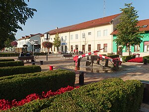
Žlutava
Municipality in Zlín, Czech Republic
Distance: Approx. 12 meters
Latitude and longitude: 49.19972222,17.49027778
Žlutava is a municipality and village in Zlín District in the Zlín Region of the Czech Republic. It has about 1,200 inhabitants. Žlutava lies approximately 14 kilometres (9 mi) west of Zlín and 242 km (150 mi) south-east of Prague.

Dřevnice
River in Zlín, Czech Republic
Distance: Approx. 1577 meters
Latitude and longitude: 49.20333333,17.51138889
The Dřevnice is a river in the Czech Republic, a left tributary of the Morava River. It flows through the Zlín Region. It is 41.6 km (25.8 mi) long.

Otrokovice railway station
Railway station in Otrokovice, Czech Republic
Distance: Approx. 3020 meters
Latitude and longitude: 49.2026,17.5317
Otrokovice railway station (Czech: Železniční stanice Otrokovice) is a railway station in Otrokovice in the Czech Republic. It is a mainline railway station situated on an international corridor linking Austria and Slovakia with Poland, and serves the wider Zlín metropolitan area; the more centrally located Zlín střed railway station is located on an unelectrified line, and is served almost entirely by local trains. Otrokovice station is served by trains operated by Czech Railways, Arriva and Leo Express.
Weather in this IP's area
overcast clouds
7 Celsius
5 Celsius
7 Celsius
7 Celsius
1004 hPa
87 %
1004 hPa
971 hPa
10000 meters
2.96 m/s
7.31 m/s
172 degree
100 %