Country:
Region:
City:
Latitude and Longitude:
Time Zone:
Postal Code:
IP information under different IP Channel
ip-api
Country
Region
City
ASN
Time Zone
ISP
Blacklist
Proxy
Latitude
Longitude
Postal
Route
Luminati
Country
Region
zh
City
melissant
ASN
Time Zone
Europe/Amsterdam
ISP
Techcrea Solutions SAS
Latitude
Longitude
Postal
IPinfo
Country
Region
City
ASN
Time Zone
ISP
Blacklist
Proxy
Latitude
Longitude
Postal
Route
db-ip
Country
Region
City
ASN
Time Zone
ISP
Blacklist
Proxy
Latitude
Longitude
Postal
Route
ipdata
Country
Region
City
ASN
Time Zone
ISP
Blacklist
Proxy
Latitude
Longitude
Postal
Route
Popular places and events near this IP address

Dirksland
Village in South Holland, Netherlands
Distance: Approx. 2531 meters
Latitude and longitude: 51.75,4.1
Dirksland (Dutch pronunciation: [ˈdɪr(ə)kslɑnt] ) is a village and former municipality on Goeree-Overflakkee Island in the western Netherlands, in the province of South Holland. The former municipality had a population of about 8,000 in 2007, and covered an area of about 74 km2 of which about 19 km2 was water. The former municipality of Dirksland also included the communities of Herkingen, and Melissant.

Hellevoetsluis
Town in South Holland, Netherlands
Distance: Approx. 6968 meters
Latitude and longitude: 51.81666667,4.13333333
Hellevoetsluis (Dutch pronunciation: [ˌɦɛləvutˈslœys] ) is a town and former municipality in the west of Netherlands. It is located in Voorne-Putten, South Holland. The former municipality covered an area of 61.20 km2 (23.63 sq mi) of which 20.10 km2 (7.76 sq mi) was water and it included the population centres of Nieuw-Helvoet, Nieuwenhoorn, and Oude en Nieuwe Struiten, all former municipalities.

Middelharnis
Town and former municipality in South Holland, Netherlands
Distance: Approx. 6857 meters
Latitude and longitude: 51.75,4.17
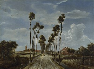
Middelharnis (Dutch pronunciation: [ˌmɪdəlˈɦɑrnɪs] ) is a town and former municipality in the western Netherlands, in the province of South Holland, on the island of Goeree-Overflakkee. The town had a population of about 6,800 in 2012. On 1 January 2013, Middelharnis merged with Goedereede, Dirksland, and Oostflakkee into the new municipality of Goeree-Overflakkee.

Goeree-Overflakkee
Island and Municipality in South Holland, Netherlands
Distance: Approx. 6636 meters
Latitude and longitude: 51.75,4.16666667
Goeree-Overflakkee (Dutch pronunciation: [ɣuˌreː ˈoːvərflɑˌkeː]) is the southernmost delta island of the province of South Holland, Netherlands. It is separated from Voorne-Putten and Hoeksche Waard by the Haringvliet, from the mainland of North Brabant by the Volkerak, and from Schouwen-Duiveland by Lake Grevelingen. Since 2013, Goeree-Overflakkee has also been a municipality consisting, from west to east, of the former municipalities of Goedereede, Dirksland, Middelharnis, and Oostflakkee.

Grevelingen
Brackish water body in the Netherlands partly isolated from the North Sea by a levee
Distance: Approx. 6781 meters
Latitude and longitude: 51.71416667,4.02222222
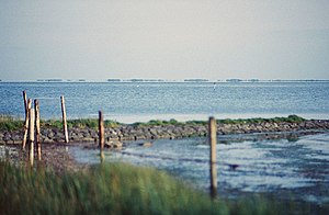
The Grevelingen or Grevelingenmeer (Lake Grevelingen) is a closed off part of the Rhine-Meuse estuary on the border of the Dutch provinces of South Holland and Zeeland. It is situated between the islands of Goeree-Overflakkee (South Holland) and Schouwen-Duiveland (Zeeland) and was closed off as part of the Delta Works, a huge engineering project designed to protect the southwestern part of the Netherlands from flooding. The Brouwersdam, a dike connecting the two islands on the west, closes off the Grevelingen from the North Sea.

Sommelsdijk
Village in South Holland, Netherlands
Distance: Approx. 5597 meters
Latitude and longitude: 51.75472222,4.15305556
Sommelsdijk is a village on the island of Goeree-Overflakkee, South Holland, the Netherlands, and part of the municipality of the same name. Sommelsdijk has (1 January 2022) 7,195 inhabitants which makes it the second largest settlement after Middelharnis on the island. In the past, Sommelsdijk was the only place on the island of Goeree-Overflakee that was part of the province of Zeeland.

Stellendam
Village in South Holland, Netherlands
Distance: Approx. 5625 meters
Latitude and longitude: 51.8061882,4.0243945
Stellendam is a village in the Dutch province of South Holland. It is a part of the municipality of Goeree-Overflakkee, and lies about 9 km west of Hellevoetsluis.

Herkingen
Village in South Holland, Netherlands
Distance: Approx. 6301 meters
Latitude and longitude: 51.71,4.08722222
Herkingen is a village in the Dutch province of South Holland. It is located on the south coast of the island Goeree-Overflakkee, in the municipality of Goeree-Overflakkee.

Melissant
Village in South Holland, Netherlands
Distance: Approx. 275 meters
Latitude and longitude: 51.76805556,4.07611111
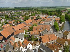
Melissant is a village in the Dutch province of South Holland. It is located on the island Goeree-Overflakkee, in the municipality of Goeree-Overflakkee.
Onwaard
Distance: Approx. 2688 meters
Latitude and longitude: 51.7625,4.1125
Onwaard is a former municipality in the Dutch province of South Holland. It was located east of the village of Melissant on the island Goeree-Overflakkee. The municipality contained no villages nor hamlets; only a few farms.
Roxenisse
Distance: Approx. 1964 meters
Latitude and longitude: 51.77222222,4.04722222
Roxenisse is a former municipality in the Dutch province of South Holland. It consisted of a single polder to the west of the village of Melissant. The municipality was formed in 1817 and only existed until 1857, when it became part of Melissant.
De Hooge Heerlijkheid
Restaurant in Middelharnis, Netherlands
Distance: Approx. 6357 meters
Latitude and longitude: 51.75865278,4.1654
De Hooge Heerlijkheid is a restaurant in Middelharnis, Netherlands. It was a fine dining restaurant that was awarded one Michelin star in the periods 1975-1992 and 1995-1996. Owner and then head chef John Kern was one of the founders of Les Patrons Cuisiniers.
Weather in this IP's area
few clouds
5 Celsius
0 Celsius
4 Celsius
6 Celsius
1003 hPa
65 %
1003 hPa
1003 hPa
10000 meters
7.15 m/s
14.31 m/s
279 degree
15 %
08:11:51
16:47:17