188.173.195.213 - IP Lookup: Free IP Address Lookup, Postal Code Lookup, IP Location Lookup, IP ASN, Public IP
Country:
Region:
City:
Location:
Time Zone:
Postal Code:
ISP:
ASN:
language:
User-Agent:
Proxy IP:
Blacklist:
IP information under different IP Channel
ip-api
Country
Region
City
ASN
Time Zone
ISP
Blacklist
Proxy
Latitude
Longitude
Postal
Route
db-ip
Country
Region
City
ASN
Time Zone
ISP
Blacklist
Proxy
Latitude
Longitude
Postal
Route
IPinfo
Country
Region
City
ASN
Time Zone
ISP
Blacklist
Proxy
Latitude
Longitude
Postal
Route
IP2Location
188.173.195.213Country
Region
gorj
City
targu jiu
Time Zone
Europe/Bucharest
ISP
Language
User-Agent
Latitude
Longitude
Postal
ipdata
Country
Region
City
ASN
Time Zone
ISP
Blacklist
Proxy
Latitude
Longitude
Postal
Route
Popular places and events near this IP address

Gorj County
County of Romania
Distance: Approx. 1722 meters
Latitude and longitude: 45.04,23.3
Gorj County (Romanian pronunciation: [ɡorʒ] ) is a county (județ) of Romania, in Oltenia, with its capital city at Târgu Jiu. Gorj comes from the Slavic Gor(no)-Jiu (“upper Jiu”), in contrast with Dolj (“lower Jiu”).

Târgu Jiu
Municipality in Gorj, Romania
Distance: Approx. 1887 meters
Latitude and longitude: 45.03416667,23.27472222
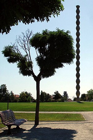
Târgu Jiu (Romanian pronunciation: [ˌtɨrɡu ˈʒiw], is the capital of Gorj County in the Oltenia region of Romania. It is situated on the Southern Sub-Carpathians, on the banks of the river Jiu. Eight localities are administered by the city: Bârsești, Drăgoieni, Iezureni, Polata, Preajba Mare, Romanești, Slobozia, and Ursați.

Ecaterina Teodoroiu
World War I soldier and nurse
Distance: Approx. 1335 meters
Latitude and longitude: 45.041141,23.271861
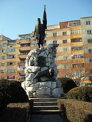
Ecaterina Teodoroiu (Romanian pronunciation: [ekateˈrina te.odoˈroju]; formal rendition of Cătălina Toderoiu; 14 January 1894 – 3 September 1917) was a Romanian woman who fought on the front and died in World War I, and is regarded as a heroine of Romania. A Romanian Scouts member, she had initially worked as a nurse but she subsequently decided to become a front-line soldier, being deeply impressed by the patriotism of the wounded and the death of her brother Nicolae, a sergeant in the Romanian Army. It was an unusual decision for a woman of that era, so she was sent to the front rather reluctantly.

Stadionul Tudor Vladimirescu (1963)
Former multi-purpose stadium in Târgu Jiu, Romania
Distance: Approx. 1260 meters
Latitude and longitude: 45.04363889,23.27005556
Stadionul Tudor Vladimirescu was a multi-purpose stadium in Târgu Jiu, Romania. It was mostly used for football matches and was the home ground of Pandurii Târgu Jiu. It was named after Wallachian hero Tudor Vladimirescu.
Suseni (river)
River in Gorj, Romania
Distance: Approx. 6180 meters
Latitude and longitude: 45.087,23.2247
The Suseni (in its upper course also: Surlău) is a right tributary of the river Șușița in Romania. It discharges into the Șușița in Ursați. Its length is 24 km (15 mi) and its basin size is 68 km2 (26 sq mi).
Cornul
River in Gorj County, Romania
Distance: Approx. 3331 meters
Latitude and longitude: 45.0533,23.2412
The Cornul (also: Urmuroasa, Cernădia) is a left tributary of the river Șușița in Romania. It flows into the Șușița in Bârsești. Its length is 16 km (9.9 mi) and its basin size is 21 km2 (8.1 sq mi).

Bălești, Gorj
Commune in Gorj, Romania
Distance: Approx. 6422 meters
Latitude and longitude: 45.01666667,23.21666667
Bălești is a commune in Gorj County, Oltenia, Romania. It is composed of nine villages: Bălești, Ceauru, Cornești, Găvănești, Rasova, Stolojani, Tălpășești, Tămășești, and Voinigești. The commune is located in the north-central part of the county.

Constantin Brâncuși University of Târgu Jiu
Building in Târgu Jiu, Romania
Distance: Approx. 1489 meters
Latitude and longitude: 45.039707,23.271209
Constantin Brâncuși University of Târgu Jiu (Romanian: Universitatea „Constantin Brâncuși” din Târgu Jiu) is an accredited higher education institution of public interest, with legal personality and non-profit character, established in accordance with the legal provisions, according to the Romanian Government Decision no. 288 / 01.06.1992, and operates on the basis of the principles of university autonomy and academic freedom, under the coordination of the Ministry of National Education - central specialized authority. Constantin Brâncuși University of Târgu-Jiu is a university concerned, especially, in offering young people the chance to choose various study programs, in accordance with the requirements of the highly qualified labor market.
Jiu Bridge
Bridge in Romania
Distance: Approx. 1534 meters
Latitude and longitude: 45.0425,23.26694444
Jiu Bridge (Romanian: Podul Jiului) is a historic truss bridge across the Jiu River. It consisted of five arches mounted on pillars and connected two parts of the city of Târgu Jiu, Romania, where the streets Unirii and Calea Severinului meet. At the end of the 20th century, three of the original five arches have been moved one kilometer north from their initial location, to form a shorter bridge that connects Târgu Jiu Central park with an artificial island on the Jiu river.
Saints Peter and Paul Church, Târgu Jiu
Orthodox church in Târgu Jiu, Romania
Distance: Approx. 1357 meters
Latitude and longitude: 45.03823,23.2788
Saints Peter and Paul Church (Romanian: Biserica Sfinții Petru și Pavel) is a Romanian Orthodox church in Târgu Jiu, Romania, located on Calea Eroilor. The church is built along a road linking elements of the Sculptural Ensemble of Constantin Brâncuși, and is integrated with these works. It was built on the site of an earlier church from 1777.

Church of the Holy Archangels, Târgu Jiu
Heritage site in Gorj County, Romania
Distance: Approx. 1324 meters
Latitude and longitude: 45.041,23.2723
The Church of the Holy Archangels (Romanian: Biserica Sfinții Voievozi) is a Romanian Orthodox church located on Piața Victoriei, Târgu Jiu, Romania. It is dedicated to the Archangels Michael and Gabriel. The ktetors were the merchants Dobre Sîrbu and Radu Cupetu, whose portraits appear in the vestibule; it is sometimes known as the Merchants’ Church.
Tudor Vladimirescu National College
Distance: Approx. 1595 meters
Latitude and longitude: 45.0373,23.2739
Tudor Vladimirescu National College (Romanian: Colegiul Național Tudor Vladimirescu) is a high school located at 13 Unirii Street, Târgu Jiu, Romania. For some time, the residents of Târgu Jiu had requested a permanent school. Their cause was taken up by the local notable Toma Cămărășescu, who in 1890 helped persuade Education Minister Titu Maiorescu to sign an order establishing a gymnasium.
Weather in this IP's area
clear sky
-2 Celsius
-2 Celsius
-2 Celsius
-2 Celsius
1031 hPa
64 %
1031 hPa
992 hPa
10000 meters
0.33 m/s
0.49 m/s
46 degree


