Country:
 Poland
Region:
City:
Latitude and Longitude:
Time Zone:
Postal Code:
IP information under different IP Channel
ip-api
Country
Region
City
ASN
Time Zone
ISP
Blacklist
Proxy
Latitude
Longitude
Postal
Route
IPinfo
Country
Region
City
ASN
Time Zone
ISP
Blacklist
Proxy
Latitude
Longitude
Postal
Route
MaxMind
Country
Region
City
ASN
Time Zone
ISP
Blacklist
Proxy
Latitude
Longitude
Postal
Route
Luminati
Country
PLRegion
32
City
szczecin
ASN
Time Zone
Europe/Warsaw
ISP
T-Mobile Polska S.A.
Latitude
Longitude
Postal
db-ip
Country
Region
City
ASN
Time Zone
ISP
Blacklist
Proxy
Latitude
Longitude
Postal
Route
ipdata
Country
Region
City
ASN
Time Zone
ISP
Blacklist
Proxy
Latitude
Longitude
Postal
Route
Popular places and events near this IP address

Turzyn, Szczecin
Municipal neighbourhood in Szczecin, West Pomeranian Voivodeship, Poland
Distance: Approx. 483 meters
Latitude and longitude: 53.42833333,14.52194444
Turzyn is a municipal neighbourhood of the city of Szczecin, Poland situated on the left bank of Oder river, west of the Szczecin Old Town and Middle Town. As of January 2011 it had a population of 20,373.

Świerczewo, Szczecin
Municipal neighbourhood in Szczecin, West Pomeranian Voivodeship, Poland
Distance: Approx. 1404 meters
Latitude and longitude: 53.42861111,14.5025
Świerczewo is a municipal neighborhood of the city of Szczecin, Poland situated on the left bank of Oder river, west of the Szczecin Old Town and Middle Town, in Zachód (West) District. As of January 2011 it had a population of 16,860. The area became part of the emerging Polish state under its first ruler Mieszko I around 967, and following Poland's fragmentation it formed part of the Duchy of Pomerania.

Szczecin University of Technology
Polish university
Distance: Approx. 865 meters
Latitude and longitude: 53.42482,14.53517
Szczecin University of Technology (Polish: Politechnika Szczecińska) was one of the biggest universities in Szczecin, Poland.

Florian Krygier Municipal Stadium
Distance: Approx. 1420 meters
Latitude and longitude: 53.43657611,14.51865806
Stadion Miejski im. Floriana Krygiera (Florian Krygier Municipal Stadium) is a football stadium in Szczecin, Poland. It is the home ground of Pogoń Szczecin.

Province of Pomerania (1815–1945)
Province of Prussia from 1815 to 1945
Distance: Approx. 1275 meters
Latitude and longitude: 53.43333333,14.53333333
The Province of Pomerania (German: Provinz Pommern; Polish: Prowincja Pomorze) was a province of Prussia from 1815 to 1945. Pomerania was established as a province of the Kingdom of Prussia in 1815, an expansion of the older Brandenburg-Prussia province of Pomerania, and then became part of the German Empire in 1871. From 1918, Pomerania was a province of the Free State of Prussia until it was dissolved following World War II by decree of the Allied Control Council with the de jure abolition of Prussia on 25 February 1947, and its territory divided between Poland and Allied-occupied Germany.
1962 Szczecin military parade accident
Distance: Approx. 1417 meters
Latitude and longitude: 53.43194444,14.53888889
The 1962 Szczecin military parade of 9 October 1962 led to a road traffic accident in which a tank of the Polish People's Army crushed bystanders, killing seven children and injuring many more. The resultant panic in the crowd led to further injuries in the rush to escape. The incident was covered up for many years by the Polish communist authorities.

West Pomeranian University of Technology
Technical university in Szczecin, Poland
Distance: Approx. 869 meters
Latitude and longitude: 53.42444444,14.53527778
West Pomeranian University of Technology, Szczecin (Polish: Zachodniopomorski Uniwersytet Technologiczny w Szczecinie, ZUT) is a technical university in Szczecin, Poland. The university was established on January 1. 2009 in Szczecin, from the merger of the Agricultural University in Szczecin and the Szczecin University of Technology.

Central Cemetery, Szczecin
Municipal cemetery in Szczecin, Poland
Distance: Approx. 391 meters
Latitude and longitude: 53.42055556,14.52333333
The Central Cemetery in Szczecin is a municipal cemetery in Szczecin, Poland. With an area of over 167.8 hectares, and still expanding, it is officially the largest cemetery in Poland and the third largest cemetery in Europe.

Śródmieście-Zachód
Municipal neighbourhood in Szczecin, West Pomeranian Voivodeship, Poland
Distance: Approx. 1253 meters
Latitude and longitude: 53.42666667,14.54055556
Śródmieście-Zachód is a municipal neighbourhood of the city of Szczecin, Poland, in Śródmieście (Centre) District. As of January 2011 it had a population of 15,996.
Tadeusz Kościuszko Square
Urban square in Szczecin, Poland
Distance: Approx. 1061 meters
Latitude and longitude: 53.42708333,14.53733333
The Tadeusz Kościuszko Square, until 1945 known as the Schinkel Square, is an urban square in Szczecin, Poland. It is located in the neighbourhood of Śródmieście-Zachód, within the district of Śródmieście, at the intersection of Piastów Avenue, Krzywoustego Street, and Sikorskiego Street. It was constructed in 1878.

Concord Square (Szczecin)
Square in Szczecin, Poland
Distance: Approx. 1519 meters
Latitude and longitude: 53.42866667,14.54372222
The Concord Square (Polish: Plac Zgody) is an urban square in Szczecin, Poland. It is located in the district of Śródmieście, at the boundary of neighbourhoods of Centrum and Śródmieście-Zachód, at the intersection of Wojska Polskiego Avenue, Księcia Bogusława X Street, Bohaterów Getta Warszawskiego Street, and Bałuki Street.

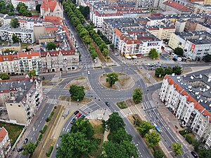
Grey Ranks Square
Urban square in Szczecin, Poland
Distance: Approx. 1568 meters
Latitude and longitude: 53.43313889,14.54019444
The Grey Ranks Square (Polish: Plac Szarych Szeregów) is an urban square and a roundabout in Szczecin, Poland. It is located at the boundary of neighbourhoods of Centrum and Śródmieście-Północ, within the district of Śródmieście. It forms the intersection of Piastów Avenue, Piątego Lipca Street, Piłsudskiego Street, Wielkopolska Street, and Wojska Polskiego Avenue.
Weather in this IP's area
broken clouds
17 Celsius
17 Celsius
17 Celsius
17 Celsius
1023 hPa
86 %
1023 hPa
1020 hPa
10000 meters
3.58 m/s
360 degree
55 %
06:37:44
19:15:49