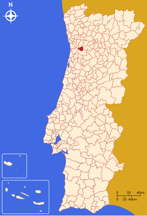
Country:
Region:
City:
Latitude and Longitude:
Time Zone:
Postal Code:
IP information under different IP Channel
ip-api
Country
Region
City
ASN
Time Zone
ISP
Blacklist
Proxy
Latitude
Longitude
Postal
Route
Luminati
Country
Region
11
City
pacodearcos
ASN
Time Zone
Europe/Lisbon
ISP
Servicos De Comunicacoes E Multimedia S.A.
Latitude
Longitude
Postal
IPinfo
Country
Region
City
ASN
Time Zone
ISP
Blacklist
Proxy
Latitude
Longitude
Postal
Route
db-ip
Country
Region
City
ASN
Time Zone
ISP
Blacklist
Proxy
Latitude
Longitude
Postal
Route
ipdata
Country
Region
City
ASN
Time Zone
ISP
Blacklist
Proxy
Latitude
Longitude
Postal
Route
Popular places and events near this IP address

Tâmega (river)
River in northern Portugal and Galicia
Distance: Approx. 3180 meters
Latitude and longitude: 41.082,-8.293
The Tâmega (European Portuguese: [ˈtɐmɨɣɐ]) or Támega (Galician: [ˈtamɪɣɐ]; Proto-Celtic: *Tamaca) is a river in Galicia, Spain and Portugal. It begins its course near Verín, Galicia, Spain, and flows to Portugal in the provinces of Trás-os-Montes and Douro Litoral. The Tâmega River is a tributary of the Douro River.

Castelo de Paiva
Municipality in Norte, Portugal
Distance: Approx. 1300 meters
Latitude and longitude: 41.06666667,-8.25
Castelo de Paiva (Portuguese pronunciation: [kɐʃˈtɛlu ðɨ ˈpajvɐ] ) is a town and a municipality of the Aveiro District in Portugal. The population in 2011 was 16,733, in an area of 115.01 km2. On 4 March 2001 at 9 pm, a 116-year-old metal bridge linking the parish/council of Sobrado (a.k.a.

Hintze Ribeiro Bridge collapse
2001 bridge collapse in Portugal
Distance: Approx. 3155 meters
Latitude and longitude: 41.07888889,-8.29583333
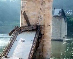
The Hintze Ribeiro Bridge collapse, also known as the Entre-os-Rios tragedy (Portuguese: Tragédia de Entre-os-Rios), occurred in the evening of 4 March 2001, between Entre-os-Rios, in the municipality of Penafiel, and Castelo de Paiva, in northern Portugal. After days of heavy rain and flooding, one of the pillars of the Hintze Ribeiro Bridge, a 114 year-old bridge over the Douro river that had visible signs of degradation, collapsed due to scour, dragging with it part of the deck. One bus and three cars fell into the Douro river, killing a total of 59 people, of which the bodies of 36 were never recovered.
Rio Mau (Penafiel)
Civil parish in Norte, Portugal
Distance: Approx. 8659 meters
Latitude and longitude: 41.053,-8.367
Rio Mau is a Portuguese parish located in the municipality of Penafiel. The population in 2011 was 1,407, in an area of 6.13 km2. It was created in 1984 by Law nº 42/84, of December 31, with places disannexed from the parish of Sebolido.
Santiago de Piães
Civil parish in Norte, Portugal
Distance: Approx. 9210 meters
Latitude and longitude: 41.065,-8.155
Santiago de Piães is a Portuguese civil parish (freguesia) in the municipality of Cinfães. The population in 2011 was 1,797, in an area of 17.59 km². The parish contains the localities Cosconhe, Crasto, Lage, Santiago de Piães, Santo António, Sanfins, Ventoselas and Vilar d'Arca.
Arda River (Douro tributary)
River in northern Portugal
Distance: Approx. 9575 meters
Latitude and longitude: 41.04888889,-8.37722222
The Arda River (Portuguese pronunciation: [ˈaɾðɐ]) is a river in Portugal. It flows into the Douro River. Arouca village is located near the Arda River.
Alpendorada, Várzea e Torrão
Civil parish in Norte, Portugal
Distance: Approx. 3233 meters
Latitude and longitude: 41.087,-8.243
Alpendorada, Várzea e Torrão is a civil parish in the municipality of Marco de Canaveses, Portugal. It was formed in 2013 by the merger of the former parishes Alpendurada e Matos, Várzea do Douro and Torrão. The population in 2011 was 8,485, in an area of 16.82 km².

Igreja de São Gens de Boelhe
Distance: Approx. 8231 meters
Latitude and longitude: 41.135045,-8.242619
Igreja de São Gens de Boelhe is a church in Penafiel, Portugal. It is classified as a National Monument.

Igreja de São Miguel de Entre-os-Rios
Distance: Approx. 3671 meters
Latitude and longitude: 41.0832907,-8.2991809
Igreja de São Miguel de Entre-os-Rios is a church in Portugal. It is classified as a National Monument.
Vila Boa do Bispo
Civil parish in Norte, Portugal
Distance: Approx. 8341 meters
Latitude and longitude: 41.127,-8.213
Vila Boa do Bispo is a civil parish in the municipality of Marco de Canaveses, in the northern district of Porto. The population in 2011 was 3,240, in an area of 12.48 km2.
Weather in this IP's area
scattered clouds
11 Celsius
10 Celsius
11 Celsius
16 Celsius
1018 hPa
94 %
1018 hPa
1013 hPa
10000 meters
2.65 m/s
2.71 m/s
102 degree
27 %
07:23:34
17:12:54