Country:
 Poland
Region:
City:
Latitude and Longitude:
Time Zone:
Postal Code:
IP information under different IP Channel
ip-api
Country
Region
City
ASN
Time Zone
ISP
Blacklist
Proxy
Latitude
Longitude
Postal
Route
IPinfo
Country
Region
City
ASN
Time Zone
ISP
Blacklist
Proxy
Latitude
Longitude
Postal
Route
MaxMind
Country
Region
City
ASN
Time Zone
ISP
Blacklist
Proxy
Latitude
Longitude
Postal
Route
Luminati
Country
PLRegion
24
City
rybnik
ASN
Time Zone
Europe/Warsaw
ISP
Leon Sp. z o.o.
Latitude
Longitude
Postal
db-ip
Country
Region
City
ASN
Time Zone
ISP
Blacklist
Proxy
Latitude
Longitude
Postal
Route
ipdata
Country
Region
City
ASN
Time Zone
ISP
Blacklist
Proxy
Latitude
Longitude
Postal
Route
Popular places and events near this IP address

Rybnik
Place in Silesian Voivodeship, Poland
Distance: Approx. 1217 meters
Latitude and longitude: 50.08333333,18.55
Rybnik (Polish pronunciation: [ˈrɨbɲik] ; Silesian: Rybńik; German: Rübnick) is a city in southern Poland, in the Silesian Voivodeship, around 38 km (24 mi) southwest of Katowice, the region's capital, and around 19 km (11 mi) from the Czech border. It is one of the major cities of the Katowice-Ostrava metropolitan area with a population of 5.3 million and the main city of the so-called Subregion Zachodni, previously also known as the Rybnik Coal Area. With a population of 135,994 as of January 1, 2022, it is the 25th most-populous city in Poland.

Rybnik County
County in Silesian Voivodeship, Poland
Distance: Approx. 1217 meters
Latitude and longitude: 50.08333333,18.55
Rybnik County (Polish: powiat rybnicki) is a suburban county in Silesian Voivodeship, southern Poland, created in 1999 as a result of Polish local government reforms. Its administrative seat is the city of Rybnik, although the city is not part of the county (it constitutes a separate city county). The county consists of three disjoint parts, separated by the city of Rybnik.

Rybnik Power Station
Distance: Approx. 4683 meters
Latitude and longitude: 50.13333333,18.53333333
Rybnik Power Station is a hard coal-fired power station at Rybnik in Poland. The power station was built in the 1970s. It has installed power generation capacity of 1,775 MW. The average annual production of electricity amounts to 9 TWh.

Niedobczyce
Rybnik District in Silesian Voivodeship, Poland
Distance: Approx. 4197 meters
Latitude and longitude: 50.06666667,18.49416667
Niedobczyce (German: Niebobschütz) is a district of Rybnik, Silesian Voivodeship, southern Poland. Between 1955 and 1975 it was an independent town On December 31, 2013 it had about 12,300 inhabitants.
Chwałowice Coal Mine
Mine in Rybnik (Chwałowice), Silesian Voivodeship, Poland
Distance: Approx. 3874 meters
Latitude and longitude: 50.05861111,18.55666667
The Chwałowice coal mine is a large mine in the south of Poland in Chwałowice district of Rybnik, Silesian Voivodeship, 294 km south-west of the capital, Warsaw. Chwałowice represents one of the largest coal reserve in Poland having estimated reserves of 243.7 million tonnes of coal. The annual coal production is around 3.7 million tonnes.

Karol and Antoni Szafranek Secondary and Tertiary State School of Music
School in Rybnik, Poland
Distance: Approx. 982 meters
Latitude and longitude: 50.0979,18.5478
Karol and Antoni Szafranek Secondary and Tertiary State School of Music, pol. Państwowa Szkoła Muzyczna I i II stopnia im. Karola i Antoniego Szafranków is a specialist music school located in Rybnik, Silesian Voivodship, Poland.

Chwałowice, Rybnik
Rybnik District in Silesian Voivodeship, Poland
Distance: Approx. 3128 meters
Latitude and longitude: 50.065334,18.554854
Chwałowice (German: Chwallowitz) is a district of Rybnik, Silesian Voivodeship, southern Poland. On December 31, 2013 it had 7,700 inhabitants.

Wielopole, Rybnik
Rybnik District in Silesian Voivodeship, Poland
Distance: Approx. 3389 meters
Latitude and longitude: 50.12022222,18.55377778
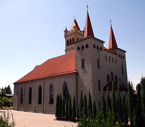
Wielopole (German: Königlich Wielopole) is a district of Rybnik, Silesian Voivodeship, southern Poland. In the late 2013 it had about 1,900 inhabitants. The biggest landmark in Wielopole is a wooden Saint Catherine church, built in 1534, rebuilt in 1676 and 1976.

Orzepowice
Rybnik District in Silesian Voivodeship, Poland
Distance: Approx. 3198 meters
Latitude and longitude: 50.116732,18.517367
Orzepowice (German: Orzupowitz) is a district of Rybnik, Silesian Voivodeship, southern Poland. In the late 2013 it had about 3,500 inhabitants.

Śródmieście, Rybnik
Rybnik District in Silesian Voivodeship, Poland
Distance: Approx. 529 meters
Latitude and longitude: 50.095589,18.541999
Śródmieście [ɕrudˈmjɛɕt͡ɕɛ] ('city centre') is a district of Rybnik, Silesian Voivodeship, southern Poland. In the late 2013 it had about 7,700 inhabitants. The quarter encompasses the traditional area of Rybnik, old city, with market square, town hall, Basilica of St.

Ligota-Ligocka Kuźnia
Rybnik District in Silesian Voivodeship, Poland
Distance: Approx. 4169 meters
Latitude and longitude: 50.090251,18.596852
Ligota-Ligocka Kuźnia is a district of Rybnik, in Upper Silesia, Silesian Voivodeship, southern Poland. in 2021, this district had 4,028 inhabitants The district encompasses three historical settlements: Ligota (German: Ellguth), Ligocka Kuźnia (German: Ellguther-Hammer, Karstenhütte) Raszowiec (German: Ruschowietz or Raschowietz) Ligota is a common name for villages in Western Poland. The word refers to the medieval custom of village founders being exempt from paying duties to their lords for a period of 5-8 years.
Zebrzydowice, Rybnik
Rybnik District in Silesian Voivodeship, Poland
Distance: Approx. 3405 meters
Latitude and longitude: 50.101562,18.49353
Zebrzydowice (German: Seibersdorf) is a district of Rybnik, Silesian Voivodeship, southern Poland. On December 31, 2013 it had 3,150 inhabitants.
Weather in this IP's area
overcast clouds
18 Celsius
18 Celsius
17 Celsius
19 Celsius
1012 hPa
72 %
1012 hPa
986 hPa
10000 meters
5.36 m/s
9.39 m/s
90 degree
99 %
06:23:35
18:57:52