Country:
Region:
City:
Latitude and Longitude:
Time Zone:
Postal Code:
IP information under different IP Channel
ip-api
Country
Region
City
ASN
Time Zone
ISP
Blacklist
Proxy
Latitude
Longitude
Postal
Route
Luminati
Country
ASN
Time Zone
Europe/Stockholm
ISP
Trafikverket
Latitude
Longitude
Postal
IPinfo
Country
Region
City
ASN
Time Zone
ISP
Blacklist
Proxy
Latitude
Longitude
Postal
Route
db-ip
Country
Region
City
ASN
Time Zone
ISP
Blacklist
Proxy
Latitude
Longitude
Postal
Route
ipdata
Country
Region
City
ASN
Time Zone
ISP
Blacklist
Proxy
Latitude
Longitude
Postal
Route
Popular places and events near this IP address

Borlänge Municipality
Municipality in Dalarna County, Sweden
Distance: Approx. 2285 meters
Latitude and longitude: 60.48333333,15.45
Borlänge Municipality (Borlänge kommun) is a municipality in Dalarna County in central Sweden, with an area of 586.4 km2. The municipality has a population of 47,640 (2007). The municipal seat is Borlänge.

Torsång
Place in Dalarna, Sweden
Distance: Approx. 8934 meters
Latitude and longitude: 60.46666667,15.56666667
Torsång (Swedish pronunciation: [ˈtɔ̂ʂːɔŋ]) is a locality situated in Borlänge Municipality, Dalarna County, Sweden with 666 inhabitants in 2010. It is situated on lakes Runnsjön and Osjön and the river Dalälven, which are connected with the canal Lillälven. Torsång Court District, or Torsångs tingslag, was a district of Dalarna in Sweden.

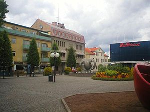
Borlänge
Place in Dalarna, Sweden
Distance: Approx. 1516 meters
Latitude and longitude: 60.48555556,15.43638889
Borlänge ([ˈbôːˌɭɛŋːɛ]) is a locality in Dalarna County, Sweden, with 44,898 inhabitants as of 2020. It is the seat of the Borlänge Municipality which as of 2017 had a total population of 51,604 inhabitants.
Domnarvsvallen
Football stadium in Borlänge, Sweden
Distance: Approx. 1676 meters
Latitude and longitude: 60.495,15.43388889
Domnarvsvallen is a football stadium in Borlänge Municipality and the home arena for IK Brage and Dalkurd FF. Domnarvsvallen has a total capacity of 6,500 spectators. The arena is mostly in wood, and was built in 1925 when IK Brage was founded.
Soltorgsgymnasiet
Public gymnasium school
Distance: Approx. 810 meters
Latitude and longitude: 60.493,15.415
Soltorgsgymnasiet commonly referred to as Soltorg is a natural science and technology focused gymnasium in Borlänge. As of 2007 the school offers interdisciplinary focus of studies. Giving the students extensive freedom of choice of higher education.

Dala Airport
Airport in Dalarna, Sweden
Distance: Approx. 9245 meters
Latitude and longitude: 60.42194444,15.515
Dala Airport or Borlänge Airport (IATA: BLE, ICAO: ESSD) is situated southeast of Borlänge, a city in the Dalarna province of Sweden. It is also 20 minutes from the city of Falun.

Norr Amsberg
Place in Dalarna, Sweden
Distance: Approx. 6138 meters
Latitude and longitude: 60.53333333,15.35
Norr Amsberg is a locality situated in Borlänge Municipality, Dalarna County, Sweden with 236 inhabitants in 2010. It lies around seven kilometres northwest of Borlänge.
Halvarsgårdarna
Place in Dalarna, Sweden
Distance: Approx. 9016 meters
Latitude and longitude: 60.40611111,15.38722222
Halvarsgårdarna is a locality situated in Borlänge Municipality, Dalarna County, Sweden with 325 inhabitants in 2010.
Ornäs
Place in Dalarna, Sweden
Distance: Approx. 7612 meters
Latitude and longitude: 60.51666667,15.53333333
Ornäs is a locality situated in Borlänge Municipality, Dalarna County, Sweden with 1,068 inhabitants in 2010.
Repbäcken
Place in Dalarna, Sweden
Distance: Approx. 5335 meters
Latitude and longitude: 60.51666667,15.33333333
Repbäcken is a locality situated in Borlänge Municipality, Dalarna County, Sweden with 220 inhabitants in 2010.
Swedish Transport Administration
Distance: Approx. 7 meters
Latitude and longitude: 60.4864191,15.4086796
The Swedish Transport Administration (Swedish: Trafikverket) is a government agency in Sweden, controlled by the Riksdag and the Government of Sweden. It is responsible for long-term infrastructure planning for transport: road, rail, shipping and aviation. It owns, constructs, operates and maintains all state-owned roads and railways and operates many car ferry services.
Weather in this IP's area
fog
2 Celsius
0 Celsius
2 Celsius
3 Celsius
1032 hPa
98 %
1032 hPa
1014 hPa
150 meters
1.54 m/s
340 degree
100 %
07:44:26
15:40:05
