188.117.203.129 - IP Lookup: Free IP Address Lookup, Postal Code Lookup, IP Location Lookup, IP ASN, Public IP
Country:
Region:
City:
Location:
Time Zone:
Postal Code:
ISP:
ASN:
language:
User-Agent:
Proxy IP:
Blacklist:
IP information under different IP Channel
ip-api
Country
Region
City
ASN
Time Zone
ISP
Blacklist
Proxy
Latitude
Longitude
Postal
Route
db-ip
Country
Region
City
ASN
Time Zone
ISP
Blacklist
Proxy
Latitude
Longitude
Postal
Route
IPinfo
Country
Region
City
ASN
Time Zone
ISP
Blacklist
Proxy
Latitude
Longitude
Postal
Route
IP2Location
188.117.203.129Country
Region
oberosterreich
City
traun
Time Zone
Europe/Vienna
ISP
Language
User-Agent
Latitude
Longitude
Postal
ipdata
Country
Region
City
ASN
Time Zone
ISP
Blacklist
Proxy
Latitude
Longitude
Postal
Route
Popular places and events near this IP address

Ansfelden
Municipality in Upper Austria, Austria
Distance: Approx. 4511 meters
Latitude and longitude: 48.20833333,14.28888889
Ansfelden is a town in the Austrian state of Upper Austria. The rivers Traun and Krems run through the municipality. The town is perhaps best known for being the birthplace of the composer and organist Anton Bruckner.

Traun
Municipality in Upper Austria, Austria
Distance: Approx. 668 meters
Latitude and longitude: 48.22166667,14.23972222
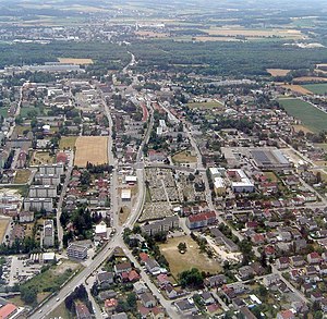
Traun (Austrian German: [traʊn] ) is an Austrian municipality located on the north bank of the river Traun and borders Linz, the capital of Upper Austria, to the east. The name Traun is derived from the Celtic word for river (dru). Traun is the fifth largest town in Upper Austria, located in the district of Linz-Land.

Pasching
Municipality in Upper Austria, Austria
Distance: Approx. 4299 meters
Latitude and longitude: 48.25888889,14.20277778
Pasching is a municipality in the Austrian state of Upper Austria. It is situated a few miles southwest of Linz and borders Leonding, Hörsching, Wilhering and Traun. Situated along the famous shopping mile the Kremstal Straße, it is the home of many retailers.
Linz-Land District
District in Upper Austria, Austria
Distance: Approx. 2109 meters
Latitude and longitude: 48.208,14.24
Bezirk Linz-Land is a district of Upper Austria in Austria.

Waldstadion (Austria)
Multi-use stadium in Pasching, Austria
Distance: Approx. 1185 meters
Latitude and longitude: 48.23638889,14.22833333
The Waldstadion (German pronunciation: [ˈvaltˌʃtaːdi̯ɔn] ), currently known as voestalpine Stadium for sponsorship purposes, is a multi-use stadium in Pasching, Austria. It is used for football matches and is the home ground of FC Juniors OÖ. Austrian Bundesliga club LASK Linz used the stadium until their new stadium was completed in 2023. The stadium holds 7,870 and was built in 1990.

Linz Airport
Airport in Hörsching, Austria
Distance: Approx. 3572 meters
Latitude and longitude: 48.23333333,14.1875
Linz Airport (German: Flughafen Linz, IATA: LNZ, ICAO: LOWL) is a minor international airport located in Hörsching, near Linz, the third-largest city in Austria. It was also known as the Blue Danube Airport until 2019.

PlusCity
Shopping centre Upper Austria, Austria
Distance: Approx. 1866 meters
Latitude and longitude: 48.24333333,14.23611111
PlusCity is a shopping centre in Pasching in Upper Austria. It is located southwest of Linz and opened in October 1989. It has a total retail floor area of approximately 70,000 square meters on two main floors, which makes it the fifth largest mall in Austria.

UNO Shopping
Distance: Approx. 2771 meters
Latitude and longitude: 48.25027778,14.24611111
The UNO Shopping was a shopping mall in Leonding, Upper Austria and is located southwest of Linz. It was opened on 16 October 1990. In 2007, the mall had a revenue of 145 Million Euro.

Hörsching
Municipality in Upper Austria, Austria
Distance: Approx. 4090 meters
Latitude and longitude: 48.22666667,14.17944444
Hörsching is a municipality in the district Linz-Land in the Austrian state of Upper Austria. It is next to the Linz Airport which is served by a shuttle bus from the Hörsching railway station. Anton Bruckner was schooled for a time in the village.
DP Camp Haid
Distance: Approx. 2905 meters
Latitude and longitude: 48.20388889,14.25388889
The DP camp Haid, officially Wohnsiedlung 121 Haid, was a camp for displaced persons, first under American administration, then Upper Austrian administration. It was located in the district of Haid, Ansfelden in Upper Austria. Displaced persons were civilians who were affected by the turmoil of World War II, first with unknown residence.
Oedter See
Lake in Upper Austria, Austria
Distance: Approx. 1877 meters
Latitude and longitude: 48.21222222,14.22138889
Oedter See is a lake of Upper Austria.
Älterer Schlier Formation
Geologic formation in Austria
Distance: Approx. 3919 meters
Latitude and longitude: 48.2,14.2
The Älterer Schlier Formation is a geologic formation in Austria. It preserves fossils dated to the Aquitanian age of the Miocene period.
Weather in this IP's area
broken clouds
6 Celsius
3 Celsius
6 Celsius
7 Celsius
1004 hPa
83 %
1004 hPa
966 hPa
10000 meters
4.12 m/s
90 degree
82 %