187.63.239.168 - IP Lookup: Free IP Address Lookup, Postal Code Lookup, IP Location Lookup, IP ASN, Public IP
Country:
Region:
City:
Location:
Time Zone:
Postal Code:
IP information under different IP Channel
ip-api
Country
Region
City
ASN
Time Zone
ISP
Blacklist
Proxy
Latitude
Longitude
Postal
Route
Luminati
Country
Region
ro
City
portovelho
ASN
Time Zone
America/Porto_Velho
ISP
BRASIL DIGITAL SERVICOS DE INFORMATICA E COMERCIO
Latitude
Longitude
Postal
IPinfo
Country
Region
City
ASN
Time Zone
ISP
Blacklist
Proxy
Latitude
Longitude
Postal
Route
IP2Location
187.63.239.168Country
Region
rondonia
City
vila murtinho
Time Zone
America/Porto_Velho
ISP
Language
User-Agent
Latitude
Longitude
Postal
db-ip
Country
Region
City
ASN
Time Zone
ISP
Blacklist
Proxy
Latitude
Longitude
Postal
Route
ipdata
Country
Region
City
ASN
Time Zone
ISP
Blacklist
Proxy
Latitude
Longitude
Postal
Route
Popular places and events near this IP address

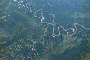
Mamoré River
River in Brazil, Bolivia
Distance: Approx. 2600 meters
Latitude and longitude: -10.38333333,-65.38333333
The Mamoré is a large river in Brazil and Bolivia which unites with the Madre de Dios River to form the Madeira, one of the largest tributaries of the Amazon. It rises on the northern slope of the Sierra de Cochabamba, east of the city of Cochabamba, and is known as the Chimoré down to its junction with the Chapare. Its larger tributaries are the Chapare, Secure, Apere, and Yacuma from the west, and the Ichilo, Guapay, Ivari, Manique and Guapore from the east.
Beni River
River in Bolivia, Brazil
Distance: Approx. 3263 meters
Latitude and longitude: -10.3821,-65.3903
The Beni River (Spanish: Río Beni) is a river in the north of Bolivia. It rises north of La Paz and flows northeast. The Madre de Dios River is where its mouth is at.

Nova Mamoré
Municipality in North, Brazil
Distance: Approx. 4389 meters
Latitude and longitude: -10.40194444,-65.32666667
Nova Mamoré is a municipality located in the Brazilian state of Rondônia. In 2020, the population of Nova Mamoré was 31,392. Its area is 10,072 km².
Villa Bella
Place in Beni Department, Bolivia
Distance: Approx. 2736 meters
Latitude and longitude: -10.39361111,-65.39083333
Villa Bella is a village in the Vaca Díez Province, in the Beni Department of Bolivia.
Weather in this IP's area
overcast clouds
28 Celsius
33 Celsius
28 Celsius
28 Celsius
1009 hPa
84 %
1009 hPa
991 hPa
7622 meters
1.72 m/s
3.9 m/s
317 degree
100 %
