187.60.20.3 - IP Lookup: Free IP Address Lookup, Postal Code Lookup, IP Location Lookup, IP ASN, Public IP
Country:
 Brazil
Region:
City:
Location:
Time Zone:
Postal Code:
ISP:
ASN:
language:
User-Agent:
Proxy IP:
Blacklist:
IP information under different IP Channel
ip-api
Country
Region
City
ASN
Time Zone
ISP
Blacklist
Proxy
Latitude
Longitude
Postal
Route
db-ip
Country
Region
City
ASN
Time Zone
ISP
Blacklist
Proxy
Latitude
Longitude
Postal
Route
IPinfo
Country
Region
City
ASN
Time Zone
ISP
Blacklist
Proxy
Latitude
Longitude
Postal
Route
IP2Location
187.60.20.3Country
brRegion
sao paulo
City
cubatao
Time Zone
America/Sao_Paulo
ISP
Language
User-Agent
Latitude
Longitude
Postal
ipdata
Country
Region
City
ASN
Time Zone
ISP
Blacklist
Proxy
Latitude
Longitude
Postal
Route
Popular places and events near this IP address
São Vicente, São Paulo
Municipality in São Paulo, Brazil
Distance: Approx. 8318 meters
Latitude and longitude: -23.96333333,-46.39222222
São Vicente (after Saint Vincent of Saragossa, the patron Saint of Lisbon, Portugal) is a coastal municipality in southern São Paulo, Brazil. It is part of the Metropolitan Region of the Baixada Santista. The population is 329,911 (2022 est.) in an area of 148,151 square kilometres (57,201.42 square miles).

Captaincy of São Vicente
1534–1709 captaincy in southern Brazil
Distance: Approx. 7465 meters
Latitude and longitude: -23.95,-46.38333333
The Captaincy of São Vicente (1534–1709) was a land grant and colonial administration in the far southern part of the colonial Portuguese Empire in Colonial Brazil.

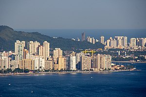
Cubatão
City in the state of São Paulo, Brazil
Distance: Approx. 40 meters
Latitude and longitude: -23.89527778,-46.42555556
Cubatão is a city in the state of São Paulo, Brazil, 12 kilometers away from Santos seaport, the largest in Latin America. It is part of the Metropolitan Region of the Baixada Santista. The population is 131,626 (2020 est.) in an area of 142.88 km2.

São Vicente Island (São Paulo, Brazil)
Island in Brazil
Distance: Approx. 9035 meters
Latitude and longitude: -23.95,-46.36
São Vicente Island (São Paulo, Brazil) (Ilha de São Vicente) is an island in São Paulo state, Brazil. It has an area of 57.4 km2 and a population of 760,000 people. The population density is 13,240/ km2, making it the most densely populated island in Brazil, and the 38th most densely populated island in the world.

Cubatão River (São Paulo)
River in Brazil
Distance: Approx. 1568 meters
Latitude and longitude: -23.88333333,-46.41666667
The Cubatão River is a Brazilian river in the state of São Paulo. It finds its origins in latitude 23º56'11 "south and longitude 46º57'20" West. Its basin is between São Paulo and Santos.

São Vicente Suspension Bridge
Bridge in São Vicente
Distance: Approx. 9697 meters
Latitude and longitude: -23.97548889,-46.38884694
São Vicente Suspension Bridge (Portuguese: Ponte Pênsil de São Vicente) is a suspension bridge in São Vicente, São Paulo, Brazil. It was one of the first suspension bridges in Brazil, and carries vehicle and pedestrian traffic between Morro dos Barbosas and Japuí. Originally conceived in 1910 as a way to carry sewage away from the city of Santos and São Vicente, construction started in 1911, and the bridge opened in May 1914.
Weather in this IP's area
clear sky
32 Celsius
36 Celsius
31 Celsius
32 Celsius
1013 hPa
60 %
1013 hPa
973 hPa
10000 meters
2.57 m/s
140 degree