Country:
 Brazil
Region:
City:
Latitude and Longitude:
Time Zone:
Postal Code:
IP information under different IP Channel
ip-api
Country
Region
City
ASN
Time Zone
ISP
Blacklist
Proxy
Latitude
Longitude
Postal
Route
IPinfo
Country
Region
City
ASN
Time Zone
ISP
Blacklist
Proxy
Latitude
Longitude
Postal
Route
MaxMind
Country
Region
City
ASN
Time Zone
ISP
Blacklist
Proxy
Latitude
Longitude
Postal
Route
Luminati
Country
BRRegion
sc
City
brusque
ASN
Time Zone
America/Sao_Paulo
ISP
V tal
Latitude
Longitude
Postal
db-ip
Country
Region
City
ASN
Time Zone
ISP
Blacklist
Proxy
Latitude
Longitude
Postal
Route
ipdata
Country
Region
City
ASN
Time Zone
ISP
Blacklist
Proxy
Latitude
Longitude
Postal
Route
Popular places and events near this IP address

Navegantes
Brazilian city
Distance: Approx. 844 meters
Latitude and longitude: -26.89888889,-48.65388889
Navegantes (Portuguese pronunciation: [naveˈɡɐ̃tʃis], Seafarers) is a coastal and tourist city located in Santa Catarina state, southern Brazil. The population is 83,626 (2020 est.) in an area of 112.0 km². Ministro Victor Konder International Airport serves the popular beach resort of Balneário Camboriú, and other cities including Itajaí and Blumenau.
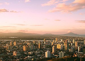
Itajaí
Municipality in Southern, Brazil
Distance: Approx. 433 meters
Latitude and longitude: -26.9,-48.66666667
Itajaí (Portuguese pronunciation: [itaʒaˈi]) is a municipality in the state of Santa Catarina, Brazil. It is located on the northern central coast of Santa Catarina and is part of the Vale do Itajaí Mesoregion, on the right bank of the Itajaí-Açu river mouth. It lies at the mouth of the Itajaí River, at 20 feet (6 metres) above sea level.
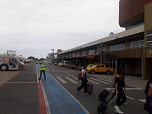
Navegantes Airport
Airport
Distance: Approx. 2639 meters
Latitude and longitude: -26.87861111,-48.65083333
Navegantes–Ministro Victor Konder International Airport (IATA: NVT, ICAO: SBNF) is the airport serving Navegantes, Brazil, as well as Itajaí, Balneário Camboriú, and Blumenau. Since June 10, 1959, it is named after the Itajaí-born Victor Konder (1886–1941), Minister of Public Works (1926–1930), whose administration encouraged the birth of Brazilian commercial aviation.

Itajaí-Açu river
River in Brazil
Distance: Approx. 2418 meters
Latitude and longitude: -26.912,-48.642
The Itajaí-Açu River is a river in the state of Santa Catarina in southeastern Brazil. It flows into the Atlantic Ocean near the city Itajaí. The river basin includes part of the 1,899 hectares (4,690 acres) Canela Preta Biological Reserve, a full protected area.
Itajaí-Mirim River
River in Brazil
Distance: Approx. 2793 meters
Latitude and longitude: -26.88333333,-48.68333333
The Itajaí-Mirim River is a river of Santa Catarina state in southeastern Brazil.
Weather in this IP's area
fog
23 Celsius
24 Celsius
23 Celsius
23 Celsius
1006 hPa
88 %
1006 hPa
1006 hPa
9000 meters
4.12 m/s
100 degree
20 %
05:53:26
18:14:44