187.188.243.250 - IP Lookup: Free IP Address Lookup, Postal Code Lookup, IP Location Lookup, IP ASN, Public IP
Country:
Region:
City:
Location:
Time Zone:
Postal Code:
IP information under different IP Channel
ip-api
Country
Region
City
ASN
Time Zone
ISP
Blacklist
Proxy
Latitude
Longitude
Postal
Route
Luminati
Country
Region
chh
City
chihuahuacity
ASN
Time Zone
America/Chihuahua
ISP
TOTAL PLAY TELECOMUNICACIONES SA DE CV
Latitude
Longitude
Postal
IPinfo
Country
Region
City
ASN
Time Zone
ISP
Blacklist
Proxy
Latitude
Longitude
Postal
Route
IP2Location
187.188.243.250Country
Region
chihuahua
City
chihuahua
Time Zone
America/Chihuahua
ISP
Language
User-Agent
Latitude
Longitude
Postal
db-ip
Country
Region
City
ASN
Time Zone
ISP
Blacklist
Proxy
Latitude
Longitude
Postal
Route
ipdata
Country
Region
City
ASN
Time Zone
ISP
Blacklist
Proxy
Latitude
Longitude
Postal
Route
Popular places and events near this IP address

Chihuahua City
City in Chihuahua, Mexico
Distance: Approx. 742 meters
Latitude and longitude: 28.63694444,-106.07694444
The city of Chihuahua or Chihuahua City (Spanish: Ciudad de Chihuahua [sjuˈða(ð) ðe tʃiˈwawa]; Lipan: Ją’éłąyá) is the state capital of the Mexican state of Chihuahua. As of 2020, the city of Chihuahua had a population of 925,762 inhabitants. while the metropolitan area had a population of 988,065 inhabitants.
Cathedral of Chihuahua
Cathedral in Chihuahua City, Mexico
Distance: Approx. 649 meters
Latitude and longitude: 28.6358,-106.0773
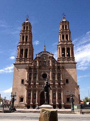
The Metropolitan Cathedral Church of the Holy Cross, Our Lady of Regla, and St Francis of Assisi is the main ecclesiastical building of the Catholic Church in Chihuahua City, Chihuahua, Mexico. It is considered perhaps the finest example of colonial architecture in northern Mexico and it was built between 1725 and 1792. The cathedral is also the seat of the Roman Catholic Archdiocese of Chihuahua.

San Francisco Temple
Catholic church in Chihuahua, Mexico
Distance: Approx. 1388 meters
Latitude and longitude: 28.64111111,-106.07222222
The Templo de San Francisco [English: Church(or Temple) of St Francis] is one of the main Catholic churches in the city of Chihuahua, Chihuahua, Mexico. It is now recognized as one of the most valuable buildings in the city as one of the few still-existing colonial monuments in the city centre. It is located at 15 Calle Libertad.

Museo Casa Chihuahua
Distance: Approx. 1156 meters
Latitude and longitude: 28.6396,-106.0739
Casa Chihuahua Centro de Patrimonio Cultural (Casa Chihuahua Cultural Heritage Center), once known as the Federal Palace of Chihuahua, is an early 20th-century building in the city centre of Chihuahua, Chih., Mexico. It served as the federal building for the city until 2004, when it was renovated as a city museum, specialising in travelling exhibits. It also houses, in the basement, the jail cell of father Miguel Hidalgo y Costilla, considered the Father of the Nation.

Roman Catholic Archdiocese of Chihuahua
Roman Catholic archdiocese in Mexico
Distance: Approx. 680 meters
Latitude and longitude: 28.6359,-106.077
The Roman Catholic Archdiocese of Chihuahua[1] (Latin: Archidioecesis Chihuahuensis) is a diocese of the Latin Church of the Roman Catholic Church in Mexico.

Government Palace of Chihuahua
Building in Chihuahua, Mexico
Distance: Approx. 1172 meters
Latitude and longitude: 28.63916667,-106.07333333
The Government Palace of Chihuahua (Palacio de Gobierno de Chihuahua) is a 19th-century building in the city of Chihuahua, Mexico. Located in the heart of the city, it is of special interest since it houses the executive offices of the governor of the state of Chihuahua and, until 2004, the state legislature met here. The building is a landmark in the city as it contains a shrine commemorating the execution of Miguel Hidalgo, considered the Father of the Country, who died at the hands of a Spanish firing squad on July 30, 1811.

City Hall of Chihuahua
Distance: Approx. 772 meters
Latitude and longitude: 28.63666667,-106.07638889
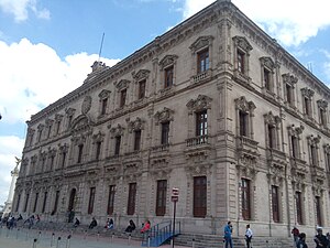
The City Hall of Chihuahua is an early 20th-century building in the city of Chihuahua, Chihuahua, Mexico. Located in front of the Plaza de Armas and the Cathedral, the City Hall houses the executive power of Chihuahua, the office of the mayor of Chihuahua, and the City Council whose salon is of special interest. The edifice is considered one of the main landmarks in the city centre.

Museo Casa Juárez
Distance: Approx. 956 meters
Latitude and longitude: 28.6386,-106.0756
The Museo de la Lealtad Republicana (Museum of the Republican Loyalty), also known as the Museo Casa Juárez, is a 19th-century building in the city centre of Chihuahua, Mexico. It housed the constitutional government of President Benito Juárez during his stay in Chihuahua while Maximilian of Habsburg reigned as Emperor of Mexico, supported by the French, and was thus the de facto National Palace of Mexico.

Chihuahua Municipality
Municipality in the Mexican state of Chihuahua
Distance: Approx. 589 meters
Latitude and longitude: 28.63527778,-106.08888889
Chihuahua is one of the 67 municipalities of Chihuahua, in northern Mexico. The municipal seat is the city of Chihuahua, which is also the capital of the state of Chihuahua. As of 2010, the municipality had a total population of 819,543, up from 758,791 in 2005.
Chihuahua (state)
State of Mexico
Distance: Approx. 1172 meters
Latitude and longitude: 28.63916667,-106.07333333
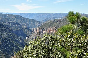
Chihuahua, officially the Free and Sovereign State of Chihuahua, is one of the 31 states which, along with Mexico City, comprise the 32 federal entities of Mexico. It is located in the northwestern part of Mexico and is bordered by the states of Sonora to the west, Sinaloa to the southwest, Durango to the south, and Coahuila to the east. To the north and northeast, it shares an extensive border with the U.S. adjacent to the U.S. states of New Mexico and Texas.
Timeline of Chihuahua City
Distance: Approx. 589 meters
Latitude and longitude: 28.635278,-106.088889
The following is a timeline of the history of the city of Chihuahua, Mexico.

Quinta Gameros
Mansion in Chihuahua, Mexico
Distance: Approx. 956 meters
Latitude and longitude: 28.6322,-106.0736
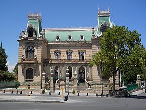
The Quinta Gameros (English: Gameros Country House) is a mansion in Chihuahua, Chihuahua. The building is an Historic National Monument of Mexico. Quinta Gameros currently houses the Centro Cultural Universitario Quinta Gameros, a regional museum of Mexico.
Weather in this IP's area
clear sky
15 Celsius
13 Celsius
15 Celsius
15 Celsius
1026 hPa
42 %
1026 hPa
846 hPa
10000 meters
0.86 m/s
0.61 m/s
33 degree
5 %

