187.184.173.192 - IP Lookup: Free IP Address Lookup, Postal Code Lookup, IP Location Lookup, IP ASN, Public IP
Country:
Region:
City:
Location:
Time Zone:
Postal Code:
IP information under different IP Channel
ip-api
Country
Region
City
ASN
Time Zone
ISP
Blacklist
Proxy
Latitude
Longitude
Postal
Route
Luminati
Country
Region
yuc
City
merida
ASN
Time Zone
America/Merida
ISP
Cablemas Telecomunicaciones SA de CV
Latitude
Longitude
Postal
IPinfo
Country
Region
City
ASN
Time Zone
ISP
Blacklist
Proxy
Latitude
Longitude
Postal
Route
IP2Location
187.184.173.192Country
Region
oaxaca
City
cuilapan de guerrero
Time Zone
America/Mexico_City
ISP
Language
User-Agent
Latitude
Longitude
Postal
db-ip
Country
Region
City
ASN
Time Zone
ISP
Blacklist
Proxy
Latitude
Longitude
Postal
Route
ipdata
Country
Region
City
ASN
Time Zone
ISP
Blacklist
Proxy
Latitude
Longitude
Postal
Route
Popular places and events near this IP address

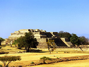
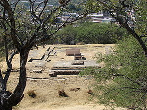
Monte Albán
Pre-Columbian archaeological site in Mexico
Distance: Approx. 4887 meters
Latitude and longitude: 17.04388889,-96.76777778
Monte Albán is a large pre-Columbian archaeological site in the Santa Cruz Xoxocotlán Municipality in the southern Mexican state of Oaxaca (17.043° N, 96.767°W). The site is located on a low mountainous range rising above the plain in the central section of the Valley of Oaxaca, where the latter's northern Etla, eastern Tlacolula, and southern Zimatlán and Ocotlán (or Valle Grande) branches meet. The present-day state capital Oaxaca City is located approximately 9 km (6 mi) east of Monte Albán.

Oaxaca International Airport
International airport in Oaxaca, Mexico
Distance: Approx. 4262 meters
Latitude and longitude: 17,-96.72666667
Oaxaca International Airport (Spanish: Aeropuerto Internacional de Oaxaca) officially Aeropuerto Internacional Xoxocotlán (Xoxocotlán International Airport) (Classical Nahuatl: Xōxōkot͡ɬan [ʃoʃokotlan], χoχokot͡ɬán in Mexican Spanish) (IATA: OAX, ICAO: MMOX) is an international airport located in the municipality of Santa Cruz Xoxocotlán, a southern suburb of Oaxaca City, Mexico. It handles national and international air traffic for the Metropolitan Area of Oaxaca and a significant portion of the State of Oaxaca. The airport is operated by Grupo Aeroportuario del Sureste (ASUR) and derives its name from the Nahuatl word "xocotl," meaning "sour or sweet and sour fruit." The airport serves as the hub for the regional airline Aerotucán and offers passenger services for both domestic and international destinations.
Santa Cruz Xoxocotlán
City and municipality in Oaxaca, Mexico
Distance: Approx. 4609 meters
Latitude and longitude: 17.02638889,-96.73333333
Santa Cruz Xoxocotlán is a small city and municipality located 5 km from the state capital of Oaxaca in the south of Mexico. It is part of the Centro District in the Valles Centrales region. The name comes from the Nahuatl word “xocotl” which means “sour or sweet and sour fruit” with the duplicative “xo” to indicate “very.” The meaning of the entire phrase means “among the very sour fruits.” The Mixtec name for the area was Nuunitatnohoyoo which mean “land of the moon-faced flowers.” However, the community is most commonly referred to simply as Xoxo.
Zaachila
Distance: Approx. 5843 meters
Latitude and longitude: 16.95,-96.75
Zaachila (the Zapotec name; Nahuatl: Teotzapotlan; Mixtec: Ñuhu Tocuisi) was a powerful Mesoamerican city in what is now Oaxaca, Mexico, 6 km (3.7 mi) from the city of Oaxaca. The city is named after Zaachila Yoo, the Zapotec ruler, in the late 14th and early 15th century. Zaachila was home of Donaji- the last Zapotec princess.

Cuilapan de Guerrero
Town and municipality in Oaxaca, Mexico
Distance: Approx. 1623 meters
Latitude and longitude: 16.99722222,-96.78166667
Cuilapan de Guerrero is a town and municipality located in the central valley region of Oaxaca in southern Mexico. It is 10 kilometres (6.2 mi) to the south of the capital city of Oaxaca on the road leading to Villa de Zaachila, and is in the Centro District in the Valles Centrales region. Cuilapan, originally called Sahayuca, has been a permanent settlement since at least 500 BCE. It developed into a city state but was absorbed by Monte Albán until between 600 and 900 CE. After this, Cuilapan returned to being an independent city-state, equal to a number of other important city states in the area.

Ánimas Trujano, Oaxaca
Municipality and town in Oaxaca, Mexico
Distance: Approx. 5640 meters
Latitude and longitude: 16.98333333,-96.71666667
Animas Trujano is a town and municipality in Oaxaca in south-western Mexico. The municipality covers an area of 6.7 km², and it is part of the Centro District in the Valles Centrales region. Its climate is warm most of the time, and the municipal area has a diversity of both animal and plant species.
San Agustín de las Juntas
Municipality and town in Oaxaca, Mexico
Distance: Approx. 5326 meters
Latitude and longitude: 17,-96.71666667
San Agustín de las Juntas is a town and municipality in Oaxaca in south-western Mexico. The municipality covers an area of 12.76 km². It is part of the Centro District in the Valles Centrales region.
Villa de Zaachila
Town and municipality in Oaxaca, Mexico
Distance: Approx. 5783 meters
Latitude and longitude: 16.95083333,-96.74916667
Villa de Zaachila is a town and municipality in Oaxaca, Mexico, 6 km (3.7 mi) from Oaxaca City. It is part of the Zaachila District in the west of the Valles Centrales Region. In the pre-Hispanic era, it was the main city-state for the Valley of Oaxaca after the fall of Monte Albán, and the Zaachila Zapotecs were the prominent political force for much of the Valley of Oaxaca when the Spanish arrived.
San Raymundo Jalpan
Municipality and town in Oaxaca, Mexico
Distance: Approx. 5137 meters
Latitude and longitude: 16.96666667,-96.73333333
San Raymundo Jalpan is a town and municipality in Oaxaca in south-western Mexico. The municipality covers an area of km². It is part of the Centro District in the Valles Centrales region.

Monastery of Santiago Apóstol, Cuilapan de Guerrero
Distance: Approx. 1572 meters
Latitude and longitude: 16.99228,-96.77907
The Ex-monastery of Santiago Apóstol is located in the town of Cuilapan de Guerrero in the Mexican state of Oaxaca. The fortress-like complex is easily seen from the highway as one travels south from the capital city of Oaxaca on the road leading to Villa de Zaachila, and it is visited by both Mexican and international tourists. The complex is located on a small hill which gives it a view of much of the valley area.

Zaachila District
District in Oaxaca, Mexico
Distance: Approx. 6603 meters
Latitude and longitude: 16.95,-96.73333333
Zaachila District is located in the west of the Valles Centrales Region of the State of Oaxaca, Mexico. The district includes the municipalities of San Antonio Huitepec, San Miguel Peras, San Pablo Cuatro Venados, Santa Inés del Monte, Trinidad Zaachila and Villa de Zaachila.

Congress of Oaxaca
Mexican state legislature
Distance: Approx. 1650 meters
Latitude and longitude: 16.9925,-96.75333333
The Congress of the State of Oaxaca (Spanish: Congreso del Estado de Oaxaca) is the legislature of Oaxaca, a state of Mexico. The Congress is unicameral.
Weather in this IP's area
few clouds
13 Celsius
13 Celsius
13 Celsius
13 Celsius
1022 hPa
90 %
1022 hPa
851 hPa
10000 meters
2.25 m/s
2.62 m/s
347 degree
22 %


