187.184.172.241 - IP Lookup: Free IP Address Lookup, Postal Code Lookup, IP Location Lookup, IP ASN, Public IP
Country:
Region:
City:
Location:
Time Zone:
Postal Code:
ISP:
ASN:
language:
User-Agent:
Proxy IP:
Blacklist:
IP information under different IP Channel
ip-api
Country
Region
City
ASN
Time Zone
ISP
Blacklist
Proxy
Latitude
Longitude
Postal
Route
db-ip
Country
Region
City
ASN
Time Zone
ISP
Blacklist
Proxy
Latitude
Longitude
Postal
Route
IPinfo
Country
Region
City
ASN
Time Zone
ISP
Blacklist
Proxy
Latitude
Longitude
Postal
Route
IP2Location
187.184.172.241Country
Region
oaxaca
City
san juan guelavia
Time Zone
America/Mexico_City
ISP
Language
User-Agent
Latitude
Longitude
Postal
ipdata
Country
Region
City
ASN
Time Zone
ISP
Blacklist
Proxy
Latitude
Longitude
Postal
Route
Popular places and events near this IP address
Sierra Madre de Oaxaca
Mountain range in southern Mexico
Distance: Approx. 7702 meters
Latitude and longitude: 17,-96.5
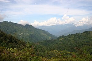
The Sierra Madre de Oaxaca is a mountain range in southern Mexico. It is primarily in the state of Oaxaca, and extends north into the states of Puebla and Veracruz.

San Jerónimo Tlacochahuaya
Place in Oaxaca, Mexico
Distance: Approx. 7331 meters
Latitude and longitude: 17.00888889,-96.58083333
San Jerónimo Tlacochahuaya is a little town and municipality in the Mexican state of Oaxaca, 21 km from the city of Oaxaca on Federal Highway 190 between Santa Maria del Tule and Mitla.

Tlacolula de Matamoros
City and municipality in Oaxaca, Mexico
Distance: Approx. 7557 meters
Latitude and longitude: 16.95416667,-96.47916667
Tlacolula de Matamoros is a city and municipality in the Mexican state of Oaxaca, about 30 km from the center of the city of Oaxaca on Federal Highway 190, which leads east to Mitla and the Isthmus of Tehuantepec. It is part of the Tlacolula District in the east of the Valles Centrales Region. The city is the main commercial center for the Tlacolula Valley area, and best known for its weekly open air market held on Sundays.
Lambityeco
Distance: Approx. 6635 meters
Latitude and longitude: 16.97166667,-96.49194444
Lambityeco is a small archaeological site about three kilometers west of the city of Tlacolula de Matamoros in the Mexican state of Oaxaca. It is located just off Highway 190 about 25 km (16 mi) east from the city of Oaxaca en route to Mitla. The site has been securely dated to the Late Classical Period.

Dainzú
Zapotec archaeological site in Oaxaca, Mexico
Distance: Approx. 6014 meters
Latitude and longitude: 17.00361111,-96.55694444
Dainzú is a Zapotec archaeological site located in the eastern side of the Valles Centrales de Oaxaca, about 20 km south-east of the city of Oaxaca, Oaxaca State, Mexico. It is an ancient village near to and contemporary with Monte Albán and Mitla, with an earlier development. Dainzú was first occupied 700-600 BC but the main phase of occupation dates from about 200 BC to 350 AD. The site was excavated in 1965 by Mexican archaeologist Ignacio Bernal.
Magdalena Teitipac
Municipality and town in Oaxaca, Mexico
Distance: Approx. 5566 meters
Latitude and longitude: 16.9,-96.55
Magdalena Teitipac is a town and municipality in Oaxaca in south-western Mexico. The municipality covers an area of 48.5 km2. It is part of the Tlacolula District in the east of the Valles Centrales Region.
San Juan Guelavía
Municipality and town in Oaxaca, Mexico
Distance: Approx. 1775 meters
Latitude and longitude: 16.95,-96.53333333
San Juan Guelavía is a town and municipality in Oaxaca in south-western Mexico. The municipality covers an area of 17.86 km2. It is part of the Tlacolula District in the east of the Valles Centrales Region.
San Juan Teitipac
Municipality and town in Oaxaca, Mexico
Distance: Approx. 5638 meters
Latitude and longitude: 16.93333333,-96.6
San Juan Teitipac is a town and municipality in Oaxaca in south-western Mexico. The municipality covers an area of 11.48 km². It is part of the Tlacolula District in the east of the Valles Centrales Region.
San Sebastián Abasolo
Municipality and town in Oaxaca, Mexico
Distance: Approx. 6381 meters
Latitude and longitude: 16.99443333,-96.58785833
San Sebastián Abasolo is a town and municipality in Oaxaca in south-western Mexico. The municipality covers an area of km². It is part of the Tlacolula District in the east of the Valles Centrales Region.
San Sebastián Teitipac
Municipality and town in Oaxaca, Mexico
Distance: Approx. 7099 meters
Latitude and longitude: 16.95,-96.61666667
San Sebastián Teitipac is a town and municipality in Oaxaca in south-western Mexico. The municipality covers an area of km². It is part of the Tlacolula District in the east of the Valles Centrales Region.
Santa Cruz Papalutla
Municipality and town in Oaxaca, Mexico
Distance: Approx. 3549 meters
Latitude and longitude: 16.95,-96.58333333
Santa Cruz Papalutla is a town and municipality in Oaxaca in south-western Mexico. The municipality covers an area of km2. It is part of the Tlacolula District in the east of the Valles Centrales Region.

Estadio Independiente MRCI
Distance: Approx. 7164 meters
Latitude and longitude: 17.01055556,-96.57277778
Estadio Independiente MRCI is a football stadium in San Jerónimo Tlacochahuaya, Oaxaca, Mexico. It is currently used mostly for football matches and is the home stadium of Chapulineros de Oaxaca and Mezcaleros de Oaxaca. The stadium seats 3,000 people.
Weather in this IP's area
scattered clouds
10 Celsius
8 Celsius
10 Celsius
10 Celsius
1026 hPa
82 %
1026 hPa
825 hPa
10000 meters
3.23 m/s
3.37 m/s
47 degree
35 %

