187.184.16.121 - IP Lookup: Free IP Address Lookup, Postal Code Lookup, IP Location Lookup, IP ASN, Public IP
Country:
Region:
City:
Location:
Time Zone:
Postal Code:
ISP:
ASN:
language:
User-Agent:
Proxy IP:
Blacklist:
IP information under different IP Channel
ip-api
Country
Region
City
ASN
Time Zone
ISP
Blacklist
Proxy
Latitude
Longitude
Postal
Route
db-ip
Country
Region
City
ASN
Time Zone
ISP
Blacklist
Proxy
Latitude
Longitude
Postal
Route
IPinfo
Country
Region
City
ASN
Time Zone
ISP
Blacklist
Proxy
Latitude
Longitude
Postal
Route
IP2Location
187.184.16.121Country
Region
guerrero
City
chilpancingo
Time Zone
America/Mexico_City
ISP
Language
User-Agent
Latitude
Longitude
Postal
ipdata
Country
Region
City
ASN
Time Zone
ISP
Blacklist
Proxy
Latitude
Longitude
Postal
Route
Popular places and events near this IP address

Chilpancingo
City in the Mexican state of Guerrero
Distance: Approx. 0 meters
Latitude and longitude: 17.55,-99.5
Chilpancingo de los Bravo (commonly shortened to Chilpancingo; Spanish pronunciation: [tʃilpanˈsiŋɡo] ; Nahuatl: Chilpantzinco (pronounced [t͡ʃiɬpanˈt͡siŋko])) is the capital and second-largest city of the Mexican state of Guerrero. In 2010 it had a population of 187,251 people. The municipality has an area of 2,338.4 km2 (902.9 sq mi) in the south-central part of the state, situated in the Sierra Madre del Sur mountains, on the bank of the Huacapa River.
Roman Catholic Diocese of Chilpancingo-Chilapa
Roman Catholic diocese in Mexico
Distance: Approx. 321 meters
Latitude and longitude: 17.5526,-99.5013
The Roman Catholic Diocese of Chilpancingo–Chilapa (Latin: Dioecesis Chilpancingensis–Chilapensis) is a suffragan diocese of the Archdiocese of Acapulco.

Leonardo Bravo (municipality)
Municipality in the Mexican state of Guerrero
Distance: Approx. 7076 meters
Latitude and longitude: 17.55,-99.56666667
Leonardo Bravo is a municipality in the Mexican state of Guerrero. The municipal seat lies at Chichihualco. The municipality covers an area of 852 km².

Chilpancingo National Airport
Airfield in Chilpancingo, Guerrero, Mexico
Distance: Approx. 3070 meters
Latitude and longitude: 17.57388889,-99.51444444
Chilpancingo Airfield (Spanish: Aeropuerto de Chilpancingo); officially Aeródromo Nicolás Bravo (Nicolás Bravo Aerodrome) (ICAO: MMCH, FAA LID: CHG) is a small airfield located in Chilpancingo, Guerrero, México. It handles domestic air traffic and supports flight training and general aviation activities. The airfield is named in honor of the Mexican President Nicolás Bravo.
Ayotzinapa
Locality in Guerrero, Mexico
Distance: Approx. 9531 meters
Latitude and longitude: 17.55361111,-99.41027778
Ayotzinapa is a locality located in the municipality of Tixtla de Guerrero, in the Mexican state of Guerrero in southwestern Mexico.
Ayotzinapa Rural Normal School
Normal School in Guerrero, Mexico
Distance: Approx. 9530 meters
Latitude and longitude: 17.55333333,-99.41027778
Raúl Isidro Burgos Rural Normal School, commonly known as the Ayotzinapa Rural Normal School, is a men's normal school, located in the municipality of Tixtla, Guerrero, Mexico. The school is part of the rural teacher's education system that was created as part of an ambitious mass education plan implemented by the state in the 1920s. Moisés Sáenz was the head of the Secretariat of Public Education at the time of the school's creation.

Autonomous University of Guerrero
Distance: Approx. 1542 meters
Latitude and longitude: 17.5368,-99.4956
The Autonomous University of Guerrero (Universidad Autónoma de Guerrero or UAGro) is a public and autonomous institution of secondary education and higher education in the Mexican state of Guerrero. Its main campus is in Chilpancingo, with facilities in Acapulco, Taxco, Iguala, Tixtla, Ometepec, Tecpan de Galeana, Altamirano and other cities in the state.
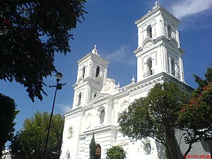
Chilpancingo Cathedral
Church in Chilpancingo, Mexico
Distance: Approx. 322 meters
Latitude and longitude: 17.55263889,-99.50125
The St. Mary of the Assumption Cathedral (also Chilpancingo Cathedral; Spanish: Catedral de Santa María de la Asunción de Chilpancingo) is the main Catholic church of the city of Chilpancingo in Mexico. It is consecrated to the Virgin Mary in its invocation of St.

7th federal electoral district of Guerrero
Federal electoral district of Mexico
Distance: Approx. 0 meters
Latitude and longitude: 17.55,-99.5
The 7th federal electoral district of Guerrero (Distrito electoral federal 07 de Guerrero) is one of the 300 electoral districts into which Mexico is divided for elections to the federal Chamber of Deputies and one of eight such districts in the state of Guerrero. It elects one deputy to the lower house of Congress for each three-year legislative period by means of the first-past-the-post system. Votes cast in the district also count towards the calculation of proportional representation ("plurinominal") deputies elected from the fourth region.
Weather in this IP's area
scattered clouds
20 Celsius
19 Celsius
20 Celsius
20 Celsius
1016 hPa
57 %
1016 hPa
836 hPa
10000 meters
1.37 m/s
1.03 m/s
354 degree
36 %
