186.96.210.1 - IP Lookup: Free IP Address Lookup, Postal Code Lookup, IP Location Lookup, IP ASN, Public IP
Country:
Region:
City:
Location:
Time Zone:
Postal Code:
IP information under different IP Channel
ip-api
Country
Region
City
ASN
Time Zone
ISP
Blacklist
Proxy
Latitude
Longitude
Postal
Route
Luminati
Country
Region
pos
City
portofspain
ASN
Time Zone
America/Port_of_Spain
ISP
AMPLIA COMMUNICATIONS LTD.
Latitude
Longitude
Postal
IPinfo
Country
Region
City
ASN
Time Zone
ISP
Blacklist
Proxy
Latitude
Longitude
Postal
Route
IP2Location
186.96.210.1Country
Region
arima
City
arima
Time Zone
America/Port_of_Spain
ISP
Language
User-Agent
Latitude
Longitude
Postal
db-ip
Country
Region
City
ASN
Time Zone
ISP
Blacklist
Proxy
Latitude
Longitude
Postal
Route
ipdata
Country
Region
City
ASN
Time Zone
ISP
Blacklist
Proxy
Latitude
Longitude
Postal
Route
Popular places and events near this IP address

Arima
Borough in The Royal Chartered Borough of Arima, Trinidad and Tobago
Distance: Approx. 5 meters
Latitude and longitude: 10.63333333,-61.28333333
Arima, officially The Royal Chartered Borough of Arima is the easternmost and second largest in area of the three boroughs of Trinidad and Tobago. It is geographically adjacent to Sangre Grande and Arouca at the south central foothills of the Northern Range. To the south is the Caroni–Arena Dam.

Arouca, Trinidad and Tobago
Town in Tunapuna–Piarco, Trinidad and Tobago
Distance: Approx. 5474 meters
Latitude and longitude: 10.63333333,-61.33333333
Arouca is a town in the East–West Corridor of Trinidad and Tobago located 19 km (12 mi) east of Port of Spain, along the Eastern Main Road. It is located west of Arima, east of Tunapuna and Tacarigua, south of Lopinot, and north of Piarco. It is governed by the Tunapuna–Piarco Regional Corporation.

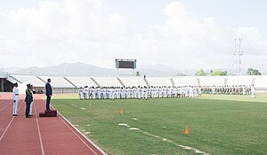
Larry Gomes Stadium
Distance: Approx. 1872 meters
Latitude and longitude: 10.6165,-61.2825
The Larry Gomes Stadium, located in Malabar, Arima, Trinidad and Tobago, is named for West Indies cricketer Larry Gomes. The stadium was constructed for the 2001 U-17 World Cup which was hosted by Trinidad and Tobago. It also hosted games from the 2010 FIFA U-17 Women's World Cup.
Malabar Settlement
Neighborhoods of Arima in Saint George, Trinidad and Tobago
Distance: Approx. 1852 meters
Latitude and longitude: 10.61666667,-61.28333333
Malabar is a diverse neighbourhood in South Arima, in Trinidad and Tobago. It is noted for middle class housing. Its boundaries are marked by Omeara Road to the west, Tumpuna Road to the east, the Churchill-Roosevelt Highway to the south and Pro Queen Street to the north.
Wallerfield
Community in Tunapuna–Piarco, Trinidad and Tobago
Distance: Approx. 6369 meters
Latitude and longitude: 10.630136,-61.225173
Wallerfield is a residential and industrial area east of Arima in Trinidad and Tobago. It served as Waller Air Force Base, and since the closure of U.S. Army base in May 1949 it became the informal home of various types of racing (using former airstrips) for over 40 years. It is the site of a new multimillion-dollar University of Trinidad and Tobago campus complex, as well as several housing developments and other projects.

Arima Government Secondary School
Public/government school in Trinidad and Tobago
Distance: Approx. 709 meters
Latitude and longitude: 10.6343,-61.2769
Arima Central Secondary School, formerly called Arima Government Secondary School (commonly referred to as "Central" or "ACSS"), is a co-educational secondary school on Roberts Street in Arima in the Republic of Trinidad and Tobago. The school is administered by the Ministry of Education, Trinidad and Tobago. Arima Central Secondary school is regarded as one of the best schools in east Trinidad.
Holy Cross College (Trinidad)
Distance: Approx. 1693 meters
Latitude and longitude: 10.64847,-61.28436
Holy Cross College is a government assisted, Roman Catholic secondary school situated on Calvary Hill, in the town of Arima, which is located north-east of Trinidad ( and Tobago).
Bon Air High School
Distance: Approx. 4701 meters
Latitude and longitude: 10.631489,-61.326232
Bon Air Secondary School is a co-educational secondary school in Arouca, Trinidad and Tobago. It is located at the Corner of Bon Air Gardens Junction and the Priority Bus Route, Arouca. Bon Air Secondary School is a five year secondary school consisting of Forms 1-5.
D'Abadie
Place in Trinidad and Tobago
Distance: Approx. 3651 meters
Latitude and longitude: 10.63333333,-61.31666667
D'Abadie is a community located in the Tunapuna-Piarco regional corporation in Trinidad and Tobago. Its population is 5,827 people. Some schools include Pinehaven S.D.A. Primary School and D'abadie Government Primary School.
Talparo Formation
Distance: Approx. 4133 meters
Latitude and longitude: 10.6,-61.3
The Talparo Formation is a geologic formation in Trinidad and Tobago. It preserves fossils dating back to the Early Pliocene period.

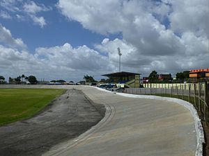
Arima Velodrome
Sporting venue in Trinidad and Tobago
Distance: Approx. 418 meters
Latitude and longitude: 10.63699694,-61.28399389
The Arima Velodrome is an outdoor velodrome in Arima, Trinidad and Tobago. The velodrome is an open outdoor velodrome serving the Borough of Arima and its suburbs. It hosts grass and concrete surface.

Princess Royal Park, Arima
Cricket ground in Arima, Trinidad and Tobago
Distance: Approx. 491 meters
Latitude and longitude: 10.6376,-61.2823
Princess Royal Park is a public park and former major cricket venue in Arima, Trinidad and Tobago.
Weather in this IP's area
light rain
24 Celsius
24 Celsius
24 Celsius
24 Celsius
1012 hPa
88 %
1012 hPa
1006 hPa
10000 meters
20 %