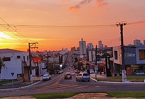
186.251.7.145 - IP Lookup: Free IP Address Lookup, Postal Code Lookup, IP Location Lookup, IP ASN, Public IP
Country:
Region:
City:
Location:
Time Zone:
Postal Code:
IP information under different IP Channel
ip-api
Country
Region
City
ASN
Time Zone
ISP
Blacklist
Proxy
Latitude
Longitude
Postal
Route
Luminati
Country
Region
sp
City
assis
ASN
Time Zone
America/Sao_Paulo
ISP
OnLine Assis Telecomunicacoes Ltda-EPP
Latitude
Longitude
Postal
IPinfo
Country
Region
City
ASN
Time Zone
ISP
Blacklist
Proxy
Latitude
Longitude
Postal
Route
IP2Location
186.251.7.145Country
Region
sao paulo
City
assis
Time Zone
America/Sao_Paulo
ISP
Language
User-Agent
Latitude
Longitude
Postal
db-ip
Country
Region
City
ASN
Time Zone
ISP
Blacklist
Proxy
Latitude
Longitude
Postal
Route
ipdata
Country
Region
City
ASN
Time Zone
ISP
Blacklist
Proxy
Latitude
Longitude
Postal
Route
Popular places and events near this IP address

Assis
Municipality in Southeast, Brazil
Distance: Approx. 46 meters
Latitude and longitude: -22.66194444,-50.41194444
Assis is a city and a municipality in the southwestern part of the state of São Paulo in Brazil. The population is 101,409 (2022 est.) in an area of 460.61 km2. The town was founded on July 5, 1905, and became a municipality in 1917, when it was separated from Platina.

Cândido Mota
Municipality in the state of São Paulo in Brazil
Distance: Approx. 9789 meters
Latitude and longitude: -22.74638889,-50.38694444
Cândido Mota is a municipality in the state of São Paulo in Brazil. The population is 31,346 (2020 est.) in an area of 596 km2. The elevation is 479 m.

Roman Catholic Diocese of Assis
Catholic ecclesiastical territory
Distance: Approx. 79 meters
Latitude and longitude: -22.6619,-50.4129
The Roman Catholic Diocese of Assis (Latin: Dioecesis Assisensis) is a diocese located in the city of Assis in the ecclesiastical province of Botucatu in Brazil.

Assis Airport
Airport
Distance: Approx. 5162 meters
Latitude and longitude: -22.63861111,-50.45583333
Assis–Marcelo Pires Halzhausen State Airport (IATA: AIF, ICAO: SNAX) is the airport serving Assis, Brazil.

Mesoregion of Assis
Mesoregion in Southeast, Brazil
Distance: Approx. 45 meters
Latitude and longitude: -22.6619,-50.4119
The Mesoregion of Assis (or Paranapanema Valley's Mesoregion) is one of the 15 mesoregions of the São Paulo state, Brazil. It is located at the southwest portion of the state, and has an area of 12,710.210 km2 and the seat of mesoregion is in Assis. The population of the mesoregion is 567,858 inhabitants (IBGE/2010), spread over 35 municipalities.

Microregion of Assis
Microregion in Southeast, Brazil
Distance: Approx. 45 meters
Latitude and longitude: -22.6619,-50.4119
The Microregion of Assis (Portuguese: Microrregião de Assis) is located on the west of São Paulo state, Brazil, and is made up of 17 municipalities and it belongs to the Mesoregion of Assis.

Fundação Educacional do Município de Assis
Distance: Approx. 2197 meters
Latitude and longitude: -22.6437862,-50.4213949
The Instituto Municipal de Ensino Superior de Assis (IMESA) (or in English Assis's Municipal Institute of Higher Education) is a city university in the city of Assis in Brazil. It is governed by the Fundação Educacional do Município de Assis - FEMA and was founded in 1985 and is controlled by Prefeitura Municipal de Assis. O IMESA have 15 undergraduate and 4 postgraduate courses.
Weather in this IP's area
clear sky
29 Celsius
29 Celsius
29 Celsius
29 Celsius
1010 hPa
42 %
1010 hPa
954 hPa
10000 meters
2.15 m/s
1.66 m/s
100 degree
1 %