Country:
Region:
City:
Latitude and Longitude:
Time Zone:
Postal Code:
IP information under different IP Channel
ip-api
Country
Region
City
ASN
Time Zone
ISP
Blacklist
Proxy
Latitude
Longitude
Postal
Route
Luminati
Country
Region
sp
City
cordeiropolis
ASN
Time Zone
America/Sao_Paulo
ISP
TELECOM CORDEIROPOLIS LTDA - ME
Latitude
Longitude
Postal
IPinfo
Country
Region
City
ASN
Time Zone
ISP
Blacklist
Proxy
Latitude
Longitude
Postal
Route
db-ip
Country
Region
City
ASN
Time Zone
ISP
Blacklist
Proxy
Latitude
Longitude
Postal
Route
ipdata
Country
Region
City
ASN
Time Zone
ISP
Blacklist
Proxy
Latitude
Longitude
Postal
Route
Popular places and events near this IP address

Limeira
Municipality in Southeast, Brazil
Distance: Approx. 9329 meters
Latitude and longitude: -22.565,-47.40194444
Limeira is a city in the eastern part of the Brazilian state of São Paulo. With a population of approximately 291,869 people (2022 IBGE.) and covering an area of 581 square kilometers, it sits at an elevation of 588 meters. The city is situated 154 kilometers from São Paulo, the capital of the state, and 1011 kilometers from Brasilia, the capital of Brazil.

Estádio Major José Levy Sobrinho
Distance: Approx. 8457 meters
Latitude and longitude: -22.55529444,-47.38504167
Estádio Major José Levy Sobrinho, also known as Limeirão, is a multi-purpose stadium in Limeira, in the Brazilian state of São Paulo. It is currently used mostly for football matches. The stadium has a capacity of 18,000 people.

Cordeirópolis
Municipality in São Paulo state, Brazil
Distance: Approx. 5529 meters
Latitude and longitude: -22.48194444,-47.45694444
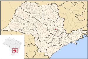
Cordeirópolis is a municipality in São Paulo state, Brazil. The population is 24,826 (2020 est.) in an area of 138 km2. Its elevation is 651 m.
Roman Catholic Diocese of Limeira
Catholic ecclesiastical territory
Distance: Approx. 8973 meters
Latitude and longitude: -22.5618,-47.4021
The Roman Catholic Diocese of Limeira (Latin: Dioecesis Limeirensis) is a diocese located in the city of Limeira in the ecclesiastical province of Campinas in Brazil.
University of Campinas School of Applied Sciences
Academic unit in the State University of Campinas
Distance: Approx. 8856 meters
Latitude and longitude: -22.5565,-47.431
The School of Applied Sciences (Portuguese: Faculdade de Ciências Aplicadas, FCA) is an academic unit of the State University of Campinas, one of the most respected universities in Latin America. Its campus is located in the city of Limeira, which is 55 km (34 mi) from the main UNICAMP campus in Campinas, both located in the state of São Paulo. Established in 2009, it is the most recent unit of UNICAMP. The differential of FCA in relation to the other units of UNICAMP is its philosophy based on expanded interdisciplinary and coexistence among students of various fields of knowledge.
Weather in this IP's area
overcast clouds
19 Celsius
20 Celsius
19 Celsius
19 Celsius
1013 hPa
97 %
1013 hPa
936 hPa
10000 meters
1.58 m/s
3.59 m/s
57 degree
100 %
05:22:28
18:23:58
