Country:
 Brazil
Region:
City:
Latitude and Longitude:
Time Zone:
Postal Code:
IP information under different IP Channel
ip-api
Country
Region
City
ASN
Time Zone
ISP
Blacklist
Proxy
Latitude
Longitude
Postal
Route
IPinfo
Country
Region
City
ASN
Time Zone
ISP
Blacklist
Proxy
Latitude
Longitude
Postal
Route
MaxMind
Country
Region
City
ASN
Time Zone
ISP
Blacklist
Proxy
Latitude
Longitude
Postal
Route
Luminati
Country
BRRegion
sp
City
piracicaba
ASN
Time Zone
America/Sao_Paulo
ISP
SOPHUS INFORMACOES CADASTRAIS LTDA - EPP
Latitude
Longitude
Postal
db-ip
Country
Region
City
ASN
Time Zone
ISP
Blacklist
Proxy
Latitude
Longitude
Postal
Route
ipdata
Country
Region
City
ASN
Time Zone
ISP
Blacklist
Proxy
Latitude
Longitude
Postal
Route
Popular places and events near this IP address
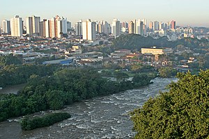
Piracicaba
Municipality in Southeast, Brazil
Distance: Approx. 1001 meters
Latitude and longitude: -22.72527778,-47.64916667
Piracicaba (Portuguese pronunciation: [piɾɐsiˈkabɐ] or [piˌɾasiˈkabɐ]) is a city located in the Brazilian state of São Paulo. The population is 423,323 (2022) in an area of 1,378.07 km2. It is at an elevation of 547 m above sea level.

Estádio Barão da Serra Negra
Distance: Approx. 2323 meters
Latitude and longitude: -22.72972222,-47.63694444
Estádio Barão da Serra Negra is a multi-use stadium located in Piracicaba, Brazil. It is used mostly for football matches and hosts the home matches of Esporte Clube XV de Novembro. The stadium has a maximum capacity of 18,799 people and was built in 1965.
Corumbataí River (São Paulo)
River in Brazil
Distance: Approx. 5244 meters
Latitude and longitude: -22.68333333,-47.68333333
The Corumbataí River is a river of São Paulo state in southeastern Brazil.

College of Agriculture, University of São Paulo
Distance: Approx. 2540 meters
Latitude and longitude: -22.70833333,-47.64166667
The Luiz de Queiroz College of Agriculture (Portuguese: Escola Superior de Agricultura Luiz de Queiroz, ESALQ) is a unit of the University of São Paulo involved with research, teaching and extension of services in agriculture, animal husbandry, agricultural and related sciences. The school's main campus, located in Piracicaba, São Paulo, is home to seven undergraduate and eighteen graduate programs. In addition, the school maintains exchange agreements with many other institutions of the world, and welcome exchange students of several nationalities.
Renascer Community
Slum in São Paulo, Brazil
Distance: Approx. 3250 meters
Latitude and longitude: -22.75194444,-47.67027778
Renascer Community (Portuguese: Comunidade Renascer, pronounced [ko.mu.niˈda.d͡ʒi ʁe.naˈseʁ], reborn community) is a slum located in the Novo Horizonte neighborhood, in the city of Piracicaba, interior of the state of São Paulo, Brazil. It was founded around December 2019, and it is grewing very fast since 2020. In 2021, Renascer had more than 2,000 inhabitants, and it is considered one of the largest urban communities of the interior of São Paulo.
Weather in this IP's area
overcast clouds
27 Celsius
27 Celsius
27 Celsius
27 Celsius
1006 hPa
34 %
1006 hPa
954 hPa
10000 meters
2.03 m/s
3.11 m/s
2 degree
100 %
05:35:14
18:15:50