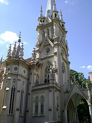
Country:
Region:
City:
Latitude and Longitude:
Time Zone:
Postal Code:
IP information under different IP Channel
ip-api
Country
Region
City
ASN
Time Zone
ISP
Blacklist
Proxy
Latitude
Longitude
Postal
Route
Luminati
Country
Region
mg
City
belohorizonte
ASN
Time Zone
America/Sao_Paulo
ISP
Vogel Solucoes em Telecom e Informatica SA
Latitude
Longitude
Postal
IPinfo
Country
Region
City
ASN
Time Zone
ISP
Blacklist
Proxy
Latitude
Longitude
Postal
Route
db-ip
Country
Region
City
ASN
Time Zone
ISP
Blacklist
Proxy
Latitude
Longitude
Postal
Route
ipdata
Country
Region
City
ASN
Time Zone
ISP
Blacklist
Proxy
Latitude
Longitude
Postal
Route
Popular places and events near this IP address

Carlos Drummond de Andrade Airport
Airport in Minas Gerais, Brazil
Distance: Approx. 2163 meters
Latitude and longitude: -19.85194444,-43.95055556
Pampulha–Carlos Drummond de Andrade Airport (IATA: PLU, ICAO: SBBH) is an airport serving Belo Horizonte, Brazil, located in the neighborhood of Pampulha. Since December 16, 2004, the airport is also named after the Minas Gerais-born poet Carlos Drummond de Andrade (1902–1987).
Roman Catholic Archdiocese of Belo Horizonte
Catholic ecclesiastical territory
Distance: Approx. 3480 meters
Latitude and longitude: -19.8833,-43.9333
The Roman Catholic Archdiocese of Belo Horizonte (Latin: Archidioecesis Bellohorizontinus) is an archdiocese located in the city of Belo Horizonte in Brazil.

Jesuit School of Philosophy and Theology
Distance: Approx. 2796 meters
Latitude and longitude: -19.83856111,-43.95232778
The Jesuit School of Philosophy and Theology (FAJE) is a private Jesuit college located in Belo Horizonte, Brazil. It offers undergraduate and graduate courses in philosophy and theology. According to the General Course Index for the three-year period from 2009 to 2011, FAJE was considered the fifth best private college of higher education in Brazil, receiving a 5 on a scale from 1 to 5.
Vila Olímpica
Association football training ground in Belo Horizonte, Brazil
Distance: Approx. 3636 meters
Latitude and longitude: -19.82833333,-43.95361111
Vila Olímpica (Olympic Village) is Atlético Mineiro's former training ground, located in Belo Horizonte, Brazil. Inaugurated in 1973, it served as the club's main training facility for almost three decades, before Cidade do Galo was built. It also hosted the Brazil national football team in its preparation for the 1982 FIFA World Cup.

Christ the King Cathedral, Belo Horizonte
Church in Belo Horizonte, Brazil
Distance: Approx. 3913 meters
Latitude and longitude: -19.8203,-43.9456
The Christ the King Cathedral, (Portuguese: Catedral Cristo Rei) also known as the Belo Horizonte Cathedral, is a Catholic religious cathedral, currently under construction, located in Belo Horizonte, Minas Gerais, in Brazil. The building is the latest project of the renowned architect Oscar Niemeyer for the city and will be the headquarters of the Archdiocese of Belo Horizonte. The cathedral is dedicated to Christ the King, according to the election of Bishop Antonio dos Santos Cabral, who arrived in Belo Horizonte in 1922 to install the diocese of the capital.
José Cândido da Silveira station
Belo Horizonte metro station
Distance: Approx. 3924 meters
Latitude and longitude: -19.88361111,-43.91288889
José Cândido da Silveira is a Belo Horizonte Metro station on Line 1. It was opened in April 1997 as part of a two-station extension of the line from Santa Inês to Minas Shopping. The station is located between Santa Inês and Minas Shopping.
Minas Shopping station
Belo Horizonte metro station
Distance: Approx. 2352 meters
Latitude and longitude: -19.87322222,-43.92769444
Minas Shopping is a Belo Horizonte Metro station on Line 1. It was opened in April 1997 as a terminus of the two-station extension of the line from Santa Inês. On 5 January 2002 the line was extended to São Gabriel.
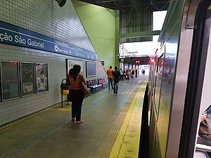
São Gabriel station
Belo Horizonte metro station
Distance: Approx. 1276 meters
Latitude and longitude: -19.86313889,-43.92625
São Gabriel is a Belo Horizonte Metro station on Line 1. It was opened on 5 January 2002 as a one-station extension of the line from Minas Shopping. In April 2002, the line was extended to Primeiro de Maio.
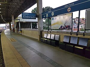
Primeiro de Maio station
Belo Horizonte metro station
Distance: Approx. 766 meters
Latitude and longitude: -19.85797222,-43.93388889
Primeiro de Maio is a Belo Horizonte Metro station on Line 1. It was opened in April 2002 as a one-station extension of the line from São Gabriel. In July 2002, the line was extended to Floramar.
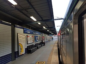
Waldomiro Lobo station
Belo Horizonte metro station
Distance: Approx. 569 meters
Latitude and longitude: -19.84780556,-43.93266667
Waldomiro Lobo is a Belo Horizonte Metro station on Line 1. It was opened in July 2002 as part of a two-station extension of the line from Primeiro de Maio to Floramar. The station is located between Primeiro de Maio and Floramar.

Floramar station
Belo Horizonte metro station
Distance: Approx. 2290 meters
Latitude and longitude: -19.83416667,-43.94041667
Floramar is a Belo Horizonte Metro station on Line 1. It was opened in July 2002 as the northern terminus of the two-station extension of the line from Primeiro de Maio to Floramar. On 20 September 2002, the line was extended to Vilarinho.
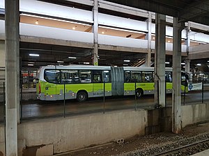
Vilarinho station
Belo Horizonte metro station
Distance: Approx. 3877 meters
Latitude and longitude: -19.82161111,-43.94761111
Vilarinho is a Belo Horizonte Metro station on Line 1 which serves as the north terminus of the line. It was opened 20 September 2002 as a one-station extension of the line from Floramar. The adjacent station is Floramar.
Weather in this IP's area
broken clouds
28 Celsius
29 Celsius
27 Celsius
28 Celsius
1012 hPa
53 %
1012 hPa
923 hPa
10000 meters
2.06 m/s
30 degree
75 %
05:11:17
18:07:37
