Lookup
Country:
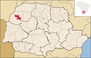
 Brazil
Region:
pr
City:
umuarama
Latitude and Longitude:
-23.762700,-53.312000
Time Zone:
America/Sao_Paulo
Postal Code:
87500-000
IP information under different IP Channel
ip-api
Country
Region
City
ASN
Time Zone
ISP
Blacklist
Proxy
Latitude
Longitude
Postal
Route
IPinfo
Country
Region
City
ASN
Time Zone
ISP
Blacklist
Proxy
Latitude
Longitude
Postal
Route
MaxMind
Country
Region
City
ASN
Time Zone
ISP
Blacklist
Proxy
Latitude
Longitude
Postal
Route
Luminati
Country
BRASN
Time Zone
America/Sao_Paulo
ISP
MHNET TELECOM
Latitude
-22.8305
Longitude
-43.2192
Postal
-
db-ip
Country
Region
City
ASN
Time Zone
ISP
Blacklist
Proxy
Latitude
Longitude
Postal
Route
ipdata
Country
Region
City
ASN
Time Zone
ISP
Blacklist
Proxy
Latitude
Longitude
Postal
Route
Popular places and events near this IP address
Umuarama
Municipality in South, Brazil
Distance: Approx. 1370 meters
Latitude and longitude: -23.76583333,-53.325
Umuarama is a municipality in the state of Paraná in Brazil. Its population was 112,500 inhabitants in 2020. Umuarama is one of the most important cities in Paraná, one of the three states of southern Brazil.
Umuarama Airport
Airport
Distance: Approx. 4064 meters
Latitude and longitude: -23.79916667,-53.31388889
Orlando de Carvalho Airport (IATA: UMU, ICAO: SSUM) is the airport serving Umuarama, Brazil. It is operated by Infracea.
Weather in this IP's area
Current Weather
overcast clouds
Current Temperature
30 Celsius
Feeling temperature
30 Celsius
lowest temperature
30 Celsius
Maximum temperature
30 Celsius
Atmospheric pressure
1011 hPa
humidity
49 %
Sea level pressure
1011 hPa
Surface atmospheric pressure
962 hPa
visibility
10000 meters
Wind speed
3.95 m/s
gust
5.89 m/s
wind direction
309 degree
cloud
100 %
Sunrise time
05:56:57
Sunset time
18:39:20