Country:
 Brazil
Region:
City:
Latitude and Longitude:
Time Zone:
Postal Code:
IP information under different IP Channel
ip-api
Country
Region
City
ASN
Time Zone
ISP
Blacklist
Proxy
Latitude
Longitude
Postal
Route
IPinfo
Country
Region
City
ASN
Time Zone
ISP
Blacklist
Proxy
Latitude
Longitude
Postal
Route
MaxMind
Country
Region
City
ASN
Time Zone
ISP
Blacklist
Proxy
Latitude
Longitude
Postal
Route
Luminati
Country
BRASN
Time Zone
America/Sao_Paulo
ISP
CTF TECHNOLOGIES DO BRASIL LTDA
Latitude
Longitude
Postal
db-ip
Country
Region
City
ASN
Time Zone
ISP
Blacklist
Proxy
Latitude
Longitude
Postal
Route
ipdata
Country
Region
City
ASN
Time Zone
ISP
Blacklist
Proxy
Latitude
Longitude
Postal
Route
Popular places and events near this IP address
São Paulo Research Foundation
Brazilian research foundation
Distance: Approx. 1308 meters
Latitude and longitude: -23.5364,-46.7142
The São Paulo Research Foundation (FAPESP, Portuguese: Fundação de Amparo à Pesquisa do Estado de São Paulo) is a public foundation located in São Paulo, Brazil, with the aim of providing grants, funds and programs to support research, education and innovation of private and public institutions and companies in the state of São Paulo. It was founded in 1962 and is maintained by endowments by the State government which are guaranteed as a fixed percentage of the State's tax, besides the income generated by the financial revenues of its own assets. FAPESP is an important institution for Brazilian science.

Pinheiros River
River in São Paulo state, Brazil
Distance: Approx. 2526 meters
Latitude and longitude: -23.52666667,-46.75
The Pinheiros River (Portuguese: Rio Pinheiros) is a tributary of the Tietê River that runs 25 kilometres (16 mi) through the city of São Paulo, Brazil. Until 1920, the river was known as Jurubatuba. After being channelized its name was changed to Pinheiros.

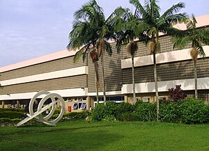
Polytechnic School of the University of São Paulo
Distance: Approx. 2267 meters
Latitude and longitude: -23.555,-46.72972222
The Escola Politécnica of the University of São Paulo (or the Engineering School of the University of São Paulo, Portuguese: Escola Politécnica da Universidade de São Paulo) (usually called Poli, Poli-USP or EPUSP) is an engineering school at the University of São Paulo (USP) in São Paulo, Brazil. It was founded in 1893 - before the creation of USP itself - and was the first engineering school in the state of São Paulo. Its original name was "Escola Politécnica de São Paulo".

Alto de Pinheiros
District of São Paulo, Brazil
Distance: Approx. 2061 meters
Latitude and longitude: -23.54916667,-46.71416667
Alto de Pinheiros is a district in the subprefecture of Pinheiros of the West Zone of São Paulo, Brazil.
School of Communications and Arts, University of São Paulo
Distance: Approx. 2619 meters
Latitude and longitude: -23.55833056,-46.72693889
The School of Communications and Arts (Portuguese: Escola de Comunicações e Artes) at the University of São Paulo is an institution of higher education and research in the field of Arts and Communication located in São Paulo, Brazil. It was established on June 15, 1966 as School of Cultural Communication.

NeuroMat
Distance: Approx. 2707 meters
Latitude and longitude: -23.55865,-46.73206944
The Research, Innovation, and Dissemination Center for Neuromathematics (RIDC NeuroMat, or simply NeuroMat) is a Brazilian research center established in 2013 at the University of São Paulo that is dedicated to integrating mathematical modeling and theoretical neuroscience. Among the core missions of NeuroMat are the creation of a new mathematical system to understanding neural data and the development of neuroscientific open-source computational tools, keeping an active role under the context of open knowledge, open science and scientific dissemination. The research center is headed by Antonio Galves, from USP's Institute of Mathematics and Statistics, and is funded by the São Paulo Research Foundation (FAPESP).

Villa-Lobos State Park
Distance: Approx. 1447 meters
Latitude and longitude: -23.54667,-46.72111
Villa-Lobos State Park (Portuguese: Parque Estadual Villa-Lobos) is a park in São Paulo, Brazil. It is named after composer Heitor Villa-Lobos, and is located next to Pinheiros River. It was created in 1989 on a site that was previously used as a rubbish tip.

Ceasa (CPTM)
Railway station in São Paulo, Brazil
Distance: Approx. 1629 meters
Latitude and longitude: -23.537412,-46.742604
Ceasa is a train station on ViaMobilidade Line 9-Emerald, located in the district of Vila Leopoldina, city of São Paulo.

Villa Lobos-Jaguaré (CPTM)
Railway station in São Paulo, Brazil
Distance: Approx. 1385 meters
Latitude and longitude: -23.546009,-46.732798
Villa Lobos-Jaguaré is a train station on ViaMobilidade Line 9-Emerald, in the district of Jaguare in São Paulo. In the future, it might be connected with an unnamed CPTM line in project.

Imperatriz Leopoldina (CPTM)
Railway station in São Paulo, Brazil
Distance: Approx. 1633 meters
Latitude and longitude: -23.523779,-46.737462
Imperatriz Leopoldina is a train station on ViaMobilidade Line 8-Diamond, located in the district of Vila Leopoldina in São Paulo.

General Miguel Costa (CPTM)
Railway station in São Paulo, Brazil
Distance: Approx. 1640 meters
Latitude and longitude: -23.523779,-46.737562
General Miguel Costa is a train station, belonging to ViaMobilidade Line 8-Diamond, located in the municipality of Osasco, Brazil.
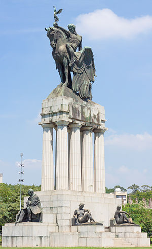
Monument to Ramos de Azevedo
Monument in São Paulo city, Brazil
Distance: Approx. 2574 meters
Latitude and longitude: -23.55694444,-46.73416667
The Monument to Ramos de Azevedo is a sculptural set in bronze and granite located in the city of São Paulo. It was designed by Italian-born Brazilian sculptor Galileo Emendabili as a posthumous tribute to Francisco de Paula Ramos de Azevedo, one of the most prominent names in architecture and urbanism in São Paulo. Azevedo died on 12 June 1928 and the monument in his honor, chosen through a competition, was inaugurated on 25 January 1934, the city's anniversary.
Weather in this IP's area
clear sky
29 Celsius
31 Celsius
28 Celsius
31 Celsius
1013 hPa
56 %
1013 hPa
932 hPa
10000 meters
3.6 m/s
10 degree
05:46:47
18:05:55