Country:
 Brazil
Region:
City:
Latitude and Longitude:
Time Zone:
Postal Code:
IP information under different IP Channel
ip-api
Country
Region
City
ASN
Time Zone
ISP
Blacklist
Proxy
Latitude
Longitude
Postal
Route
IPinfo
Country
Region
City
ASN
Time Zone
ISP
Blacklist
Proxy
Latitude
Longitude
Postal
Route
MaxMind
Country
Region
City
ASN
Time Zone
ISP
Blacklist
Proxy
Latitude
Longitude
Postal
Route
Luminati
Country
BRRegion
es
City
colatina
ASN
Time Zone
America/Sao_Paulo
ISP
Logos Net Servicos de Comunicacao Ltda
Latitude
Longitude
Postal
db-ip
Country
Region
City
ASN
Time Zone
ISP
Blacklist
Proxy
Latitude
Longitude
Postal
Route
ipdata
Country
Region
City
ASN
Time Zone
ISP
Blacklist
Proxy
Latitude
Longitude
Postal
Route
Popular places and events near this IP address
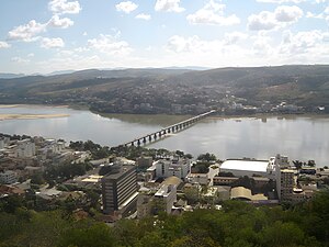
Colatina
Municipality in Southeast, Brazil
Distance: Approx. 9444 meters
Latitude and longitude: -19.53888889,-40.63083333
Colatina is the second largest city in the north of Espírito Santo, Brazil, 127 km north of the capital Vitória and on the trainline from Vitória to Minas Gerais. It lies on the banks of the Doce River, through which as much as 700 cubic meters of water per second may flow. Its population was 123,400 (2020 est.) and its area is 1,398 km2.
Roman Catholic Diocese of Colatina
Catholic ecclesiastical territory
Distance: Approx. 9316 meters
Latitude and longitude: -19.5375,-40.6305
The Roman Catholic Diocese of Colatina (Latin: Dioecesis Colatinensis) is a diocese located in the city of Colatina in the ecclesiastical province of Vitória in Brazil.
Pancas River
River in Brazil
Distance: Approx. 8089 meters
Latitude and longitude: -19.5096,-40.6092
The Pancas River is a river of Espírito Santo state in eastern Brazil.

Santa Maria do Rio Doce River
River in Brazil
Distance: Approx. 8772 meters
Latitude and longitude: -19.53333333,-40.63333333
The Santa Maria do Rio Doce River is a river of Espírito Santo state in eastern Brazil.
São João Pequeno River
River in Brazil
Distance: Approx. 9780 meters
Latitude and longitude: -19.5,-40.75
The São João Pequeno River is a river of Espírito Santo state in eastern Brazil.
Weather in this IP's area
scattered clouds
21 Celsius
21 Celsius
21 Celsius
21 Celsius
1014 hPa
84 %
1014 hPa
989 hPa
10000 meters
1.01 m/s
1.14 m/s
62 degree
33 %
05:22:53
17:40:40