186.219.241.237 - IP Lookup: Free IP Address Lookup, Postal Code Lookup, IP Location Lookup, IP ASN, Public IP
Country:
Region:
City:
Location:
Time Zone:
Postal Code:
ISP:
ASN:
language:
User-Agent:
Proxy IP:
Blacklist:
IP information under different IP Channel
ip-api
Country
Region
City
ASN
Time Zone
ISP
Blacklist
Proxy
Latitude
Longitude
Postal
Route
db-ip
Country
Region
City
ASN
Time Zone
ISP
Blacklist
Proxy
Latitude
Longitude
Postal
Route
IPinfo
Country
Region
City
ASN
Time Zone
ISP
Blacklist
Proxy
Latitude
Longitude
Postal
Route
IP2Location
186.219.241.237Country
Region
rondonia
City
porto velho
Time Zone
America/Porto_Velho
ISP
Language
User-Agent
Latitude
Longitude
Postal
ipdata
Country
Region
City
ASN
Time Zone
ISP
Blacklist
Proxy
Latitude
Longitude
Postal
Route
Popular places and events near this IP address

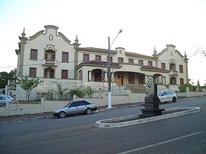
Porto Velho
Capital city of Rondônia, Brazil
Distance: Approx. 40 meters
Latitude and longitude: -8.76194444,-63.90388889
Porto Velho (Portuguese pronunciation: [ˈpoʁtu ˈvɛʎu], Old Port) is the capital of the Brazilian state of Rondônia, in the upper Amazon River basin. The population is 548,952 people (as of the IBGE 2021 estimation). Located on the border of Rondônia and the state of Amazonas, the town is an important trading center for cassiterite, the mining of which represents the most important economic activity in the region, as well as a transportation and communication center.

Federal University of Rondônia
Brazilian public university
Distance: Approx. 9088 meters
Latitude and longitude: -8.8356,-63.9389
The Federal University of Rondônia (Portuguese: Universidade Federal de Rondônia, UNIR) is located in the state of Rondônia, in Brazil. It is the only public university in Rondônia.
Governador Jorge Teixeira de Oliveira International Airport
Airport serving Porto Velho, Brazil
Distance: Approx. 5344 meters
Latitude and longitude: -8.71361111,-63.90277778
Porto Velho–Governador Jorge Teixeira de Oliveira International Airport (IATA: PVH, ICAO: SBPV), also called Belmonte Airport referring to the neighborhood where it is located, is an airport serving Porto Velho, Brazil. Since 3 July 2002, the airport has been named after Jorge Teixeira de Oliveira (1922-1987), the first Governor of the State of Rondônia. The airport is operated by Vinci SA. Some of its facilities are shared with the Porto Velho Air Force Base of the Brazilian Air Force.
Aluizão
Stadium in Porto Velho, Brazil
Distance: Approx. 870 meters
Latitude and longitude: -8.75722222,-63.91055556
Estádio Aluízio Ferreira, usually known as Estádio Aluízio Ferreira and nicknamed Aluizão, is a football stadium located in Porto Velho, Rondônia state, Brazil. The stadium is owned by the Governo de Rondônia and it was built in 1957. Its formal name honors Aluízio Ferreira, who was the first governor of the former Território Federal do Guaporé (nowadays Rondônia) from 1942 to 1957.

Roman Catholic Archdiocese of Porto Velho
Catholic ecclesiastical territory
Distance: Approx. 1364 meters
Latitude and longitude: -8.75,-63.9
The Roman Catholic Archdiocese of Porto Velho (Latin: Archidioecesis Portus Veteris) is an archdiocese located in the city of Porto Velho in Brazil.

Porto Velho Air Force Base
Air base of the Brazilian Air Force
Distance: Approx. 5344 meters
Latitude and longitude: -8.71361111,-63.90277778
Porto Velho Air Force Base – ALA6 (IATA: PVH, ICAO: SBPV) is a base of the Brazilian Air Force, located in Porto Velho, Brazil. It shares some facilities with Gov. Jorge Teixeira de Oliveira International Airport.

Santo Antônio Dam
Dam in Rondônia, Brazil
Distance: Approx. 6815 meters
Latitude and longitude: -8.80166667,-63.95083333
The Santo Antônio Dam is a hydroelectric dam on the Madeira River 6 km (4 mi) southwest of Porto Velho in the state of Rondônia, Brazil. The dam's run-of-the-river hydroelectric power station has 50 turbines, each rated at 71.6 MW resulting in a total installed capacity of 3,580 MW. The first unit began commercial production in March 2012, and as of June 2015 a total of 32 units were operational. The last 6 units went online in December 2016.
Caiari Airport
Former airport that served Porto Velho, Brazil
Distance: Approx. 753 meters
Latitude and longitude: -8.7575,-63.90944444
Caiari Airport (IATA: PVH) was an airport that served Porto Velho, Brazil until 1969, when Governador Jorge Teixeira de Oliveira International Airport was opened. On that very occasion the airport was closed.

Rede Amazônica Porto Velho
Television station in Rondônia, Brazil
Distance: Approx. 1391 meters
Latitude and longitude: -8.76436111,-63.89166667
Rede Amazônica Porto Velho (channel 4) is a Brazilian television station based in Porto Velho, capital of the state of Rondônia, serving as an affiliate of TV Globo for most of the state, including the capital area. The station is part of Grupo Rede Amazônica, a complex of radio and television stations spread across northern Brazil (except in the states of Pará and Tocantins), founded by businessman Phelippe Daou.
Weather in this IP's area
clear sky
26 Celsius
26 Celsius
26 Celsius
26 Celsius
1014 hPa
83 %
1014 hPa
1004 hPa
10000 meters