186.211.167.192 - IP Lookup: Free IP Address Lookup, Postal Code Lookup, IP Location Lookup, IP ASN, Public IP
Country:
Region:
City:
Location:
Time Zone:
Postal Code:
IP information under different IP Channel
ip-api
Country
Region
City
ASN
Time Zone
ISP
Blacklist
Proxy
Latitude
Longitude
Postal
Route
Luminati
Country
Region
go
City
formosa
ASN
Time Zone
America/Sao_Paulo
ISP
BR.Digital Provider
Latitude
Longitude
Postal
IPinfo
Country
Region
City
ASN
Time Zone
ISP
Blacklist
Proxy
Latitude
Longitude
Postal
Route
IP2Location
186.211.167.192Country
Region
goias
City
itumbiara
Time Zone
America/Sao_Paulo
ISP
Language
User-Agent
Latitude
Longitude
Postal
db-ip
Country
Region
City
ASN
Time Zone
ISP
Blacklist
Proxy
Latitude
Longitude
Postal
Route
ipdata
Country
Region
City
ASN
Time Zone
ISP
Blacklist
Proxy
Latitude
Longitude
Postal
Route
Popular places and events near this IP address

Itumbiara
Municipality in Meia Ponte Microregion, Brazil
Distance: Approx. 312 meters
Latitude and longitude: -18.41666667,-49.21666667
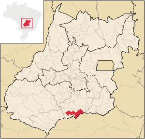
Itumbiara is a municipality in the extreme south of the state of Goiás, Brazil. Its population in 2022 was of 107,970 in a total area of 2,461,3 km2. Itumbiara is one of the most prosperous cities in Goiás and is a major producer of soybeans, corn, cattle, and milk.

Estádio JK
Distance: Approx. 3204 meters
Latitude and longitude: -18.40861111,-49.24361111
Estádio Municipal Juscelino Kubitschek, usually known as Estádio JK, is a multi-use stadium in Itumbiara, Goiás, Brazil. It is currently used mostly for football matches. The stadium holds 14,445.

Araporã
Town and municipality in the state of Minas Gerais, Brazil
Distance: Approx. 3596 meters
Latitude and longitude: -18.43694444,-49.18694444
Araporã (Brazilian Portuguese: /aɾapoˈɾɐ̃/) is a Brazilian municipality located in the west of the state of Minas Gerais. Its population as of 2020 was 6,931 people living in a total area of 298 square kilometres (115 sq mi). The city belongs to the statistical mesoregion of Triângulo Mineiro and Alto Paranaíba and to the microregion of Uberlândia.

Itumbiara Airport
Airport
Distance: Approx. 2875 meters
Latitude and longitude: -18.445,-49.21416667
Francisco Vilela do Amaral Airport (IATA: ITR, ICAO: SBIT) is the airport serving Itumbiara, Brazil.
Weather in this IP's area
broken clouds
31 Celsius
33 Celsius
31 Celsius
31 Celsius
1011 hPa
51 %
1011 hPa
952 hPa
10000 meters
1.2 m/s
1.86 m/s
46 degree
66 %