Country:
 Brazil
Region:
City:
Latitude and Longitude:
Time Zone:
Postal Code:
IP information under different IP Channel
ip-api
Country
Region
City
ASN
Time Zone
ISP
Blacklist
Proxy
Latitude
Longitude
Postal
Route
IPinfo
Country
Region
City
ASN
Time Zone
ISP
Blacklist
Proxy
Latitude
Longitude
Postal
Route
MaxMind
Country
Region
City
ASN
Time Zone
ISP
Blacklist
Proxy
Latitude
Longitude
Postal
Route
Luminati
Country
BRRegion
sp
City
atibaia
ASN
Time Zone
America/Sao_Paulo
ISP
Net Turbo Telecom
Latitude
Longitude
Postal
db-ip
Country
Region
City
ASN
Time Zone
ISP
Blacklist
Proxy
Latitude
Longitude
Postal
Route
ipdata
Country
Region
City
ASN
Time Zone
ISP
Blacklist
Proxy
Latitude
Longitude
Postal
Route
Popular places and events near this IP address

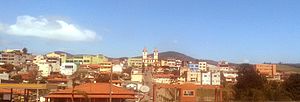
Atibaia
Place in Southeast, Brazil
Distance: Approx. 491 meters
Latitude and longitude: -23.11722222,-46.55055556
Atibaia (or Estância de Atibaia) is a Brazilian municipality in the state of São Paulo, Brazil. The name is derived from an indigenous language called Tupi, and means "healthy water river". Its name has changed over time, from the primitive Tupi word Tybaia, to Thibaia, Atubaia, Thibaya, and finally the city's modern name, Atibaia.
Bom Jesus dos Perdões
Municipality in the state of São Paulo in Brazil
Distance: Approx. 8551 meters
Latitude and longitude: -23.135,-46.46527778
Bom Jesus dos Perdões is a municipality in the state of São Paulo, Brazil. The population is 25,985 (2020 est.) in an area of 108 km2. The municipality is at an elevation of 770 m.
Cachoeira River (São Paulo)
River in Brazil
Distance: Approx. 6427 meters
Latitude and longitude: -23.11666667,-46.48333333
The Cachoeira River is a river of São Paulo state in southeastern Brazil.

Pierre Kaufmann Radio Observatory
Observatory
Distance: Approx. 7848 meters
Latitude and longitude: -23.1852,-46.5583
Pierre Kauffman Radio Observatory (Portuguese: Rádio Observatório Pierre Kauffman - ROPK), formerly known as the Itapetinga Radio Observatory (Portuguese: Rádio Observatório de Itapetinga - ROI), is a radio observatory located in the municipality of Atibaia in the state of São Paulo in Brazil. It is located approximately 7.5 km (4.7 mi) south of Atibaia and 40 km (25 mi) north of São Paulo. ROI was founded in 1970 by Universidade Presbiteriana Mackenzie (UPM).
Weather in this IP's area
broken clouds
20 Celsius
19 Celsius
20 Celsius
21 Celsius
1013 hPa
67 %
1013 hPa
922 hPa
10000 meters
2.62 m/s
6.75 m/s
142 degree
54 %
05:45:11
18:05:24