186.209.33.27 - IP Lookup: Free IP Address Lookup, Postal Code Lookup, IP Location Lookup, IP ASN, Public IP
Country:
Region:
City:
Location:
Time Zone:
Postal Code:
IP information under different IP Channel
ip-api
Country
Region
City
ASN
Time Zone
ISP
Blacklist
Proxy
Latitude
Longitude
Postal
Route
Luminati
Country
Region
sp
City
campinas
ASN
Time Zone
America/Sao_Paulo
ISP
Net Turbo Telecom
Latitude
Longitude
Postal
IPinfo
Country
Region
City
ASN
Time Zone
ISP
Blacklist
Proxy
Latitude
Longitude
Postal
Route
IP2Location
186.209.33.27Country
Region
sao paulo
City
americana
Time Zone
America/Sao_Paulo
ISP
Language
User-Agent
Latitude
Longitude
Postal
db-ip
Country
Region
City
ASN
Time Zone
ISP
Blacklist
Proxy
Latitude
Longitude
Postal
Route
ipdata
Country
Region
City
ASN
Time Zone
ISP
Blacklist
Proxy
Latitude
Longitude
Postal
Route
Popular places and events near this IP address

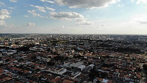
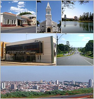
Americana, São Paulo
Municipality in São Paulo, Southeast Brazil
Distance: Approx. 72 meters
Latitude and longitude: -22.73861111,-47.33111111
Americana (Portuguese pronunciation: [ameɾiˈkɐnɐ]) is a municipality (município) located in the Brazilian state of São Paulo. It is part of the Metropolitan Region of Campinas. The population is 237,240 (2022 Census) in an area of 133.91 km2 (51.70 sq mi).

Nova Odessa
Municipality in Southeast, Brazil
Distance: Approx. 5636 meters
Latitude and longitude: -22.78,-47.29888889
Nova Odessa (literally "New Odesa") is a Brazilian municipality in the state of São Paulo. It is part of the Metropolitan Region of Campinas. The population is 60,956 (2020 est.) in an area of 73.79 km2.
Santa Bárbara d'Oeste
Place in São Paulo, Brazil
Distance: Approx. 8665 meters
Latitude and longitude: -22.75444444,-47.41416667
Santa Bárbara d'Oeste is a municipality in the State of São Paulo in Brazil. It is part of the Metropolitan Region of Campinas. It lies about 138 kilometres (86 mi) northwest of the State capital.

Estádio Décio Vitta
Multi-use stadium in São Paulo, Brazil
Distance: Approx. 1786 meters
Latitude and longitude: -22.73442778,-47.34800833
Estádio Décio Vitta, nicknamed Riobrancão, is a multi-use stadium located in Americana, São Paulo, Brazil. It is used mostly for football matches and hosts the home matches of Rio Branco Esporte Clube and Americana Futebol. The stadium has a maximum capacity of 16,000 people and was built in 1977.

Estádio Antônio Lins Ribeiro Guimarães
Distance: Approx. 9726 meters
Latitude and longitude: -22.755475,-47.42447778
Estádio Antônio Lins Ribeiro Guimarães is a multi-use stadium located in Santa Bárbara d'Oeste, Brazil. It is used mostly for football matches and hosts the home matches of União Agrícola Barbarense Futebol Clube. The stadium has a maximum capacity of 15,000 people and was built in 1921.

Jaguari River (Piracicaba River tributary)
River in Brazil
Distance: Approx. 5426 meters
Latitude and longitude: -22.7,-47.3
The Jaguari River is a Brazilian river in the states of São Paulo and Minas Gerais. The Jaguari is a tributary of the Piracicaba River.
Atibaia River
River in Brazil
Distance: Approx. 6575 meters
Latitude and longitude: -22.6933,-47.2911
The Atibaia River is a river of São Paulo state in southeastern Brazil.
Weather in this IP's area
broken clouds
19 Celsius
19 Celsius
19 Celsius
19 Celsius
1012 hPa
78 %
1012 hPa
945 hPa
10000 meters
1.96 m/s
2.96 m/s
140 degree
80 %

