Country:
 Brazil
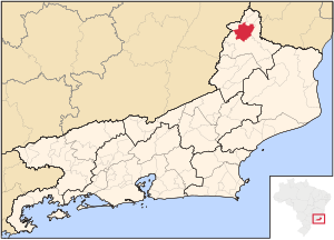
Region:
City:
Latitude and Longitude:
Time Zone:
Postal Code:
IP information under different IP Channel
ip-api
Country
Region
City
ASN
Time Zone
ISP
Blacklist
Proxy
Latitude
Longitude
Postal
Route
IPinfo
Country
Region
City
ASN
Time Zone
ISP
Blacklist
Proxy
Latitude
Longitude
Postal
Route
MaxMind
Country
Region
City
ASN
Time Zone
ISP
Blacklist
Proxy
Latitude
Longitude
Postal
Route
Luminati
Country
BRRegion
mg
City
santanadomanhuacu
ASN
Time Zone
America/Sao_Paulo
ISP
Mega Grupo de Telecomunicacoes Ltda
Latitude
Longitude
Postal
db-ip
Country
Region
City
ASN
Time Zone
ISP
Blacklist
Proxy
Latitude
Longitude
Postal
Route
ipdata
Country
Region
City
ASN
Time Zone
ISP
Blacklist
Proxy
Latitude
Longitude
Postal
Route
Popular places and events near this IP address
Natividade, Rio de Janeiro
Municipality in Rio de Janeiro, Brazil
Distance: Approx. 8205 meters
Latitude and longitude: -20.04194444,-41.97277778
Natividade (Portuguese pronunciation: [nɐtʃiviˈdadʒi], Nativity) is a municipality located in the Brazilian state of Rio de Janeiro. Its population was 15,311 (2020) and its area is 387 km².

Santana do Manhuaçu
Brazilian municipality located in the state of Minas Gerais
Distance: Approx. 6922 meters
Latitude and longitude: -20.10777778,-41.925
Santana do Manhuaçu is a Brazilian municipality located in the state of Minas Gerais. The city belongs to the mesoregion of Zona da Mata and to the microregion of Manhuaçu. As of 2020, the estimated population was 8,667.
Weather in this IP's area
clear sky
18 Celsius
17 Celsius
18 Celsius
18 Celsius
1014 hPa
59 %
1014 hPa
951 hPa
10000 meters
0.58 m/s
0.7 m/s
62 degree
5 %
05:26:43
17:46:01