186.189.200.14 - IP Lookup: Free IP Address Lookup, Postal Code Lookup, IP Location Lookup, IP ASN, Public IP
Country:
Region:
City:
Location:
Time Zone:
Postal Code:
ISP:
ASN:
language:
User-Agent:
Proxy IP:
Blacklist:
IP information under different IP Channel
ip-api
Country
Region
City
ASN
Time Zone
ISP
Blacklist
Proxy
Latitude
Longitude
Postal
Route
db-ip
Country
Region
City
ASN
Time Zone
ISP
Blacklist
Proxy
Latitude
Longitude
Postal
Route
IPinfo
Country
Region
City
ASN
Time Zone
ISP
Blacklist
Proxy
Latitude
Longitude
Postal
Route
IP2Location
186.189.200.14Country
Region
sacatepequez
City
jocotenango
Time Zone
America/Guatemala
ISP
Language
User-Agent
Latitude
Longitude
Postal
ipdata
Country
Region
City
ASN
Time Zone
ISP
Blacklist
Proxy
Latitude
Longitude
Postal
Route
Popular places and events near this IP address

Estadio Pensativo
Distance: Approx. 1711 meters
Latitude and longitude: 14.5675,-90.73805556
Estadio Pensativo is a football stadium in Antigua Guatemala, Guatemala. The venue is home to Liga Nacional club Antigua (Panzas Verdes), and has a maximum capacity of 10,000 people. The stadium is also the home of women's first division club Santiago de los Caballeros, and in 2011 it hosted three matches of the 2011 CONCACAF U-17 Championship qualification between Panama, Honduras, and Guatemala.

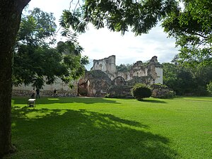
Jocotenango
Municipality in Sacatepéquez, Guatemala
Distance: Approx. 5 meters
Latitude and longitude: 14.58194444,-90.74361111
Jocotenango (alternate: Xocotenango; translation from Kaqchikel: "place of many plums") is a town and small municipality in the northeast section of Guatemalan department of Sacatepéquez, and is situated north of Antigua Guatemala. It has seven zones, two villages, and one hamlet. According to the 2018 census, the municipality has a total population of 21,657 of which 1,680 are native population and the balance are non-indigenous; and approximately 19,280 live in an urban area, while the balance are rural dwellers.
Pastores
Distance: Approx. 2130 meters
Latitude and longitude: 14.6,-90.75
Pastores is a town, with a population of 12,621 (2018 census), and a municipality, with a population of 17,814 (2018 census), in the Guatemalan department of Sacatepéquez.
1717 Guatemala earthquake
1717 earthquake centered in southwestern colonial Guatemala
Distance: Approx. 1975 meters
Latitude and longitude: 14.57,-90.73
The 1717 Guatemala earthquake struck colonial Guatemala on September 29 with an estimated moment magnitude of 7.4, and a Mercalli intensity of approximately IX (Violent). The earthquake essentially destroyed much of the architecture of Antigua Guatemala, which was the colonial capital of Central America at the time. Over 3,000 buildings were ruined including many temples and churches.

Templo de Nuestra Señora de la Asunción, Jocotenango
Church in Jocotenango, Guatemala
Distance: Approx. 835 meters
Latitude and longitude: 14.5748,-90.7411
The Templo de Nuestra Señora de la Asunción (English: Temple of Our Lady of the Assumption) is a church in Jocotenango, Guatemala. The church is situated on the Plazuela de Jocotenango, the main town square, and is the centre of annual local celebrations of Our Lady of the Assumption (that is to say, of the Virgin Mary).
Iglesia de La Merced, Antigua Guatemala
Building in Antigua Guatemala, Guatemala
Distance: Approx. 2463 meters
Latitude and longitude: 14.56167111,-90.73434694
The Church and Convent of La Merced is a Catholic church located in the city of Antigua Guatemala in Guatemala. The architect Juan de Dios Estrada was in charge of its construction from 1749. The church was inaugurated in 1767.
Hospital de San Pedro, Antigua Guatemala
Building in Antigua Guatemala, Guatemala
Distance: Approx. 2391 meters
Latitude and longitude: 14.56055556,-90.74111111
San Pedro is a hospital and adjacent church in Antigua Guatemala, Guatemala. It is dedicated to Peter of Saint Joseph Betancur.

Iglesia y Convento de las Capuchinas, Antigua Guatemala
Building in Antigua Guatemala, Guatemala
Distance: Approx. 2797 meters
Latitude and longitude: 14.55972222,-90.73138889
The Iglesia y Convento de las Capuchinas is a notable convent and church in Antigua Guatemala, Guatemala. It is one of the finest examples of an 18th-century convent in Guatemala. It was consecrated in 1736 but like the rest of the city suffered damage during the 1751 and 1773 earthquakes respectively, and was abandoned by order of the Captain General at the time.

Arco de Santa Catalina
Monument in Antigua Guatemala
Distance: Approx. 2670 meters
Latitude and longitude: 14.55972222,-90.73416667
The Santa Catalina Arch is one of the distinguishable landmarks in Antigua Guatemala, Guatemala, located on 5th Avenue North. Built in the 17th century, it originally connected the Santa Catalina convent to a school, allowing the cloistered nuns to pass from one building to the other without going out on the street. A clock on top was added in the era of the Central American Federation, in the 1830s.
Centro Cultural la Azotea
Museum complex in Jocotenango, Guatemala
Distance: Approx. 849 meters
Latitude and longitude: 14.57444444,-90.74527778
The Centro Cultural la Azotea ("La Azotea" Cultural Center) is a cultural center and museum complex, located in the township and municipality of Jocotenango in Guatemala's Sacatepéquez Department. It lies some 2 kilometres (1.2 mi) north of the department's capital Antigua Guatemala in the city's modern outskirts, and is approximately 43 kilometres (27 mi) from the national capital, Guatemala City. The center comprises three separate museums, on the grounds of a coffee-growing estate or finca.

La Recolección Architectural Complex
Building in Antigua Guatemala, Guatemala
Distance: Approx. 2391 meters
Latitude and longitude: 14.56055556,-90.74111111
La Recolección Architectural Complex is a former church and monastery of the Order of the Recollects (Ordo Fratrum Minorum Recollectorum) and its adjacent park in Antigua, Guatemala. It is in the western part of the old city.

Santiago de los Caballeros de Guatemala
Capital of the Spanish Captaincy General of Guatemala
Distance: Approx. 2025 meters
Latitude and longitude: 14.56666667,-90.73333333
Santiago de los Caballeros de Guatemala ("St. James of the Knights of Guatemala") was the name given to the capital city of the Spanish colonial Captaincy General of Guatemala in Central America. It is located in present-day Antigua Guatemala.
Weather in this IP's area
scattered clouds
15 Celsius
14 Celsius
13 Celsius
15 Celsius
1019 hPa
88 %
1019 hPa
823 hPa
10000 meters
2.87 m/s
4.76 m/s
360 degree
29 %

