186.176.187.58 - IP Lookup: Free IP Address Lookup, Postal Code Lookup, IP Location Lookup, IP ASN, Public IP
Country:
Region:
City:
Location:
Time Zone:
Postal Code:
ISP:
ASN:
language:
User-Agent:
Proxy IP:
Blacklist:
IP information under different IP Channel
ip-api
Country
Region
City
ASN
Time Zone
ISP
Blacklist
Proxy
Latitude
Longitude
Postal
Route
db-ip
Country
Region
City
ASN
Time Zone
ISP
Blacklist
Proxy
Latitude
Longitude
Postal
Route
IPinfo
Country
Region
City
ASN
Time Zone
ISP
Blacklist
Proxy
Latitude
Longitude
Postal
Route
IP2Location
186.176.187.58Country
Region
puntarenas
City
chacarita
Time Zone
America/Costa_Rica
ISP
Language
User-Agent
Latitude
Longitude
Postal
ipdata
Country
Region
City
ASN
Time Zone
ISP
Blacklist
Proxy
Latitude
Longitude
Postal
Route
Popular places and events near this IP address

Puntarenas Province
Province of Costa Rica
Distance: Approx. 6424 meters
Latitude and longitude: 9.97794,-84.83068
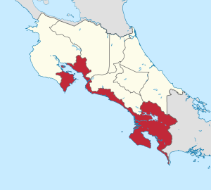
Puntarenas (Spanish pronunciation: [puntaˈɾenas]) is a province of Costa Rica. It is located in the western part of the country, covering most of Costa Rica's Pacific Ocean coast, and it is the largest province in Costa Rica. Clockwise from the northwest, it borders on the provinces Guanacaste, Alajuela, San José and Limón, and the neighbouring country of Panama.
Puntarenas
City in Costa Rica
Distance: Approx. 6931 meters
Latitude and longitude: 9.96666667,-84.83333333
Puntarenas (Spanish pronunciation: [puntaˈɾenas]) is a city in the Puntarenas Province, on the Pacific coast of Costa Rica. As the seat of the Municipality of Puntarenas canton, it is awarded the title of city, which comprises the Puntarenas, Chacarita and El Roble districts. As the city of the first canton of the province, it is the capital city of the Puntarenas Province as well, according to the Administrative divisions of Costa Rica.

Estadio Lito Pérez
Distance: Approx. 7324 meters
Latitude and longitude: 9.976422,-84.838781
Estadio Municipal de Puntarenas Miguel Ángel "Lito" Pérez Treacy is a multi-use stadium in Puntarenas Centro, Puntarenas, Costa Rica. It is nicknamed “La Olla Mágica” ("The Magic Pot") due to the warm weather that is common in the stadium. Formerly known as Estadio Municipal de Puntarenas.
Roman Catholic Diocese of Puntarenas
Latin Catholic ecclesiastical jurisdiction in Costa Rica
Distance: Approx. 6888 meters
Latitude and longitude: 9.9777,-84.8349
The Diocese of Puntarenas (Latin: Dioecesis Puntarenensis) is a Latin Church ecclesiastical territory or diocese of the Catholic Church in Costa Rica. It is a suffragan diocese in the ecclesiastical province of the metropolitan Archdiocese of San José de Costa Rica. It was erected as a diocese 17 April 1998.

Aranjuez River
River in Puntarenas, Costa Rica
Distance: Approx. 5086 meters
Latitude and longitude: 9.985888,-84.818593
The Aranjuez (Spanish pronunciation: [aɾaŋˈxwes]) is a river in Costa Rica that has its source in the mountains and crosses the Guatusos province of Puntarenas. Its basin is about 200 kilometres (120 mi) in area. It empties into the Gulf of Nicoya, in the Pacific Ocean.

Barranca River
River in Costa Rica
Distance: Approx. 4650 meters
Latitude and longitude: 9.95893,-84.737562
Barranca River is a river in the province of Puntarenas in Costa Rica.
Chacarita Airport
Airport
Distance: Approx. 168 meters
Latitude and longitude: 9.98138889,-84.77222222
Chacarita Airport (IATA: JAP, ICAO: MRCH) is an airport serving the town of Chacarita in Puntarenas Province, Costa Rica. Chacarita is on the Pacific coast at the base of the Puntarenas peninsula, just east of Puntarenas city. The runway parallels the Gulf of Nicoya shoreline, 300 metres (980 ft) inland.
Puntarenas Cathedral
Church in Puntarenas, Costa Rica
Distance: Approx. 6878 meters
Latitude and longitude: 9.9776,-84.8348
The Our Lady of Mount Carmel Cathedral (Spanish: Catedral de Nuestra Señora del Carmen) or Puntarenas Cathedral is a temple of the Roman Catholic church located in the city of Puntarenas canton of Puntarenas, in Costa Rica. Built in 1902, it has the distinction of being built with the facade to the east. It was built with stone and mortar and has brick floor.
Barranca District
District in Puntarenas canton, Puntarenas province, Costa Rica
Distance: Approx. 6911 meters
Latitude and longitude: 10.0013335,-84.7121014
Barranca is a district of the Puntarenas canton, in the Puntarenas province of Costa Rica.
Chacarita District
District in Puntarenas canton, Puntarenas province, Costa Rica
Distance: Approx. 352 meters
Latitude and longitude: 9.9841838,-84.7693637
Chacarita is a district of the Puntarenas canton, in the Puntarenas province of Costa Rica.
El Roble District
District in Puntarenas canton, Puntarenas province, Costa Rica
Distance: Approx. 3139 meters
Latitude and longitude: 9.977073,-84.7442821
El Roble is a district of the Puntarenas canton, in the Puntarenas province of Costa Rica.
Aranjuez (Costa Rica)
Distance: Approx. 8063 meters
Latitude and longitude: 10.05,-84.8
Aranjuez was a Costa Rican settlement founded in 1568 by the Governor Pero Afán de Ribera y Gómez. It was situated on the banks of the Aranjuez River and was a short distance from the Pacific Ocean coast where a pier, known as the Ribera port, simultaneously emerged. Aranjuez was depopulated in 1574 by order of the interim governor Alonso Anguciana de Gamboa, who relocated the population to the town of Espiritu Santo which he founded.
Weather in this IP's area
few clouds
23 Celsius
23 Celsius
23 Celsius
23 Celsius
1011 hPa
78 %
1011 hPa
1005 hPa
10000 meters
1.71 m/s
2.04 m/s
13 degree
14 %

