185.99.26.28 - IP Lookup: Free IP Address Lookup, Postal Code Lookup, IP Location Lookup, IP ASN, Public IP
Country:
Region:
City:
Location:
Time Zone:
Postal Code:
IP information under different IP Channel
ip-api
Country
Region
City
ASN
Time Zone
ISP
Blacklist
Proxy
Latitude
Longitude
Postal
Route
Luminati
Country
ASN
Time Zone
Europe/Madrid
ISP
TP Global Operations Limited
Latitude
Longitude
Postal
IPinfo
Country
Region
City
ASN
Time Zone
ISP
Blacklist
Proxy
Latitude
Longitude
Postal
Route
IP2Location
185.99.26.28Country
Region
madrid, comunidad de
City
pozuelo de alarcon
Time Zone
Europe/Madrid
ISP
Language
User-Agent
Latitude
Longitude
Postal
db-ip
Country
Region
City
ASN
Time Zone
ISP
Blacklist
Proxy
Latitude
Longitude
Postal
Route
ipdata
Country
Region
City
ASN
Time Zone
ISP
Blacklist
Proxy
Latitude
Longitude
Postal
Route
Popular places and events near this IP address
Pozuelo de Alarcón
Place in Community of Madrid, Spain
Distance: Approx. 360 meters
Latitude and longitude: 40.43611111,-3.81388889
Pozuelo de Alarcón (Spanish pronunciation: [poˈθwelo ðe alaɾˈkon]) is a municipality in the Community of Madrid, Spain. Bordering the Moncloa-Aravaca district of Madrid proper to its west, Pozuelo de Alarcón is surrounded by large Mediterranean pine-tree forests: the Casa de Campo, the Monte del Pardo, and the Monte del Pilar. As of 2022, it ranks as the wealthiest municipality in Spain.

Francisco de Vitoria University
University in Spain
Distance: Approx. 2016 meters
Latitude and longitude: 40.4396,-3.8355
Francisco de Vitoria University (Spanish: Universidad Francisco de Vitoria) is a private university located in Pozuelo de Alarcón, in the Community of Madrid, Spain. It is a Roman Catholic institution run by the Legion of Christ. It is named after Francisco de Vitoria (c. 1483 – 1546), a Spanish philosopher, theologian, and jurist.
First Battle of the Corunna Road
Distance: Approx. 890 meters
Latitude and longitude: 40.44083333,-3.81472222
The First Battle of the Corunna Road took place between 29 November and 3 December 1936 during the Spanish Civil War. The Nationalists tried to isolate Madrid from the west, cutting the Corunna Road, but the Republican army repelled the attack.

Somosaguas Sur (Madrid Metro)
Distance: Approx. 2634 meters
Latitude and longitude: 40.4153629,-3.7925254
Somosaguas Sur [somoˈsaɣwas ˈsuɾ] is a station on Line 2 of the Metro Ligero. It is located in fare Zone B1.

Somosaguas Centro (Madrid Metro)
Distance: Approx. 1953 meters
Latitude and longitude: 40.4193653,-3.798737
Somosaguas Centro [somoˈsaɣwas ˈθen.tɾo] is a station on Line 2 of the Metro Ligero. It is located in fare Zone B1.

Pozuelo Oeste (Madrid Metro)
Distance: Approx. 1330 meters
Latitude and longitude: 40.4230733,-3.8044744
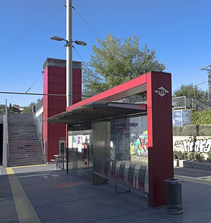
Pozuelo Oeste [poˈθwelo oˈeste] is a station on Line 2 of the Metro Ligero. It is located in fare Zone B1.

Bélgica (Madrid Metro)
Metropolitan station
Distance: Approx. 559 meters
Latitude and longitude: 40.4305834,-3.8075464
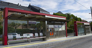
Bélgica [ˈbel.xi.ka] is a station on Line 2 of the Metro Ligero. It is located in fare Zone B2.

Dos Castillas (Madrid Metro)
Railway station in Pozuelo de Alarcón, Spain
Distance: Approx. 999 meters
Latitude and longitude: 40.4325346,-3.801616
Dos Castillas [ˈdos kasˈtiʝas] is a station on Line 2 of the Metro Ligero, servicing Madrid, Spain. It is located in fare Zone B1.

Campus de Somosaguas (Madrid Metro)
Metro station in Madrid, Spain
Distance: Approx. 1539 meters
Latitude and longitude: 40.4333803,-3.7952478
Campus de Somosaguas [ˈkampus ðe somoˈsaɣwas] is a station on Line 2 of the Metro Ligero. It is located in fare Zone B1.

Avenida de Europa
Distance: Approx. 1866 meters
Latitude and longitude: 40.4393053,-3.7930537
Avenida de Europa [aβeˈniða ðe ewˈɾo.pa] is a station on Line 2 of the Metro Ligero. It is in fare Zone B1.

Berna (Madrid Metro)
Distance: Approx. 2305 meters
Latitude and longitude: 40.4448676,-3.7911969
Berna [ˈbeɾ.na] is a station on Line 2 of the Metro Ligero. It is located in fare Zone B1.

Estación de Aravaca (Madrid Metro)
Distance: Approx. 2894 meters
Latitude and longitude: 40.4483271,-3.7859073
Estación de Aravaca [estaˈθjon de aɾaˈβaka] is a station on Line 2 of the Metro Ligero.
Weather in this IP's area
clear sky
10 Celsius
9 Celsius
9 Celsius
11 Celsius
1028 hPa
63 %
1028 hPa
945 hPa
10000 meters
1.03 m/s
