185.98.128.39 - IP Lookup: Free IP Address Lookup, Postal Code Lookup, IP Location Lookup, IP ASN, Public IP
Country:
Region:
City:
Location:
Time Zone:
Postal Code:
ISP:
ASN:
language:
User-Agent:
Proxy IP:
Blacklist:
IP information under different IP Channel
ip-api
Country
Region
City
ASN
Time Zone
ISP
Blacklist
Proxy
Latitude
Longitude
Postal
Route
db-ip
Country
Region
City
ASN
Time Zone
ISP
Blacklist
Proxy
Latitude
Longitude
Postal
Route
IPinfo
Country
Region
City
ASN
Time Zone
ISP
Blacklist
Proxy
Latitude
Longitude
Postal
Route
IP2Location
185.98.128.39Country
Region
pays-de-la-loire
City
ligne
Time Zone
Europe/Paris
ISP
Language
User-Agent
Latitude
Longitude
Postal
ipdata
Country
Region
City
ASN
Time Zone
ISP
Blacklist
Proxy
Latitude
Longitude
Postal
Route
Popular places and events near this IP address

Ancenis
Part of Ancenis-Saint-Géréon in Pays de la Loire, France
Distance: Approx. 7576 meters
Latitude and longitude: 47.3733,-1.2936
Ancenis (French pronunciation: [ɑ̃s.ni]; Breton: Ankiniz) is a former commune in the Loire-Atlantique department in western France. On 1 January 2019, it was merged into the new commune Ancenis-Saint-Géréon. It is a former sub-prefecture of the department, and was the seat of the former arrondissement of Ancenis.

Nort-sur-Erdre
Commune in Pays de la Loire, France
Distance: Approx. 9601 meters
Latitude and longitude: 47.4403,-1.4972
Nort-sur-Erdre (French pronunciation: [nɔʁ syʁ ɛʁdʁ] , literally Nort on Erdre; Breton: Enorzh) is a commune in the Loire-Atlantique department in western France. It is on the river Erdre north of Nantes.
Couffé
Commune in Pays de la Loire, France
Distance: Approx. 6813 meters
Latitude and longitude: 47.3919,-1.2914
Couffé (French pronunciation: [kufe] ; Gallo: Cófaé, Breton: Koufeg) is a commune in the Loire-Atlantique department in western France.
Petit-Mars
Commune in Pays de la Loire, France
Distance: Approx. 6040 meters
Latitude and longitude: 47.395,-1.4539
Petit-Mars is a commune in the Loire-Atlantique department in western France.

Mouzeil
Commune in Pays de la Loire, France
Distance: Approx. 4800 meters
Latitude and longitude: 47.4489,-1.3469
Mouzeil (French pronunciation: [muzɛj]; Breton: Mouzel) is a commune in the Loire-Atlantique department in the Pays de la Loire in western France.

Oudon
Commune in Pays de la Loire, France
Distance: Approx. 9900 meters
Latitude and longitude: 47.3472,-1.2858
Oudon (French pronunciation: [udɔ̃] ) is a commune in the Loire-Atlantique department in western France.
Teillé, Loire-Atlantique
Commune in Pays de la Loire, France
Distance: Approx. 9404 meters
Latitude and longitude: 47.4625,-1.2783
Teillé (French pronunciation: [tɛje] ; Gallo: Teilhaé, Breton: Tilhieg) is a commune in the Loire-Atlantique department in western France.
Trans-sur-Erdre
Commune in Pays de la Loire, France
Distance: Approx. 7379 meters
Latitude and longitude: 47.4772,-1.3722
Trans-sur-Erdre is a commune in the Loire-Atlantique department in western France.
Les Touches
Commune in Pays de la Loire, France
Distance: Approx. 5285 meters
Latitude and longitude: 47.4428,-1.4294
Les Touches (French pronunciation: [le tuʃ] ; Breton: An Dosenneg) is a commune in the Loire-Atlantique department in western France.

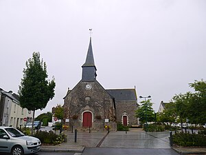
Ligné, Loire-Atlantique
Commune in Pays de la Loire, France
Distance: Approx. 202 meters
Latitude and longitude: 47.4125,-1.3758
Ligné (French pronunciation: [liɲe] ; Gallo: Lignë, Breton: Legneg) is a commune in the Loire-Atlantique department in western France.
Saint-Mars-du-Désert, Loire-Atlantique
Commune in Pays de la Loire, France
Distance: Approx. 5286 meters
Latitude and longitude: 47.3672,-1.4044
Saint-Mars-du-Désert (French pronunciation: [sɛ̃ maʁ dy dezɛʁ] ; Breton: Sant-Marzh-an-Dezerzh) is a commune in the Loire-Atlantique department in western France.
Canton of Nort-sur-Erdre
Distance: Approx. 9789 meters
Latitude and longitude: 47.44,-1.5
The canton of Nort-sur-Erdre is an administrative division of the Loire-Atlantique department, western France. Its borders were modified at the French canton reorganisation which came into effect in March 2015. Its seat is in Nort-sur-Erdre.
Weather in this IP's area
overcast clouds
10 Celsius
6 Celsius
10 Celsius
10 Celsius
1007 hPa
89 %
1007 hPa
1003 hPa
10000 meters
9.51 m/s
18.79 m/s
194 degree
100 %


