Country:
Region:
City:
Latitude and Longitude:
Time Zone:
Postal Code:
IP information under different IP Channel
ip-api
Country
Region
City
ASN
Time Zone
ISP
Blacklist
Proxy
Latitude
Longitude
Postal
Route
Luminati
Country
ASN
Time Zone
Europe/Berlin
ISP
area-7 IT-Services GmbH
Latitude
Longitude
Postal
IPinfo
Country
Region
City
ASN
Time Zone
ISP
Blacklist
Proxy
Latitude
Longitude
Postal
Route
db-ip
Country
Region
City
ASN
Time Zone
ISP
Blacklist
Proxy
Latitude
Longitude
Postal
Route
ipdata
Country
Region
City
ASN
Time Zone
ISP
Blacklist
Proxy
Latitude
Longitude
Postal
Route
Popular places and events near this IP address

Mykonos restaurant assassinations
1992 assassinations of Iranian-Kurdish opposition leaders in Berlin, Germany
Distance: Approx. 698 meters
Latitude and longitude: 52.49472222,13.33416667
In the Mykonos restaurant assassinations (Persian: ترور رستوران میکونوس, Sorani Kurdish: تێرۆری میکۆنۆس; also the "Mykonos Incident"), Iranian-Kurdish opposition leaders Sadegh Sharafkandi, Fattah Abdoli, Homayoun Ardalan and their translator Nouri Dehkordi, were assassinated at the Mykonos Greek restaurant in Berlin, Germany on 17 September 1992. The assassination took place during the KDPI insurgency (1989–96), as part of the general Kurdish separatism in Iran. The assassins were believed by German courts to have links to Iranian intelligence.

Spichernstraße (Berlin U-Bahn)
Station of the Berlin U-Bahn
Distance: Approx. 494 meters
Latitude and longitude: 52.49666667,13.33111111
Spichernstraße is a Berlin U-Bahn station located on the U3 and the U9 lines, located in Wilmersdorf neighbourhood. The U3 (then called AII and BII) portion opened on 2 June 1959, replacing the nearby Nürnberger Platz station, which was closed and dismantled. The U9 portion, which lies deeper underground, opened on 28 August 1961 as the southern terminus of the new line, then called G. The eponymous street is named after Spicheren in Lorraine, France, site of the 1870 Battle of Spicheren.

Hohenzollernplatz (Berlin U-Bahn)
Station of the Berlin U-Bahn
Distance: Approx. 178 meters
Latitude and longitude: 52.49416667,13.32472222
Hohenzollernplatz is a Berlin U-Bahn station located in the Wilmersdorf district on the U3 line. The station opened with the first section of the U3 from Wittenbergplatz to Thielplatz on 12 October 1913. As of Heidelberger Platz the architect was Wilhelm Leitgebel.

Güntzelstraße (Berlin U-Bahn)
Station of the Berlin U-Bahn
Distance: Approx. 624 meters
Latitude and longitude: 52.49194444,13.33083333
Güntzelstraße is a Berlin U-Bahn station on the U9 line. It is located in the central Wilmersdorf district of the city. The station designed by the BVG architect Rainer G. Rümmler opened on 29 January 1971 with the line's extension from Spichernstraße to Walther-Schreiber-Platz.

Kirche am Hohenzollernplatz
Church in Berlin-Wilmersdorf
Distance: Approx. 267 meters
Latitude and longitude: 52.494143,13.326995
Kirche am Hohenzollernplatz (Church at Hohenzollernplatz) is the church of the Evangelical Congregation at Hohenzollernplatz, a member of today's Protestant umbrella Evangelical Church of Berlin-Brandenburg-Silesian Upper Lusatia. The church is located on the eastern side of Hohenzollernplatz in the locality of Wilmersdorf, in the Berlin borough of Charlottenburg-Wilmersdorf. The building is considered a leading example of Brick Expressionism and a testimonial to the unique quality of expressionist church architecture in Berlin.
Nelson Mandela School, Berlin
School in Germany
Distance: Approx. 561 meters
Latitude and longitude: 52.491,13.321
The Nelson Mandela School is a public (state-funded) international school in Berlin, Charlottenburg-Wilmersdorf. Classes are taught both in German and English. Primary school is from class 1 - 6, secondary school is from class 7 - 12 or 13.

Bundeshaus (Berlin)
Distance: Approx. 555 meters
Latitude and longitude: 52.49807222,13.33120278
The Bundeshaus (Federal House) is a building in the district of Wilmersdorf in Berlin, Germany that is the domicile of Federal Government agencies in Berlin, among others the Federal Office of Administration.
Käthe Kollwitz Museum (Berlin)
Museum in Berlin, Germany
Distance: Approx. 696 meters
Latitude and longitude: 52.5017,13.3269
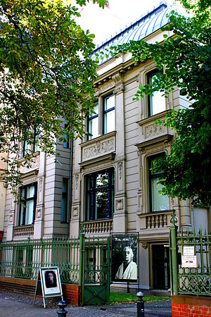
The Käthe Kollwitz Museum is a museum in Berlin that owns one of the largest collections of works by the German artist Käthe Kollwitz (1867–1945), who lived and worked in Berlin's Prenzlauer Berg for over 50 years. The museum opened in 1986, and traces its origins to the art collector Hans Pels-Leusden (d.1993). Pels-Leusden had been collecting the artist's works since 1950, and created his first Kollwitz exhibition in 1965.

Haus Cumberland
Listed Building in Berlin
Distance: Approx. 745 meters
Latitude and longitude: 52.50083333,13.31694444
The Haus Cumberland (simply translated as Cumberland House) is a Grade II listed building on the Kurfürstendamm avenue between Bleibtreu and Schlüterstraße in Charlottenburg, Berlin. It was built in 1911, and has served as a hotel and as headquarters for several administrations. In 2011, the building was restored and converted to a commercial and residential building.

Joachimsthal Gymnasium
School in Brandenburg, Germany
Distance: Approx. 520 meters
Latitude and longitude: 52.49861111,13.33
The Joachimsthal Gymnasium (German Joachimsthalsches or Joachimsthaler Gymnasium), was a princely high school (German Fürstenschule) for gifted boys, founded in 1607 in Joachimsthal, Brandenburg. In 1636, during the Thirty Years' War, the school’s buildings were destroyed, and the school migrated to Berlin. In 1912 it moved again, to Templin, where it was a boarding school.

Haus der Berliner Festspiele
Theatre in Berlin
Distance: Approx. 450 meters
Latitude and longitude: 52.49861111,13.32861111
The Haus der Berliner Festspiele is a theater in Berlin (Schaperstraße 24, 10719 Berlin). It was opened on 1 May 1963 as the "Theater der Freien Volksbühne". Previously, the West Berlin part of the former Volksbühne Berlin, the Freie Volksbühne Berlin, which was founded in 1948, had used the Theater am Kurfürstendamm as its venue from 1949 to 1963.

Artillerie Prüfungskommission
Distance: Approx. 555 meters
Latitude and longitude: 52.49807222,13.33120278
The Artillerie Prüfungskommission, (Artillery Test Commission) was founded in 1809 as part of the artillery of the Prussian Army. It was responsible for answering technical questions, testing the quality of new artillery materiel, and excuting experiments. The Artillerie Prüfungskommission later became part of the Imperial German Army.
Weather in this IP's area
clear sky
7 Celsius
5 Celsius
6 Celsius
8 Celsius
1026 hPa
90 %
1026 hPa
1021 hPa
10000 meters
2.68 m/s
3.13 m/s
255 degree
07:10:45
16:29:51
