185.93.59.129 - IP Lookup: Free IP Address Lookup, Postal Code Lookup, IP Location Lookup, IP ASN, Public IP
Country:
Region:
City:
Location:
Time Zone:
Postal Code:
IP information under different IP Channel
ip-api
Country
Region
City
ASN
Time Zone
ISP
Blacklist
Proxy
Latitude
Longitude
Postal
Route
Luminati
Country
ASN
Time Zone
Europe/Berlin
ISP
Equinix Asia Pacific
Latitude
Longitude
Postal
IPinfo
Country
Region
City
ASN
Time Zone
ISP
Blacklist
Proxy
Latitude
Longitude
Postal
Route
IP2Location
185.93.59.129Country
Region
mecklenburg-vorpommern
City
rostock
Time Zone
Europe/Berlin
ISP
Language
User-Agent
Latitude
Longitude
Postal
db-ip
Country
Region
City
ASN
Time Zone
ISP
Blacklist
Proxy
Latitude
Longitude
Postal
Route
ipdata
Country
Region
City
ASN
Time Zone
ISP
Blacklist
Proxy
Latitude
Longitude
Postal
Route
Popular places and events near this IP address

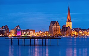
Rostock
Largest city in Mecklenburg-Vorpommern, Germany
Distance: Approx. 759 meters
Latitude and longitude: 54.08333333,12.13333333
Rostock (German: [ˈʁɔstɔk] ; Polabian: Roztoc), officially the Hanseatic and University City of Rostock (German: Hanse- und Universitätsstadt Rostock), is the largest city in the German state of Mecklenburg-Vorpommern and lies in the Mecklenburgian part of the state, close to the border with Pomerania. With around 210,000 inhabitants, it is the third-largest city on the German Baltic coast after Kiel and Lübeck, the eighth-largest city in the area of former East Germany, as well as the 39th-largest city of Germany. Rostock was the largest coastal and most important port city in East Germany.

St. Peter's Church, Rostock
Distance: Approx. 535 meters
Latitude and longitude: 54.09055556,12.14805556
St. Peter's Church, in German Petrikirche, was built in the 13th century and is the oldest of three town churches found in the Hanseatic city of Rostock, in northern Germany. The other two are St.

Rostock Hauptbahnhof
Railway station in Rostock, Germany
Distance: Approx. 1343 meters
Latitude and longitude: 54.07805556,12.13083333
Rostock Hauptbahnhof, also Rostock Central Station IATA code "RTK"(from 1896 until the turn of the 20th century called Rostock Central-Bahnhof), is the main railway station in the German city of Rostock. It is situated well to the south of the city centre, to which it is linked by tram. The station was opened in 1886 by the Deutsch-Nordischer Lloyd, operating a combined railway/ferry line to Nykøbing Falster in Denmark.

St. Mary's Church, Rostock
Church in Rostock, Germany
Distance: Approx. 175 meters
Latitude and longitude: 54.09,12.139
St. Mary's Church, Rostock, in German Marienkirche, is the biggest of three town churches found in the Hanseatic city of Rostock, in northern Germany. The other two are St.

Rostock-Lichtenhagen
Stadtteil of Rostock in Mecklenburg-Vorpommern, Germany
Distance: Approx. 759 meters
Latitude and longitude: 54.08333333,12.13333333
Lichtenhagen is a borough of Rostock in the federal state Mecklenburg-Vorpommern, Germany. It is a Plattenbau housing estate built from 1974 to 1976. It derives its name from the adjacent village of Elmenhorst/Lichtenhagen.
Rostock University of Music and Theatre
German music, theatre, and dance university
Distance: Approx. 419 meters
Latitude and longitude: 54.09166667,12.14444444
The Rostock University of Music and Drama (short HMT, Hochschule für Musik und Theater Rostock in German) is a college of music in Rostock, Mecklenburg, Germany. It opened in 1994 and is situated in a former abbey called Katharinenkloster in the historical core of the city. The college was a member of the Association of Baltic Academies of Music until this association was dissolved in 2016.

Abbey of the Holy Cross, Rostock
Abbey in Rostock, Germany
Distance: Approx. 548 meters
Latitude and longitude: 54.08722222,12.1325
The Abbey of the Holy Cross (German: Kloster zum Heiligen Kreuz) in Rostock, Germany, was founded in the 13th century by Cistercian nuns. It is the only fully preserved abbey in the city. The complex includes the former abbey church which is used today as the University Church (Universitätskirche).

Zoological Collection Rostock
Scientific university collection
Distance: Approx. 460 meters
Latitude and longitude: 54.08745,12.13379
The Zoological Collection Rostock (ZSRO, German: Zoologische Sammlung Rostock) is a scientific university collection and associated with the zoological department of the University of Rostock, Germany. The collection was founded in 1775 by Oluf Gerhard Tychsen and is used both for teaching and research. Parts of the collection are open to the public.

Trams in Rostock
Distance: Approx. 322 meters
Latitude and longitude: 54.08583333,12.14111111
The Rostock tramway network (German: Straßenbahnnetz Rostock) is a network of tramways forming the centrepiece of the public transport system in Rostock, the largest city in the federal state of Mecklenburg-Vorpommern, Germany. Opened in 1881 as a horsecar system, the network was converted to electrical operation in 1904. It is currently operated by Rostocker Straßenbahn AG (RSAG), and integrated in the Verkehrsverbund Warnow (VVW).

Rostock astronomical clock
Distance: Approx. 153 meters
Latitude and longitude: 54.0895,12.1386
The Rostock astronomical clock is a fifteenth-century astronomical clock in St. Mary's Church, Rostock.

Michaeliskloster
Distance: Approx. 332 meters
Latitude and longitude: 54.0871,12.1362
Michaeliskloster is a monastery building in Rostock, Mecklenburg-Vorpommern, Germany. It was a home to the Brethren of the Common Life, and hosted major printing and bookbinding of the late Middle Ages. In April 1942, after British bombing raid completely burned the monastery, it was in ruins.

LOHRO
Radio station in Rostock
Distance: Approx. 1162 meters
Latitude and longitude: 54.0909778,12.1231268
LOHRO is an acronym for the local radio station of the Hanseatic City of Rostock. LOHRO is a member of the German Federal Association of Free Radios (BFR). The radio station is maintained by two associations: Kulturnetzwerk e.V. acts as license holder and foerderverein.
Weather in this IP's area
overcast clouds
7 Celsius
5 Celsius
7 Celsius
8 Celsius
1034 hPa
97 %
1034 hPa
1032 hPa
10000 meters
3.71 m/s
7.56 m/s
232 degree
100 %
