Country:
Region:
City:
Latitude and Longitude:
Time Zone:
Postal Code:
IP information under different IP Channel
ip-api
Country
Region
City
ASN
Time Zone
ISP
Blacklist
Proxy
Latitude
Longitude
Postal
Route
Luminati
Country
Region
ov
City
holten
ASN
Time Zone
Europe/Amsterdam
ISP
Connectium B.V.
Latitude
Longitude
Postal
IPinfo
Country
Region
City
ASN
Time Zone
ISP
Blacklist
Proxy
Latitude
Longitude
Postal
Route
db-ip
Country
Region
City
ASN
Time Zone
ISP
Blacklist
Proxy
Latitude
Longitude
Postal
Route
ipdata
Country
Region
City
ASN
Time Zone
ISP
Blacklist
Proxy
Latitude
Longitude
Postal
Route
Popular places and events near this IP address

Rijssen-Holten
Municipality in Overijssel, Netherlands
Distance: Approx. 6521 meters
Latitude and longitude: 52.3,6.51666667
Rijssen-Holten (Dutch: [ˌrɛisə(n) ˈɦɔltə(n)] ; Sallaans: Riesn-Hooltn [ˌriːsn̩ ˈɦoːltn̩]) is a municipality (Dutch: gemeente) in the eastern Netherlands, in the province of Overijssel. The municipality was formed in 2001 by the joining of the municipalities of Holten and Rijssen. The area of Holten belongs to the region of Salland and the area of Rijssen to the region of Twente.

Rijssen
City in Overijssel, Netherlands
Distance: Approx. 7068 meters
Latitude and longitude: 52.30861111,6.51805556
Rijssen (Dutch: [ˈrɛisə(n)]; Sallands: Riesn [ˈriːsn̩]) is a city in the Dutch province of Overijssel. It is part of Rijssen-Holten, one of thirteen municipalities in Twente. It has almost 28,000 inhabitants.

Holten
Town in Netherlands, Netherlands
Distance: Approx. 1090 meters
Latitude and longitude: 52.28138889,6.41861111
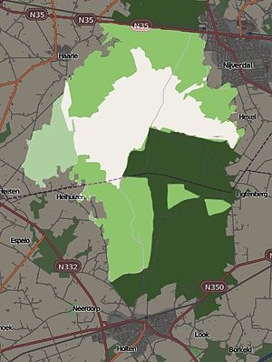
Holten (Dutch Low Saxon: Hooltn) is a village in the municipality of Rijssen-Holten in the Dutch province of Overijssel. Holten is located in a forested area just south of the Holterberg, a 65-metre (210 ft) hill, and is part of the Sallandse Heuvelrug National Park. The National Park is the only area in the Netherlands in which the black grouse (in Dutch: korhoen) can be found.
Verwolde
Distance: Approx. 6527 meters
Latitude and longitude: 52.21666667,6.41666667
Verwolde is a former municipality in the Dutch province of Gelderland. It existed between 1818 and 1854, when it was merged with Laren. The area is now a part of Lochem.

Notter, Netherlands
Hamlet in Overijssel, Netherlands
Distance: Approx. 8784 meters
Latitude and longitude: 52.33333333,6.51666667
Notter is a hamlet in the Dutch province of Overijssel. It is located in the municipality of Wierden, about 4 km southeast of the town of Nijverdal. It was first mentioned in 1297 as Nuthere.
Achterhoek, Overijssel
Hamlet in Overijssel, Netherlands
Distance: Approx. 4940 meters
Latitude and longitude: 52.24662,6.48645
Achterhoek (Dutch pronunciation: [ˈɑxtərɦuk] ) is a hamlet in the Dutch province of Overijssel. It is located in the municipality of Hof van Twente, about 2 km northwest of the village Markelo. Achter is not a statistical entity, and the postal authorities have placed it under Markelo.

Holten railway station
Railway station in Holten, Netherlands
Distance: Approx. 1219 meters
Latitude and longitude: 52.28388889,6.42055556
Holten is a railway station located in Holten, Netherlands. The station was opened on 1 September 1888 and is located on the Deventer–Almelo railway. It closed on 15 May 1938, but reopened on 1 June 1940.
Rijssen railway station
Railway station in Rijssen, Netherlands
Distance: Approx. 7317 meters
Latitude and longitude: 52.31166667,6.51916667
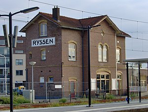
Rijssen is a railway station located in Rijssen, Netherlands. The station was opened on 1 September 1888 and is located on the Deventer–Almelo railway. The train services are operated by Nederlandse Spoorwegen.

Sallandse Heuvelrug National Park
Protected area in the Netherlands
Distance: Approx. 6593 meters
Latitude and longitude: 52.33333333,6.41666667
Sallandse Heuvelrug National Park is a national park in the Dutch province of Overijssel, located between the townships of Hellendoorn and Holten. In 2004, the Dutch Government changed the status of the area to National Park. The park is mainly managed by Staatsbosbeheer, Natuurmonumenten and the water company Vitens.
De Hegeman
Smock mill in Overijssel, Netherlands
Distance: Approx. 5426 meters
Latitude and longitude: 52.279759,6.351066
De Hegeman is a smock mill operating as a gristmill in the community of Dijkerhoek in the municipality of Rijssen-Holten, Overijssel, in the eastern Netherlands. The mill was built in 1890 using an eight-sided top structure salvaged from a demolished mill in South Holland. It is a rijksmonument (Dutch National heritage site).
Weather in this IP's area
overcast clouds
8 Celsius
7 Celsius
7 Celsius
9 Celsius
1009 hPa
97 %
1009 hPa
1005 hPa
10000 meters
1.79 m/s
4.02 m/s
261 degree
100 %
07:59:19
16:39:35

