Country:
 Hungary
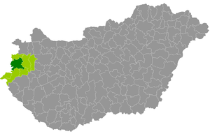
Region:
City:
Latitude and Longitude:
Time Zone:
Postal Code:
IP information under different IP Channel
ip-api
Country
Region
City
ASN
Time Zone
ISP
Blacklist
Proxy
Latitude
Longitude
Postal
Route
IPinfo
Country
Region
City
ASN
Time Zone
ISP
Blacklist
Proxy
Latitude
Longitude
Postal
Route
MaxMind
Country
Region
City
ASN
Time Zone
ISP
Blacklist
Proxy
Latitude
Longitude
Postal
Route
Luminati
Country
HURegion
va
City
vep
ASN
Time Zone
Europe/Budapest
ISP
Invitech ICT Services Kft.
Latitude
Longitude
Postal
db-ip
Country
Region
City
ASN
Time Zone
ISP
Blacklist
Proxy
Latitude
Longitude
Postal
Route
ipdata
Country
Region
City
ASN
Time Zone
ISP
Blacklist
Proxy
Latitude
Longitude
Postal
Route
Popular places and events near this IP address

Szombathely
City with county rights in Western Transdanubia, Hungary
Distance: Approx. 6911 meters
Latitude and longitude: 47.23512,16.62191
Szombathely (Hungarian pronunciation: [ˈsombɒthɛj]; German: Steinamanger, German pronunciation: [ʃtaɪ̯naˈmaŋɐ] ; also see names) is the 10th largest city in Hungary. It is the administrative centre of Vas County in the west of the country, located near the border with Austria. Szombathely lies by the streams Perint and Gyöngyös (literally "pearly"), where the Alpokalja (Lower Alps) mountains meet the Little Hungarian Plain.

Bozzai
Place in Vas, Hungary
Distance: Approx. 4781 meters
Latitude and longitude: 47.20822,16.76463
Bozzai is a village in Vas County in western Hungary, 10 km east of Szombathely.

Tanakajd
Place in Vas, Hungary
Distance: Approx. 5610 meters
Latitude and longitude: 47.1869,16.74224
Tanakajd is a village in Vas county, Hungary.
Vát
Place in Vas, Hungary
Distance: Approx. 7100 meters
Latitude and longitude: 47.27999,16.77731
Vát is a village in Vas county, Hungary.
Vép
Place in Vas, Hungary
Distance: Approx. 789 meters
Latitude and longitude: 47.22749,16.71928
Vép is a town in Vas county, Hungary.

Táplánszentkereszt
Place in Vas, Hungary
Distance: Approx. 4133 meters
Latitude and longitude: 47.19734,16.69968
Táplánszentkereszt is a village in Vas county, Hungary. As of 2001, the population was 2,389. It was created through joining seven villages along the banks of a stream.
Kenéz
Village in Western Transdanubia, Hungary
Distance: Approx. 6684 meters
Latitude and longitude: 47.20376,16.79026
Kenéz is a village in Vas County, Hungary.

Nemesbőd
Village in Western Transdanubia, Hungary
Distance: Approx. 4011 meters
Latitude and longitude: 47.26666667,16.73333333
Nemesbőd is a village in Vas county, Hungary.

Porpác
Place in Western Transdanubia, Hungary
Distance: Approx. 6811 meters
Latitude and longitude: 47.25,16.8
Porpác is a village in Vas county, Hungary.

Vassurány
Place in Western Transdanubia, Hungary
Distance: Approx. 5660 meters
Latitude and longitude: 47.28333333,16.7
Vassurány is a village in Vas county, Hungary. with a Population of 837.

Vasszécseny
Place in Western Transdanubia, Hungary
Distance: Approx. 6872 meters
Latitude and longitude: 47.18333333,16.76666667
Vasszécseny is a village in Vas county, Hungary.
Szombathely District
Districts of Hungary in Vas
Distance: Approx. 7062 meters
Latitude and longitude: 47.23,16.62
Szombathely (Hungarian: Szombathelyi járás) is a district in central-western part of Vas County. Szombathely is also the name of the town where the district seat is found. The district is located in the Western Transdanubia Statistical Region.
Weather in this IP's area
scattered clouds
14 Celsius
13 Celsius
14 Celsius
14 Celsius
1021 hPa
48 %
1021 hPa
998 hPa
10000 meters
4.86 m/s
6.48 m/s
170 degree
31 %
07:15:53
18:00:16