185.90.97.95 - IP Lookup: Free IP Address Lookup, Postal Code Lookup, IP Location Lookup, IP ASN, Public IP
Country:
Region:
City:
Location:
Time Zone:
Postal Code:
IP information under different IP Channel
ip-api
Country
Region
City
ASN
Time Zone
ISP
Blacklist
Proxy
Latitude
Longitude
Postal
Route
Luminati
Country
ASN
Time Zone
Europe/Paris
ISP
ADISTA SAS
Latitude
Longitude
Postal
IPinfo
Country
Region
City
ASN
Time Zone
ISP
Blacklist
Proxy
Latitude
Longitude
Postal
Route
IP2Location
185.90.97.95Country
Region
centre-val de loire
City
chanceaux-sur-choisille
Time Zone
Europe/Paris
ISP
Language
User-Agent
Latitude
Longitude
Postal
db-ip
Country
Region
City
ASN
Time Zone
ISP
Blacklist
Proxy
Latitude
Longitude
Postal
Route
ipdata
Country
Region
City
ASN
Time Zone
ISP
Blacklist
Proxy
Latitude
Longitude
Postal
Route
Popular places and events near this IP address

Tours Val de Loire Airport
Airport
Distance: Approx. 4600 meters
Latitude and longitude: 47.43194444,0.72305556
Tours Val de Loire Airport (French: Aéroport Tours-Val de Loire) (IATA: TUF, ICAO: LFOT) is an airport in the French department of Indre-et-Loire, 6 km (3.2 NM) north-northeast of the city of Tours in the Loire Valley (Val de Loire). The airport is located partly on the territory of the communes of Tours and Parçay-Meslay. The airport is open to both national and international carriers, private planes and is certified for both instrument flight and visual flight.
Notre-Dame-d'Oé
Commune in Centre-Val de Loire, France
Distance: Approx. 1493 meters
Latitude and longitude: 47.4583,0.7089
Notre-Dame-d'Oé (French pronunciation: [nɔtʁ dam dɔe] ) is a commune in the Indre-et-Loire department of central France.
Parçay-Meslay
Commune in Centre-Val de Loire, France
Distance: Approx. 4466 meters
Latitude and longitude: 47.4425,0.7464
Parçay-Meslay (French pronunciation: [paʁsɛ mɛlɛ] ) is a commune in the Indre-et-Loire department, central France.
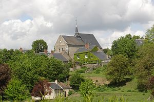
Chanceaux-sur-Choisille
Commune in Centre-Val de Loire, France
Distance: Approx. 671 meters
Latitude and longitude: 47.4667,0.7
Chanceaux-sur-Choisille (French pronunciation: [ʃɑ̃so syʁ ʃwazij] ) is a commune in the Indre-et-Loire department in central France.
Cerelles
Commune in Centre-Val de Loire, France
Distance: Approx. 3618 meters
Latitude and longitude: 47.5003,0.6831
Cerelles (French pronunciation: [səʁɛl] ) is a commune in the Indre-et-Loire department in central France.
La Membrolle-sur-Choisille
Commune in Centre-Val de Loire, France
Distance: Approx. 6098 meters
Latitude and longitude: 47.4389,0.6403
La Membrolle-sur-Choisille (French pronunciation: [la mɑ̃bʁɔl syʁ ʃwazij] ) is a commune in the Indre-et-Loire department in central France.
Saint-Antoine-du-Rocher
Commune in Centre-Val de Loire, France
Distance: Approx. 6264 meters
Latitude and longitude: 47.4969,0.6311
Saint-Antoine-du-Rocher (French pronunciation: [sɛ̃.t‿ɑ̃twan dy ʁɔʃe] ) is a commune in the Indre-et-Loire department in central France.
Mettray
Commune in Centre-Val de Loire, France
Distance: Approx. 4714 meters
Latitude and longitude: 47.4528,0.6492
Mettray (French pronunciation: [mɛtʁɛ] ) is a commune in the Indre-et-Loire department in central France. The Mettray Penal Colony was opened there in 1839.

Tours Aerodrome
Distance: Approx. 4670 meters
Latitude and longitude: 47.43055556,0.71888889
Tours Aerodrome was a complex of military airfields in the French department of Indre-et-Loire, 6 km (3.2 NM) north-northeast of the city of Tours. They were used during World War I as part of the Second Air Instructional Center (2d AIC), American Expeditionary Forces for training United States airmen prior to being sent into combat. Today Tours Airdrome #1 airfield is Tours Val de Loire Airport (Base Aérienne 604).
Lycée Choiseul
Distance: Approx. 4372 meters
Latitude and longitude: 47.4348,0.6847
Lycée Choiseul is a senior high school/sixth-form college in Tours, Indre-et-Loire, France. The school includes a boarding facility. The École Supérieure « Sévigné » first opened in 1884 with 50 students, and it became the Collège de Jeunes Filles, a school for girls.
Lycée Vaucanson (Tours)
Senior high school in France
Distance: Approx. 5333 meters
Latitude and longitude: 47.4236,0.7068
Lycée Jacques de Vaucanson is a senior high school/sixth-form college in Tours, Indre-et-Loire, France. It opened in 1989 and moved into a new building in 2012. The school includes a boarding facility.

École de L'Aviation de Chasse 314 Christian Martell
Military unit
Distance: Approx. 4592 meters
Latitude and longitude: 47.432,0.723
École de L'Aviation de Chasse 314 Christian Martell was a French Air and Space Force (Armée de l'air et de l'espace) Fighter Pilot Training School located at Tours Saint Symphorien Air Base (BA 705), Indre-et-Loire, France which operated the Dassault/Dornier Alpha Jet. It was operational from 1961, until Pilatus PC-21 light trainers were ordered to replace its Alpha Jets, which entered service in 2018 with EPAA 00.315 at BA 709 Cognac. On 12 September 2020, École de Pilotage de l’Armée de l’Air 315 Général Jarry (EPAA 00.315) was merged with the école de l'aviation chasse EAC 00.314, to form l'école de l'aviation de chasse 00.315 "Christian Martell" at Cognac.
Weather in this IP's area
mist
6 Celsius
5 Celsius
6 Celsius
7 Celsius
1028 hPa
98 %
1028 hPa
1016 hPa
1500 meters
1.54 m/s
270 degree
100 %

