185.87.232.219 - IP Lookup: Free IP Address Lookup, Postal Code Lookup, IP Location Lookup, IP ASN, Public IP
Country:
Region:
City:
Location:
Time Zone:
Postal Code:
ISP:
ASN:
language:
User-Agent:
Proxy IP:
Blacklist:
IP information under different IP Channel
ip-api
Country
Region
City
ASN
Time Zone
ISP
Blacklist
Proxy
Latitude
Longitude
Postal
Route
db-ip
Country
Region
City
ASN
Time Zone
ISP
Blacklist
Proxy
Latitude
Longitude
Postal
Route
IPinfo
Country
Region
City
ASN
Time Zone
ISP
Blacklist
Proxy
Latitude
Longitude
Postal
Route
IP2Location
185.87.232.219Country
Region
mazowieckie
City
siedlce
Time Zone
Europe/Warsaw
ISP
Language
User-Agent
Latitude
Longitude
Postal
ipdata
Country
Region
City
ASN
Time Zone
ISP
Blacklist
Proxy
Latitude
Longitude
Postal
Route
Popular places and events near this IP address

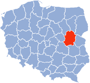
Siedlce Voivodeship
Former administrative division of Poland
Distance: Approx. 554 meters
Latitude and longitude: 52.166113,22.28246
Siedlce Voivodeship (Polish: województwo siedleckie) was a unit of administrative division and local government in Poland in the years 1975–1998, superseded by Masovian Voivodeship and Lublin Voivodeship. Its capital city was Siedlce.

Siedlce
Place in Masovian Voivodeship, Poland
Distance: Approx. 1317 meters
Latitude and longitude: 52.165,22.27138889
Siedlce (Polish pronunciation: ['ɕɛdlt͡sɛ] ) (Yiddish: שעדליץ Shedlits) is a city in eastern Poland with 77,354 inhabitants (as of 2021). Situated in the Masovian Voivodeship (since 1999), previously the city was the capital of a separate Siedlce Voivodeship (1975–1998). The city is situated between two small rivers, the Muchawka and the Helenka, and lies along the European route E30, around 90 kilometres (56 mi) east of Warsaw.

Siedlce Department
Distance: Approx. 2534 meters
Latitude and longitude: 52.15,22.266667
Siedlce Department (Polish: Departament siedlecki) was a unit of administrative division and local government in Polish Duchy of Warsaw in years 1809–1815. Its capital city was Siedlce, and it was further divided onto 9 powiats. In 1815 it was transformed into Podlasie Voivodeship.

Siedlce County
County in Masovian Voivodeship, Poland
Distance: Approx. 1317 meters
Latitude and longitude: 52.165,22.27138889
Siedlce County (Polish: powiat siedlecki) is a unit of territorial administration and local government (powiat) in Masovian Voivodeship, east-central Poland. It came into being on January 1, 1999, as a result of the Polish local government reforms passed in 1998. Its administrative seat is the city of Siedlce, although the city is not part of the county (it constitutes a separate city county).
Podlaskie Voivodeship (1816–1837)
Distance: Approx. 683 meters
Latitude and longitude: 52.16506,22.281087
Administrative subdivision of Congress Poland It was created in 1816 from the Siedlce Department. Its capital was in Siedlce.

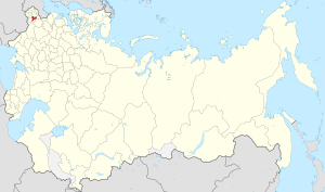
Siedlce Governorate
1867–1912 unit of Poland
Distance: Approx. 2534 meters
Latitude and longitude: 52.15,22.266667
Siedlce Governorate was an administrative-territorial unit (guberniya) of Congress Poland of the Russian Empire.
Gmina Siedlce
Gmina in Masovian Voivodeship, Poland
Distance: Approx. 1317 meters
Latitude and longitude: 52.165,22.27138889
Gmina Siedlce is a rural gmina (administrative district) in Siedlce County, Masovian Voivodeship, in east-central Poland. Its seat is the town of Siedlce, although the town is not part of the territory of the gmina. The gmina covers an area of 141.54 square kilometres (54.6 sq mi), and as of 2006 its total population is 15,893 (17,506 in 2014).
Roman Catholic Diocese of Siedlce
Roman Catholic diocese in Poland
Distance: Approx. 1113 meters
Latitude and longitude: 52.169634,22.274235
The Diocese of Siedlce (Latin: Siedlecen(sis)) is a Latin Church ecclesiastical territory or diocese of the Catholic Church in Poland. Its episcopal see is Siedlce. The Diocese of Siedlce is a suffragan diocese in the ecclesiastical province of the metropolitan Archdiocese of Lublin.
Żabokliki, Siedlce County
Village in Masovian Voivodeship, Poland
Distance: Approx. 2516 meters
Latitude and longitude: 52.18333333,22.31666667
Żabokliki [ʐabɔˈkliki] is a village in the administrative district of Gmina Siedlce, within Siedlce County, Masovian Voivodeship, in east-central Poland. It lies approximately 4 kilometres (2 mi) north-east of Siedlce and 90 km (56 mi) east of Warsaw.

Sejm Constituency no. 18
Polish parliamentary constituency
Distance: Approx. 2534 meters
Latitude and longitude: 52.15,22.266667
Siedlce is a Polish parliamentary constituency in the Masovian Voivodeship. It elects twelve members of the Sejm. The district has the number '18' for elections to the Sejm and is named after the city of Siedlce.
Siedlce railway station
Railway station in Siedlce, Poland
Distance: Approx. 1377 meters
Latitude and longitude: 52.16166667,22.2725
Siedlce railway station is a railway station in Siedlce, Poland. As of 2011, it is served by Koleje Mazowieckie (which runs the KM2 services from Warszawa Zachodnia to Łuków and KM31 services from Siedlce to Czeremcha), Przewozy Regionalne (InterRegio services between Łuków and Bielsko Biała Główna), and PKP Intercity. The station was opened in 1866.
Siedlce University of Natural Sciences and Humanities
Public university in Siedlce, Poland
Distance: Approx. 475 meters
Latitude and longitude: 52.16972222,22.28416667
The Siedlce University of Natural Sciences and Humanities (Polish: Uniwersytet Przyrodniczo-Humanistyczny w Siedlcach) is a higher-education institution in Siedlce, Poland. It was created on October 1, 2010, by the decision of Sejm signed by the President of the Republic of Poland, Bronisław Komorowski. The previous name of the university was 'Akademia Podlaska w Siedlcach', in English known officially as University of Podlasie.
Weather in this IP's area
clear sky
3 Celsius
0 Celsius
3 Celsius
3 Celsius
1028 hPa
83 %
1028 hPa
1007 hPa
10000 meters
2.32 m/s
2.32 m/s
243 degree
8 %


