185.87.179.86 - IP Lookup: Free IP Address Lookup, Postal Code Lookup, IP Location Lookup, IP ASN, Public IP
Country:
Region:
City:
Location:
Time Zone:
Postal Code:
ISP:
ASN:
language:
User-Agent:
Proxy IP:
Blacklist:
IP information under different IP Channel
ip-api
Country
Region
City
ASN
Time Zone
ISP
Blacklist
Proxy
Latitude
Longitude
Postal
Route
db-ip
Country
Region
City
ASN
Time Zone
ISP
Blacklist
Proxy
Latitude
Longitude
Postal
Route
IPinfo
Country
Region
City
ASN
Time Zone
ISP
Blacklist
Proxy
Latitude
Longitude
Postal
Route
IP2Location
185.87.179.86Country
Region
nordrhein-westfalen
City
gescher
Time Zone
Europe/Berlin
ISP
Language
User-Agent
Latitude
Longitude
Postal
ipdata
Country
Region
City
ASN
Time Zone
ISP
Blacklist
Proxy
Latitude
Longitude
Postal
Route
Popular places and events near this IP address
Borken (district)
District in North Rhine-Westphalia, Germany
Distance: Approx. 7339 meters
Latitude and longitude: 51.91666667,6.91666667
Borken is a Kreis (district) in the northwestern part of North Rhine-Westphalia, Germany in the Münster region. Neighboring districts are Steinfurt, Coesfeld, Recklinghausen, Wesel, Cleves, Bentheim in the Lower Saxony and the Dutch provinces Gelderland and Overijssel. The two biggest cities are Bocholt and Gronau.

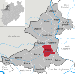
Velen
Town in North Rhine-Westphalia, Germany
Distance: Approx. 6771 meters
Latitude and longitude: 51.89388889,6.98972222
Velen is a town in the district Borken, North Rhine-Westphalia, Germany with about 12,000 citizens. It consists of the two settlements of Velen and Ramsdorf and the four rural regions Ostendorf-Krueckling, Bleking-Holthausen, Nordvelen and Waldvelen. In 2003 the town received the title "staatlich anerkannter Erholungsort" (recreation village approved by the state) from the regional president.
Stadtlohn
Town in North Rhine-Westphalia, Germany
Distance: Approx. 7503 meters
Latitude and longitude: 51.9925,6.915
Stadtlohn (Low German: Stadlaun) is a city in western Münsterland in the northwest of North Rhine-Westphalia, and is a district town of the Borken administrative district. The city had a population of 20,746 inhabitants as of 2020. The River Berkel flows through the city on its way to the Netherlands.

Battle of Stadtlohn
1623 battle of the Thirty Years' War
Distance: Approx. 8331 meters
Latitude and longitude: 52.01972222,6.94666667
The Battle of Stadtlohn was fought on 6 August 1623 between the armies of the Electoral Palatinate and of the Catholic League during the Thirty Years' War. The League's forces were led by Johann Tserclaes, Count of Tilly, the Protestants by Christian of Brunswick. The battle resulted in a resounding Catholic victory that largely ended the military resistance of the Palatinate forces and thus marked the end of the first phase of the Thirty Years' War.

Gescher
Municipality in North Rhine-Westphalia, Germany
Distance: Approx. 332 meters
Latitude and longitude: 51.95694444,7.00555556
Gescher is a municipality in the district of Borken, in North Rhine-Westphalia, Germany. It is located near the border with the Netherlands. It is most often known for its bell work, and it includes a Museum of Bells.

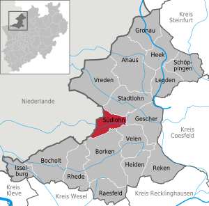
Südlohn
Municipality in North Rhine-Westphalia, Germany
Distance: Approx. 9567 meters
Latitude and longitude: 51.94361111,6.86638889
Südlohn is a municipality in the district of Borken in the northwestern part of North Rhine-Westphalia, Germany. It is located right at the border with the Netherlands, approx. 10 km east of Winterswijk.

Rosendahl-Holtwick station
Railway station in Rosendahl, Germany
Distance: Approx. 9444 meters
Latitude and longitude: 51.99805556,7.1225
Rosendahl-Holtwick (German: Bahnhof Rosendahl-Holtwick) is a railway station in the town of Rosendahl, North Rhine-Westphalia, Germany. The station lies on the Dortmund–Enschede railway and the train services are operated by Deutsche Bahn.
Weather in this IP's area
few clouds
11 Celsius
10 Celsius
11 Celsius
11 Celsius
992 hPa
69 %
992 hPa
985 hPa
10000 meters
3.58 m/s
8.05 m/s
242 degree
23 %
