Country:
 France
Region:
City:
Latitude and Longitude:
Time Zone:
Postal Code:
IP information under different IP Channel
ip-api
Country
Region
City
ASN
Time Zone
ISP
Blacklist
Proxy
Latitude
Longitude
Postal
Route
IPinfo
Country
Region
City
ASN
Time Zone
ISP
Blacklist
Proxy
Latitude
Longitude
Postal
Route
MaxMind
Country
Region
City
ASN
Time Zone
ISP
Blacklist
Proxy
Latitude
Longitude
Postal
Route
Luminati
Country
FRASN
Time Zone
Europe/Paris
ISP
ADISTA SAS
Latitude
Longitude
Postal
db-ip
Country
Region
City
ASN
Time Zone
ISP
Blacklist
Proxy
Latitude
Longitude
Postal
Route
ipdata
Country
Region
City
ASN
Time Zone
ISP
Blacklist
Proxy
Latitude
Longitude
Postal
Route
Popular places and events near this IP address

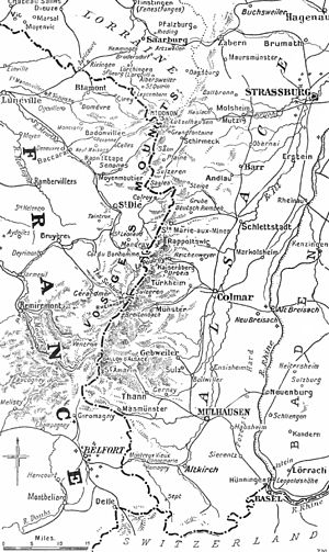
Mulhouse
Subprefecture and commune in Grand Est, France
Distance: Approx. 877 meters
Latitude and longitude: 47.75,7.34
Mulhouse (pronounced [myluz] ; Alsatian: Mìlhüsa [mɪlˈhyːsa]; German: Mülhausen [myːlˈhaʊzn̩] , meaning "mill house") is a French city of the European Collectivity of Alsace (Haut-Rhin department, in the Grand Est region of France). It is near the France–Switzerland border and France–Germany border. It is the largest city in Haut-Rhin and second largest in Alsace after Strasbourg.
Battle of Mulhouse
1914 battle on the Western Front of World War I
Distance: Approx. 895 meters
Latitude and longitude: 47.74944444,7.34
The Battle of Mulhouse (German: Mülhausen), also called the Battle of Alsace (French: Bataille d'Alsace), which began on 7 August 1914, was the opening attack of the First World War by the French Army against the German Empire. The battle was part of a French attempt to recover the province of Alsace, which France had ceded to the new empire following its defeat in the Franco-Prussian War of 1870–1871. The French occupied Mulhouse on 8 August and were then forced out by German counter-attacks on 10 August.

Arrondissement of Mulhouse
Arrondissement in Grand Est, France
Distance: Approx. 415 meters
Latitude and longitude: 47.75,7.33333333
The arrondissement of Mulhouse is an arrondissement of France in the Haut-Rhin department in the Grand Est region. It has 79 communes. Its population is 351,012 (2016), and its area is 707.1 km2 (273.0 sq mi).

Cité de l'Automobile
Automobile museum in Mulhouse, France
Distance: Approx. 983 meters
Latitude and longitude: 47.76083333,7.32861111
Musée National de l’Automobile, Collection Schlumpf is an automobile museum located in Mulhouse, France, and built around the Schlumpf Collection of classic automobiles. It has the largest displayed collection of automobiles and contains the largest and most comprehensive collection of Bugatti motor vehicles in the world.

Battle of Vosges (58 BC)
Battle during Gallic Wars (58 BC)
Distance: Approx. 413 meters
Latitude and longitude: 47.75,7.3333
The Battle of Vosges also referred to as the Battle of Vesontio was fought on September 14, 58 BC between the Germanic tribe of the Suebi, under the leadership of Ariovistus, and six Roman legions under the command of Gaius Julius Caesar. This encounter is the third major battle of the Gallic Wars. Germanic tribes crossed the Rhine, seeking a home in Gaul.
Radio Dreyeckland
Radio station in Mulhouse, France
Distance: Approx. 923 meters
Latitude and longitude: 47.74833333,7.33972222
Radio Dreyeckland is a radio station in Mulhouse, Alsace, France. Another station with the same name operates in Freiburg im Breisgau, Germany. Both stations are successors to Radio Verte Fessenheim which was started by opponents to the Fessenheim Nuclear Power Plant during the 1970s and was renamed 'Dreyeckland' in 1981.

Temple Saint-Étienne
Church in Mulhouse, France
Distance: Approx. 932 meters
Latitude and longitude: 47.74722222,7.33888889
The Temple Saint-Étienne (Protestant St. Stephen's Church; Alsatian: Schtefànskerch) is a Calvinist church located in the city of Mulhouse, Alsace, France. Its congregation forms part of the Protestant Reformed Church of Alsace and Lorraine.

Mulhouse Alsace Agglomération
Communauté d'agglomération in Haut-Rhin
Distance: Approx. 877 meters
Latitude and longitude: 47.75,7.34
The Mulhouse Alsace Agglomération is the Communauté d'agglomération, a type of local government structure, covering the metropolitan area of the city of Mulhouse in the department of Haut-Rhin and the region of Grand Est, northeastern France. Its area is 439.2 km2. Its population was 274,066 in 2018, of which 108,942 in Mulhouse proper.

Battle of Mulhouse (1674)
Battle in the Franco-Dutch War
Distance: Approx. 886 meters
Latitude and longitude: 47.7495,7.3399
The Battle of Mulhouse took place on 29 December 1674 in Alsace, part of Turenne's Winter Campaign during the Franco-Dutch War. It was fought by the French army under Turenne and part of Alexander von Bournonville's Imperial army commanded by Hermann of Baden-Baden. Following the inconclusive Battle of Entzheim on 4 October, the Imperial army took up winter quarters around Colmar.
Canton of Mulhouse-2
Distance: Approx. 1230 meters
Latitude and longitude: 47.76,7.34
The canton of Mulhouse-2 is an administrative division of the Haut-Rhin department, northeastern France. It was created at the French canton reorganisation which came into effect in March 2015. Its seat is in Mulhouse.

Musée des Beaux-Arts de Mulhouse
Art museum in Alsace, France
Distance: Approx. 1005 meters
Latitude and longitude: 47.74583333,7.33847222
The Musée des Beaux-Arts de Mulhouse is a municipal art museum in Mulhouse, France. It originated with the Société industrielle de Mulhouse (SIM), a learned society established in 1826 by local industrialists such as Dollfus, Koechlin, and Schlumberger, which had begun collecting artworks in 1831, and was founded in 1864 by Frédéric Engel-Dollfus.

Musée historique de Mulhouse
History and archaeology museum in Alsace, France
Distance: Approx. 877 meters
Latitude and longitude: 47.75,7.34
The Musée historique de Mulhouse is a municipal history museum and archaeology museum in Mulhouse, France. It is housed since 1969 in Mulhouse's Old Town Hall, a Northern Renaissance building dating mainly from 1552, which is protected as a Monument historique since 1929. The interiors of the Old Town Hall with their intact original decoration are an integral part of the museum.
Weather in this IP's area
moderate rain
17 Celsius
17 Celsius
15 Celsius
17 Celsius
1005 hPa
93 %
1005 hPa
977 hPa
10000 meters
3.58 m/s
6.71 m/s
200 degree
97 %
07:39:45
18:56:15