Country:
Region:
City:
Latitude and Longitude:
Time Zone:
Postal Code:
IP information under different IP Channel
ip-api
Country
Region
City
ASN
Time Zone
ISP
Blacklist
Proxy
Latitude
Longitude
Postal
Route
Luminati
Country
Region
naq
City
lacouronne
ASN
Time Zone
Europe/Paris
ISP
IDLINE SAS
Latitude
Longitude
Postal
IPinfo
Country
Region
City
ASN
Time Zone
ISP
Blacklist
Proxy
Latitude
Longitude
Postal
Route
db-ip
Country
Region
City
ASN
Time Zone
ISP
Blacklist
Proxy
Latitude
Longitude
Postal
Route
ipdata
Country
Region
City
ASN
Time Zone
ISP
Blacklist
Proxy
Latitude
Longitude
Postal
Route
Popular places and events near this IP address
Soyaux
Commune in Nouvelle-Aquitaine, France
Distance: Approx. 4255 meters
Latitude and longitude: 45.6414,0.1986
Soyaux (French pronunciation: [swajo] or [sojo]) is a commune in the Charente department in the Nouvelle-Aquitaine region in southwestern France.
Champniers, Charente
Commune in Nouvelle-Aquitaine, France
Distance: Approx. 4454 meters
Latitude and longitude: 45.7158,0.2064
Champniers (French pronunciation: [ʃɑ̃pnje] or [ʃɑ̃nje]) is a commune in the Charente department in southwestern France.
Gond-Pontouvre
Commune in Nouvelle-Aquitaine, France
Distance: Approx. 4363 meters
Latitude and longitude: 45.6692,0.1642
Gond-Pontouvre (French pronunciation: [ɡɔ̃ pɔ̃tuvʁ]) is a commune in the Charente department in southwestern France. It is about 3 km north of the centre of Angoulême.
L'Isle-d'Espagnac
Commune in Nouvelle-Aquitaine, France
Distance: Approx. 2177 meters
Latitude and longitude: 45.6622,0.2006
L'Isle-d'Espagnac (French pronunciation: [lil depaɲak]) is a commune in the Charente department in southwestern France.
Magnac-sur-Touvre
Commune in Nouvelle-Aquitaine, France
Distance: Approx. 1882 meters
Latitude and longitude: 45.6664,0.2383
Magnac-sur-Touvre (French pronunciation: [maɲak syʁ tuvʁ]) is a commune in the Charente department in southwestern France.
Mornac
Commune in Nouvelle-Aquitaine, France
Distance: Approx. 4195 meters
Latitude and longitude: 45.6811,0.2728
Mornac (French pronunciation: [mɔʁnak]) is a commune in the Charente department in southwestern France.
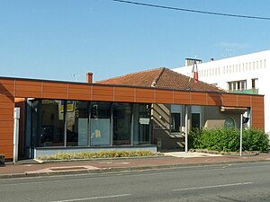
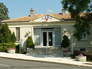
Ruelle-sur-Touvre
Commune in Nouvelle-Aquitaine, France
Distance: Approx. 248 meters
Latitude and longitude: 45.6786,0.2211
Ruelle-sur-Touvre is a commune in the Charente department in southwestern France.
Touvre
Commune in Nouvelle-Aquitaine, France
Distance: Approx. 3559 meters
Latitude and longitude: 45.6619,0.2597
Touvre (French pronunciation: [tuvʁ]) is a commune in the Charente department in southwestern France.
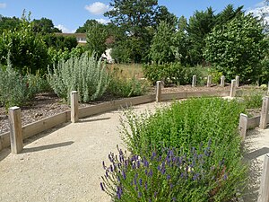
Sentier botanique de Soyaux
Distance: Approx. 4256 meters
Latitude and longitude: 45.64138889,0.19861111
The Sentier botanique de Soyaux (200 metres long) is an arboretum and botanical path located on the Chemin de la Mothe, rue du Bourg, Soyaux, Charente, Nouvelle-Aquitaine, France. It was created in 2000 along the remains of a rural road, and planted with 42 species of regional trees and shrubs (32 deciduous, 10 evergreen). The path is open daily without charge.

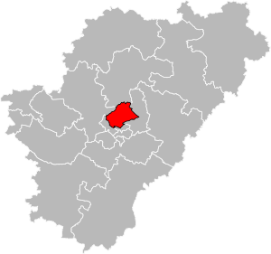
Canton of Touvre-et-Braconne
Canton in Nouvelle-Aquitaine, France
Distance: Approx. 361 meters
Latitude and longitude: 45.68,0.22
The canton of Touvre-et-Braconne is an administrative division of the Charente department, southwestern France. It was created at the French canton reorganisation which came into effect in March 2015. Its seat is in Ruelle-sur-Touvre.

Canton of Gond-Pontouvre
Canton in Nouvelle-Aquitaine, France
Distance: Approx. 4620 meters
Latitude and longitude: 45.68,0.16
The canton of Gond-Pontouvre is an administrative division of the Charente department, southwestern France. Its borders were not modified at the French canton reorganisation which came into effect in March 2015. Its seat is in Gond-Pontouvre.
Grand Angoulême
Communauté d'agglomération in Nouvelle-Aquitaine, France
Distance: Approx. 4241 meters
Latitude and longitude: 45.66666667,0.16666667
Grand Angoulême is the communauté d'agglomération, an intercommunal structure, centred on the city of Angoulême. It is located in the Charente department, in the Nouvelle-Aquitaine region, southwestern France. It was created in January 2017.
Weather in this IP's area
overcast clouds
9 Celsius
8 Celsius
7 Celsius
10 Celsius
1021 hPa
80 %
1021 hPa
1014 hPa
10000 meters
1.54 m/s
100 %
08:03:18
17:25:43


