185.83.69.86 - IP Lookup: Free IP Address Lookup, Postal Code Lookup, IP Location Lookup, IP ASN, Public IP
Country:
Region:
City:
Location:
Time Zone:
Postal Code:
IP information under different IP Channel
ip-api
Country
Region
City
ASN
Time Zone
ISP
Blacklist
Proxy
Latitude
Longitude
Postal
Route
Luminati
Country
Region
eng
City
cricklewood
ASN
Time Zone
Europe/London
ISP
24SHELLS
Latitude
Longitude
Postal
IPinfo
Country
Region
City
ASN
Time Zone
ISP
Blacklist
Proxy
Latitude
Longitude
Postal
Route
IP2Location
185.83.69.86Country
Region
england
City
brent
Time Zone
Europe/London
ISP
Language
User-Agent
Latitude
Longitude
Postal
db-ip
Country
Region
City
ASN
Time Zone
ISP
Blacklist
Proxy
Latitude
Longitude
Postal
Route
ipdata
Country
Region
City
ASN
Time Zone
ISP
Blacklist
Proxy
Latitude
Longitude
Postal
Route
Popular places and events near this IP address

Wembley
Suburb of London
Distance: Approx. 306 meters
Latitude and longitude: 51.5528,-0.2979
Wembley () is a large suburb in the London Borough of Brent, north-west London, 8 miles (13 km) northwest of Charing Cross. It includes the neighbourhoods of Alperton, Kenton, North Wembley, Preston, Sudbury, Tokyngton and Wembley Park. The population was 102,856 in 2011.

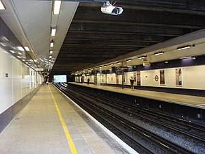
Wembley Central station
London Underground and railway station
Distance: Approx. 398 meters
Latitude and longitude: 51.5526,-0.2966
Wembley Central is an interchange station in Wembley, north-west London. It is situated on the east-west High Road and is near to both Wembley Stadium and Wembley Arena. The station provides an interchange between Bakerloo line services of the London Underground; Lioness line services of the London Overground; and National Rail services operated by Southern on the West Coast main line.

Sudbury & Harrow Road railway station
British railway station
Distance: Approx. 1002 meters
Latitude and longitude: 51.554,-0.3167
Sudbury & Harrow Road is a National Rail station served by Chiltern Railways in Harrow Road, Sudbury in Greater London. It was the least used railway station in Greater London in 2023/24 and is 400 m (1,300 ft) north of Sudbury Town Underground station.
Sudbury Town tube station
London Underground station
Distance: Approx. 952 meters
Latitude and longitude: 51.55083333,-0.31555556
Sudbury Town () is a London Underground station in Sudbury, north-west London. It is on the Uxbridge branch of the Piccadilly line between Sudbury Hill and Alperton stations, and is in Travelcard Zone 4. It is located on the border between the London Boroughs of Brent and Ealing, with its main entrance on Station Approach in Sudbury.

North Wembley
Human settlement in England
Distance: Approx. 349 meters
Latitude and longitude: 51.556,-0.3042
North Wembley is a district in north-west London, England. It is located in the London Borough of Brent and is mostly made up of the 1930s Sudbury Court Estate. North Wembley forms the north-western part of the district of that is its namesake.

Harrow Road
Street in London
Distance: Approx. 904 meters
Latitude and longitude: 51.5545,-0.31517
Harrow Road is an ancient route in North West London which runs from Paddington in a northwesterly direction towards Harrow. It is also the name given to the immediate surrounding area of Queens Park and Kensal Green, straddling the NW10, W10, W2 and W9 postcodes. With minor deviations in the 19th and 20th centuries, the route remains otherwise unaltered.
Wembley Central (ward)
Electoral ward in England
Distance: Approx. 435 meters
Latitude and longitude: 51.551,-0.297
Wembley Central is an electoral ward of the London Borough of Brent. The ward was first used in the 1968 elections. It returns three councillors to Brent London Borough Council.

Wembley Central rail crash
1984 railway accident in London, England
Distance: Approx. 737 meters
Latitude and longitude: 51.54957,-0.2933
The Wembley Central rail crash was a fatal railway accident that occurred on 11 October 1984 just outside Wembley Central railway station, Greater London. The 17:54 passenger train from London Euston to Bletchley, formed of two Class 310 electric multiple units, collided with a Freightliner train which was leaving Willesden yard. The first two coaches of the passenger train overturned onto their sides and three passengers were killed; 17 passengers and the driver were injured.
Ark Elvin Academy
Academy in Wembley, London, England
Distance: Approx. 859 meters
Latitude and longitude: 51.5527,-0.2899
Ark Elvin Academy (formerly Copland Community School) is a mixed secondary school and sixth form located in Wembley area of the London Borough of Brent. 92% of students are of minority ethnic origin, 36% qualify for free school meals, and over 50 different languages are spoken by students.
London Hackspace
Non-profit hackerspace in United Kingdom
Distance: Approx. 855 meters
Latitude and longitude: 51.5539268,-0.2900229
London Hackspace (abbreviated LHS) is a non–profit hackerspace in London, UK, established in 2009. Originally located in Islington, it moved to Hoxton in July 2010, and later to Wembley. In 2012, it was the largest hackerspace in the United Kingdom by membership, with over 1000 paying members.

St Gabriel's Hurling Club
Distance: Approx. 984 meters
Latitude and longitude: 51.55789,-0.31424
St Gabriel's Hurling Club is a Gaelic Athletic Association club located in Wembley, London, England. The club was founded in 1961 and is exclusively concerned with the game of hurling.

Wembley Central Mosque
Mosque in London, England
Distance: Approx. 436 meters
Latitude and longitude: 51.5503,-0.2979
The Wembley Central Mosque (formerly the St Andrew's Presbyterian Church) is a mosque in the London Borough of Brent. The principal mosque in North West London, it is located on Ealing Road, Wembley, and serves the United Kingdom’s fifth largest Muslim community, which is predominantly Pakistani and Bangladeshi. Along with the adjacent Muslim Welfare Association, it can hold up to 2200 people.
Weather in this IP's area
light intensity drizzle rain
12 Celsius
11 Celsius
11 Celsius
13 Celsius
1008 hPa
89 %
1008 hPa
1004 hPa
7000 meters
9.26 m/s
230 degree
75 %

