Country:
Region:
City:
Latitude and Longitude:
Time Zone:
Postal Code:
IP information under different IP Channel
ip-api
Country
Region
City
ASN
Time Zone
ISP
Blacklist
Proxy
Latitude
Longitude
Postal
Route
Luminati
Country
ASN
Time Zone
Europe/Helsinki
ISP
Cloud Center Finland Oy
Latitude
Longitude
Postal
IPinfo
Country
Region
City
ASN
Time Zone
ISP
Blacklist
Proxy
Latitude
Longitude
Postal
Route
db-ip
Country
Region
City
ASN
Time Zone
ISP
Blacklist
Proxy
Latitude
Longitude
Postal
Route
ipdata
Country
Region
City
ASN
Time Zone
ISP
Blacklist
Proxy
Latitude
Longitude
Postal
Route
Popular places and events near this IP address

Lahti
City in Päijänne Tavastia, Finland
Distance: Approx. 356 meters
Latitude and longitude: 60.98333333,25.65
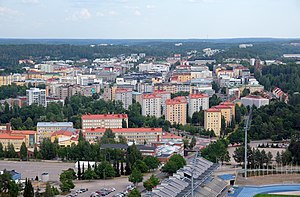
Lahti (Finnish pronunciation: [ˈlɑhti]; Swedish: Lahtis) is a city in Finland and the regional capital of Päijät-Häme. It is located in the Finnish Lakeland. The population of Lahti is approximately 121,000, while the sub-region has a population of approximately 205,000.

Lahti longwave transmitter
Distance: Approx. 556 meters
Latitude and longitude: 60.97944444,25.64694444
The Lahti longwave transmitter was a facility for longwave transmission on the Radio Hill in Lahti, Finland on 252 kHz. It was inaugurated in 1927 and used a T-type aerial strung between two 150-metre-high (490 ft) freestanding steel framework towers. The Lahti longwave transmitter was shut down in 1993.
Lahti railway station
Railway station in Lahti, Finland
Distance: Approx. 558 meters
Latitude and longitude: 60.97694444,25.6575
The Lahti railway station (Finnish: Lahden rautatieasema, Swedish: Lahtis järnvägsstation) is located in the city of Lahti in Finland.

Lahden kisapuisto
Stadium in Lahti, Finland
Distance: Approx. 585 meters
Latitude and longitude: 60.98638889,25.65027778
The Lahden kisapuisto is a multi-use stadium in Lahti, Finland. It is used mostly for football and hosts the home matches of FC Lahti. The stadium holds 4,000 people and is all-seater.

Lahti Town Hall
Administration building in Lahti, Finland
Distance: Approx. 184 meters
Latitude and longitude: 60.98027778,25.65527778
Lahti Town Hall was designed in 1911 by Finnish architect Eliel Saarinen. The building was completed in 1912. Material used for building, dark bricks, were brought from Sweden.

Battle of Lahti
Distance: Approx. 281 meters
Latitude and longitude: 60.983506,25.651888
Battle of Lahti was a 1918 Finnish Civil War battle, fought from 19 April to 1 May by the German troops and Finnish Whites against the Finnish Reds in Lahti, Finland. Together with the Battle of Viipuri, from 24 to 29 April, it was the last major battle of the war. The German unit Detachment Brandenstein, commanded by colonel Otto von Brandenstein, attacked Lahti on 19 April, taking the town by the next evening.

Radio and TV Museum (Lahti, Finland)
Museum in Lahti, Finland
Distance: Approx. 498 meters
Latitude and longitude: 60.97916667,25.64861111
Radio and TV Museum, also known as Mastola, is a museum located in Lahti, Finland. The museum is near the city centre on the Radiomäki hill (literally translated to Radio Hill). Next to the museum building are two 150-meter-high radio masts built in 1927.

Lahti Art Museum
Art museum in Lahti, Finland
Distance: Approx. 441 meters
Latitude and longitude: 60.984329,25.662361
The Lahti Art Museum is a museum focusing on visual arts, located in Lahti, Finland. The museum was founded in 1950. In connection with it is also the Poster Museum, established in 1975.

Ristinkirkko, Lahti
Church in Lahti, Finland
Distance: Approx. 413 meters
Latitude and longitude: 60.985555,25.657241
Ristinkirkko (English: Church of the Cross) is the main church in Lahti, Finland. The modernist church, completed in 1978, was one of the last design projects of the renowned Finnish architect Alvar Aalto.

Radio Hill (Lahti)
Hill in Lahti, Finland
Distance: Approx. 550 meters
Latitude and longitude: 60.9795,25.647
Radio Hill (Finnish: Radiomäki) is a hill located in the city centre of Lahti, Finland. It is part of the Salpausselkä ridge system, with its peak at an elevation of c. 140 metres (460 ft).
Keski-Lahti
District in Päijät-Häme, Finland
Distance: Approx. 141 meters
Latitude and longitude: 60.983,25.6572
Keski-Lahti ("Central Lahti") is the 1st district of the city of Lahti, in the region of Päijät-Häme, Finland. It covers the downtown areas of the city, circling the Market Square. It borders the districts of Niemi in the north, Kiveriö in the northeast, Paavola and Möysä in the east, Asemantausta in the south, Hennala and Sopenkorpi in the west and Kartano in the northwest.

Lahti bus station
Bus station in Lahti, Finland
Distance: Approx. 404 meters
Latitude and longitude: 60.98444444,25.65055556
The Lahti bus station (Finnish: Lahden linja-autoasema) is located in the Kartano district of the city of Lahti, Finland.
Weather in this IP's area
light rain
4 Celsius
1 Celsius
4 Celsius
4 Celsius
1008 hPa
90 %
1008 hPa
995 hPa
10000 meters
3.75 m/s
11.07 m/s
250 degree
100 %
08:19:39
15:44:16

