185.81.55.12 - IP Lookup: Free IP Address Lookup, Postal Code Lookup, IP Location Lookup, IP ASN, Public IP
Country:
Region:
City:
Location:
Time Zone:
Postal Code:
IP information under different IP Channel
ip-api
Country
Region
City
ASN
Time Zone
ISP
Blacklist
Proxy
Latitude
Longitude
Postal
Route
Luminati
Country
Region
ara
City
annecy
ASN
Time Zone
Europe/Paris
ISP
Celeste SAS
Latitude
Longitude
Postal
IPinfo
Country
Region
City
ASN
Time Zone
ISP
Blacklist
Proxy
Latitude
Longitude
Postal
Route
IP2Location
185.81.55.12Country
Region
auvergne-rhone-alpes
City
les houches
Time Zone
Europe/Paris
ISP
Language
User-Agent
Latitude
Longitude
Postal
db-ip
Country
Region
City
ASN
Time Zone
ISP
Blacklist
Proxy
Latitude
Longitude
Postal
Route
ipdata
Country
Region
City
ASN
Time Zone
ISP
Blacklist
Proxy
Latitude
Longitude
Postal
Route
Popular places and events near this IP address

Les Houches
Commune in Auvergne-Rhône-Alpes, France
Distance: Approx. 253 meters
Latitude and longitude: 45.8908,6.7992
Les Houches (French pronunciation: [le.z‿uʃ]; Arpitan: Les Ouches or Les Oucies) is an alpine commune in the Haute-Savoie department in the Auvergne-Rhône-Alpes region in Southeastern France. It is located just west of Chamonix-Mont-Blanc, in the larger canton of Le Mont-Blanc.
Lac de l'Aiguillette
Distance: Approx. 4055 meters
Latitude and longitude: 45.925,6.81111111
Lac de l'Aiguillette is a lake in Haute-Savoie, France.

Tête Rousse Hut
Mountain hut in the Mont Blanc massif
Distance: Approx. 4239 meters
Latitude and longitude: 45.85513889,6.81777778
The Tête Rousse Hut (French: Refuge de Tête Rousse) is a mountain hut in the Mont Blanc massif in the French Alps. It is located beside the Tête Rousse Glacier at an elevation of 3,167 m. Owned by the Club Alpin Francais (CAF), it is normally reached after an approximately two hour climb from Nid d'Aigle, the highest stop on the Mont Blanc Tramway.
Tremplin Olympique du Mont
Distance: Approx. 3668 meters
Latitude and longitude: 45.89833333,6.84194444
The Tremplin Olympique du Mont (English: Olympic jumping hill of Le Mont) was a ski jumping venue constructed for the 1924 Winter Olympics in Chamonix, France.

Les Houches School of Physics
International physics school center
Distance: Approx. 2240 meters
Latitude and longitude: 45.8989,6.7701
Les Houches School of Physics (French: École de physique des Houches) is an international physics center dedicated to seasonal schools and workshops. It is located in Les Houches, France. The school was founded in 1951 by French scientist Cécile DeWitt-Morette.

Tête Rousse Glacier
Glacier located in the Mont Blanc massif
Distance: Approx. 4210 meters
Latitude and longitude: 45.8559,6.8193
The Tête Rousse Glacier (French: Glacier de Tête Rousse) is a small but significant glacier located in the Mont Blanc massif within the French Alps whose collapse in 1892 killed 200 people in the town of Saint-Gervais-les-Bains.

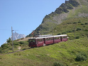
Nid d'Aigle station
Terminus of the Tramway du Mont Blanc
Distance: Approx. 3527 meters
Latitude and longitude: 45.85846,6.79851
Gare du Nid d'Aigle (French: Eagle's Nest Station) is the terminus of the Tramway du Mont Blanc (TMB) from Saint-Gervais-les-Bains on the slopes of the Mont Blanc. This station welcomes mountaineers as well as hikers at 2,362 m altitude below the glacier of Bionnassay. During the winter months the tram only stops at the lower Bellevue station, because of the avalanche risks.
Les Bossons station
Railway station in Chamonix-Mont-Blanc, France
Distance: Approx. 3819 meters
Latitude and longitude: 45.90674611,6.83919694
Les Bossons station (French: Gare des Bossons) is a railway station in the commune of Chamonix-Mont-Blanc, in the French department of Haute-Savoie.
Taconnaz station
Railway station in Les Houches, France
Distance: Approx. 2520 meters
Latitude and longitude: 45.89920694,6.82587611
Taconnaz station (French: Gare de Taconnaz) is a railway station in the commune of Les Houches, in the French department of Haute-Savoie.

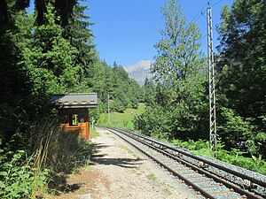
Les Houches station
Railway station in Les Houches, France
Distance: Approx. 391 meters
Latitude and longitude: 45.89356389,6.79692389
Les Houches station (French: Gare des Houches) is a railway station in the commune of Les Houches, in the French department of Haute-Savoie.
Viaduc-Sainte-Marie station
Railway station in Les Houches, France
Distance: Approx. 1159 meters
Latitude and longitude: 45.89709611,6.78501306
Viaduc-Sainte-Marie station (French: Gare du Viaduc-Sainte-Marie) is a railway station in the commune of Les Houches, in the French department of Haute-Savoie.
Vaudagne station
Railway station in Servoz, France
Distance: Approx. 2766 meters
Latitude and longitude: 45.90885194,6.77266694
Vaudagne station (French: Gare de Vaudagne) is a railway station in the commune of Les Houches, in the French department of Haute-Savoie.
Weather in this IP's area
overcast clouds
2 Celsius
-1 Celsius
2 Celsius
2 Celsius
1030 hPa
92 %
1030 hPa
911 hPa
10000 meters
2.83 m/s
4.08 m/s
43 degree
91 %


