Country:
 Denmark
Region:
City:
Latitude and Longitude:
Time Zone:
Postal Code:
IP information under different IP Channel
ip-api
Country
Region
City
ASN
Time Zone
ISP
Blacklist
Proxy
Latitude
Longitude
Postal
Route
IPinfo
Country
Region
City
ASN
Time Zone
ISP
Blacklist
Proxy
Latitude
Longitude
Postal
Route
MaxMind
Country
Region
City
ASN
Time Zone
ISP
Blacklist
Proxy
Latitude
Longitude
Postal
Route
Luminati
Country
DKRegion
84
City
elsinore
ASN
Time Zone
Europe/Copenhagen
ISP
Helsingoer Kommune
Latitude
Longitude
Postal
db-ip
Country
Region
City
ASN
Time Zone
ISP
Blacklist
Proxy
Latitude
Longitude
Postal
Route
ipdata
Country
Region
City
ASN
Time Zone
ISP
Blacklist
Proxy
Latitude
Longitude
Postal
Route
Popular places and events near this IP address

Gladsaxe Municipality
Municipality in Hovedstaden, Denmark
Distance: Approx. 911 meters
Latitude and longitude: 55.7333,12.4833
Gladsaxe Municipality (Danish: Gladsaxe Kommune) is a municipality (Danish, kommune) near Copenhagen in Region Hovedstaden on the island of Zealand (Sjælland) in eastern Denmark. The municipality covers an area of 25 km2 (10 sq mi), and has a total population of 70,600 (2024). Its mayor is Trine Græse, a member of the Social Democrats (Socialdemokraterne) political party.

Gladsaxe Stadium
Danish sports complex
Distance: Approx. 1676 meters
Latitude and longitude: 55.7328,12.4967
Gladsaxe Stadium (Danish: Gladsaxe Stadion) is a sports center located on Gladsaxevej 200, Søborg, Gladsaxe Municipality, in Copenhagen, which is primarily used for association football matches. The stadium hosts a number of training courses for running the football, handball and softball and hosts a restaurant. The ground is the home ground of Akademisk Boldklub and Gladsaxe-Hero Boldklub (rail size: 68 x 105 meters, and lighting: 700 lux.).

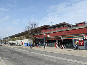
Stengården railway station
Commuter railway station in Greater Copenhagen, Denmark
Distance: Approx. 2046 meters
Latitude and longitude: 55.75666667,12.47305556
Stengården station is an S-train railway station serving the eastern part of the suburb of Bagsværd northwest of Copenhagen, Denmark. It is located on the Farum radial of Copenhagen's S-train network.
Buddinge railway station
Commuter railway station in Greater Copenhagen, Denmark
Distance: Approx. 1675 meters
Latitude and longitude: 55.74722222,12.49333333
Buddinge station is a suburban rail railway station serving the suburb of Buddinge northwest of Copenhagen, Denmark. The station is located on the Farum radial of Copenhagen's S-train network.
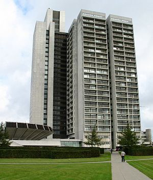
Herlev Hospital
Hospital in Capital Region, Denmark
Distance: Approx. 1927 meters
Latitude and longitude: 55.73138889,12.44361111
Herlev Hospital (former Danish: Amtssygehuset i Herlev) is a teaching hospital in Herlev, Denmark, close to Copenhagen. The building is 120 metres (390 ft) tall and has 25 floors. It was famous for being Denmark's tallest building, but was surpassed in 2022 by Light House in Aarhus.

Buddinge
Distance: Approx. 1852 meters
Latitude and longitude: 55.73333333,12.5
Buddinge is a suburb 10 km northwest of central Copenhagen, Denmark. The suburb used to be a small village, but by the 1960s merged with nearby suburban areas, subsequently becoming a suburb. The suburb is part of Gladsaxe municipal and is connected by the S-Train with two stations: Buddinge and Kildebakke.

Mørkhøj
Distance: Approx. 1350 meters
Latitude and longitude: 55.727,12.464
55.727°N 12.464°E / 55.727; 12.464 Mørkhøj is a suburb c. 10 kilometres (6.2 mi) northwest of central Copenhagen, Denmark. Mørkhøj is part of Gladsaxe Municipality.

Høje Gladsaxe
Distance: Approx. 1608 meters
Latitude and longitude: 55.72916667,12.49166667
Høje Gladsaxe is a large housing project, approximately 10 km northwest of central Copenhagen, Denmark. The project contains five 15-storey blocks, two 8-storey blocks and some smaller blocks. It contains around 2,500 apartments.
Villum Foundation
Distance: Approx. 602 meters
Latitude and longitude: 55.7407,12.4804
The Villum Foundation (Danish: Villum Fonden); formerly Villum Kann Rasmussen Foundation (Villum Kann Rasmussen Fonden) was set up in 1971 by civil engineer Villum Kann Rasmussen (1909–1993). 10 years later, he set up the Velux Foundation (Velux Fonden). Rasmussen was the founder of VELUX and Velfac, Danish window companies.
2010 Copenhagen terror plot
(2010) Copenhagen Plot: Denmark
Distance: Approx. 2116 meters
Latitude and longitude: 55.7193,12.4711
The 2010 Copenhagen terror plot was a terrorist plot against Jyllands-Posten, the publisher of the controversial cartoons of Muhammad in 2005.

TV-Byen
Distance: Approx. 1376 meters
Latitude and longitude: 55.7262,12.4763
TV-Byen is the former headquarters of national Danish broadcaster DR, located in Gladsaxe, approximately 9 kilometres northwest of central Copenhagen, Denmark. The 207,000 m2 site has been redeveloped with a mixture of offices, housing and retail after DR inaugurated their new headquarters, DR Byen in 2007.

Blaagaard Seminarium
Teacher's training college in Denmark
Distance: Approx. 1678 meters
Latitude and longitude: 55.7235,12.4769
Blaagaard Seminarium (also spelled Blågård Seminarium) has been the name of two teacher training colleges both originating in the Nørrebro district of Copenhagen, Denmark. The first of them, which was the first teacher training college in Denmark, changed its name to Jonstrup Seminarium in 1808. The second one was founded in 1859.
Weather in this IP's area
light rain
8 Celsius
5 Celsius
8 Celsius
9 Celsius
1014 hPa
90 %
1014 hPa
1009 hPa
10000 meters
4.67 m/s
11.09 m/s
239 degree
20 %
07:33:08
18:20:05