Country:
Region:
City:
Latitude and Longitude:
Time Zone:
Postal Code:
IP information under different IP Channel
ip-api
Country
Region
City
ASN
Time Zone
ISP
Blacklist
Proxy
Latitude
Longitude
Postal
Route
Luminati
Country
ASN
Time Zone
America/Chicago
ISP
EXOSTAR-AVA-02
Latitude
Longitude
Postal
IPinfo
Country
Region
City
ASN
Time Zone
ISP
Blacklist
Proxy
Latitude
Longitude
Postal
Route
db-ip
Country
Region
City
ASN
Time Zone
ISP
Blacklist
Proxy
Latitude
Longitude
Postal
Route
ipdata
Country
Region
City
ASN
Time Zone
ISP
Blacklist
Proxy
Latitude
Longitude
Postal
Route
Popular places and events near this IP address
Dulles, Virginia
Unincorporated community in Virginia, United States
Distance: Approx. 2420 meters
Latitude and longitude: 38.95166667,-77.44805556
Dulles ( DUL-iss) is an unincorporated area in Loudoun County, Virginia, United States, and is part of the Washington metropolitan area. The headquarters of Northrop Grumman Innovation Systems and ODIN Technologies, as well as the former headquarters of MCI Inc. and AOL are located in Dulles.

Innovation Center station
Washington Metro station
Distance: Approx. 595 meters
Latitude and longitude: 38.96083333,-77.41555556
Innovation Center station (preliminary names Route 28, Herndon – Dulles East) is a Washington Metro station in Fairfax County, Virginia on the Silver Line. It is located adjacent to the Virginia Center for Innovative Technology at the intersection of the SR 267 and SR 28 in McNair, near the Fairfax / Loudoun county line. Originally planned to begin operation in 2016, the station opened on November 15, 2022.

Dulles International Airport station
Washington Metro station at Dulles Airport
Distance: Approx. 2252 meters
Latitude and longitude: 38.95583333,-77.44777778
Washington Dulles International Airport station (commonly Dulles International Airport station or Dulles Airport station) is a Washington Metro station at Dulles International Airport in Loudoun County, Virginia, U.S., on the Silver Line. After years of delays, the station opened on November 15, 2022. The station was originally planned to be underground but was built as an above-ground station next to daily parking garage 1.

American Airlines Flight 444
Attempted bombing of flight from Chicago to Washington, D.C.
Distance: Approx. 2524 meters
Latitude and longitude: 38.953,-77.45
American Airlines Flight 444 was a scheduled American Airlines flight from Chicago to Washington, D.C.'s National Airport. On November 15, 1979, the Boeing 727 serving the flight was attacked by Ted Kaczynski (also known as the Unabomber), who sent a pipe bomb in the mail and set it to detonate at a certain altitude. The bomb partially detonated in the cargo hold and caused "a sucking explosion and a loss of pressure," which was then followed by large quantities of smoke filling the passenger cabin, forcing the pilots to make an emergency landing at Dulles International Airport.
Oak Grove, Loudoun County, Virginia
Census-designated place in Virginia
Distance: Approx. 2738 meters
Latitude and longitude: 38.98472222,-77.41861111
Oak Grove is a census-designated place in Loudoun County, Virginia, United States. The population as of the 2010 United States Census was 1,777. Oak Grove is located in eastern Loudoun County, on the Fairfax County border, between the communities of Sterling Park and Herndon.

Merrybrook
Historic house in Virginia, United States
Distance: Approx. 1305 meters
Latitude and longitude: 38.95555556,-77.40861111
Merrybrook is the only known remaining home of American Civil War Confederate spy Laura Ratcliffe. The house is located south of Herndon, Virginia, in Fairfax County, Virginia. She lived here from the earliest days of the Civil War until her death in 1923.

Frying Pan Meetinghouse
Historic church in Virginia, United States
Distance: Approx. 2392 meters
Latitude and longitude: 38.94,-77.41333333
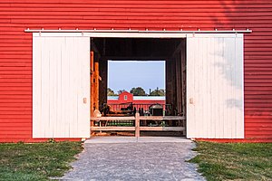
The Frying Pan Meetinghouse (also known as Frying Pan Old School Baptist Church (1832) or Frying Pan Spring Meeting House) is a historic church building within Frying Pan Farm Park in Floris, Virginia. It was built in 1791 as a church building. In 1984 the last remaining trustee deeded the building to the Fairfax County Park Authority to preserve and maintain the property.

Floris, Virginia
Census-designated place in Virginia, United States
Distance: Approx. 2723 meters
Latitude and longitude: 38.93694444,-77.41305556
Floris is a census-designated place (CDP) located within the Oak Hill area of Fairfax County, Virginia, United States. The population at the 2020 census was 8,341.

McNair, Virginia
Census-designated place in Virginia, United States
Distance: Approx. 1163 meters
Latitude and longitude: 38.95222222,-77.41388889
McNair is a census-designated place located in the Oak Hill section of Fairfax County, Virginia, United States. It is directly to the east of Washington Dulles International Airport. The population as of the 2020 census was 21,598.

Floris Historic District
Historic district in Virginia, United States
Distance: Approx. 2792 meters
Latitude and longitude: 38.93805556,-77.4075
Floris Historic District is a historic district that is listed on the U.S. National Register of Historic Places (NRHP). It's located in the vicinity of the town of Herndon, Virginia, and just about one mile east of Dulles International Airport. It includes the last remaining working farm in Fairfax County, Virginia, the Frying Pan Farm, which is now also a park.
Cortona Academy
Private school in Herndon, Virginia, United States
Distance: Approx. 1187 meters
Latitude and longitude: 38.9525,-77.41305556
Cortona Academy, founded in 1992, is a private, co-educational, college preparatory academy in Herndon, Virginia, serving grades 7–12. It serves students from the greater Washington area. The campus is situated in Herndon and 100% of Cortona seniors are accepted to college.
Hutchison, Virginia
Census-designated place in Virginia
Distance: Approx. 1313 meters
Latitude and longitude: 38.96472222,-77.40833333
Hutchison is a census designated place in Fairfax County, Virginia, United States. It is a residential development just north of Virginia State Route 267, located 23 miles west of Washington, D.C. The community is one of the census-designated places newly recognized for the 2020 United States census. As of the 2020 census, the population of Hutchison is 6,231.
Weather in this IP's area
few clouds
6 Celsius
4 Celsius
4 Celsius
8 Celsius
1020 hPa
75 %
1020 hPa
1007 hPa
10000 meters
3.6 m/s
330 degree
20 %
06:55:24
16:54:25