Country:
Region:
City:
Latitude and Longitude:
Time Zone:
Postal Code:
IP information under different IP Channel
ip-api
Country
Region
City
ASN
Time Zone
ISP
Blacklist
Proxy
Latitude
Longitude
Postal
Route
Luminati
Country
ASN
Time Zone
Europe/Madrid
ISP
Inetum Espana, S.A.
Latitude
Longitude
Postal
IPinfo
Country
Region
City
ASN
Time Zone
ISP
Blacklist
Proxy
Latitude
Longitude
Postal
Route
db-ip
Country
Region
City
ASN
Time Zone
ISP
Blacklist
Proxy
Latitude
Longitude
Postal
Route
ipdata
Country
Region
City
ASN
Time Zone
ISP
Blacklist
Proxy
Latitude
Longitude
Postal
Route
Popular places and events near this IP address
Fuencarral
Distance: Approx. 1472 meters
Latitude and longitude: 40.5,-3.68333333
Fuencarral [fweŋˈkaral] is a neighborhood located in the northern part of Madrid, Spain. It includes the municipal area of the ancient town of Fuencarral, which was annexed to the city of Madrid by a decree of November 10, 1950. Administratively, Fuencarral belongs to the municipal district of Valverde in the district of Fuencarral-El Pardo.

Herrera Oria (Madrid Metro)
Madrid Metro station
Distance: Approx. 1436 meters
Latitude and longitude: 40.4846443,-3.7075242
Herrera Oria [eˈre.ɾa ˈoɾ.ja] is a station on Line 9 of the Madrid Metro, near the Avenida del Cardenal Herrera Oria ("Cardinal Herrera Oria Avenue").
Mirasierra (Madrid Metro)
Madrid Metro station
Distance: Approx. 1497 meters
Latitude and longitude: 40.4910935,-3.7163508
Mirasierra [ˌmi.ɾaˈsje.ra] is a station on Line 9 of the Madrid Metro, serving the Mirasierra barrio. It is located in fare Zone A. The building of the station faced controversies since the original project (approved by the president of the region Esperanza Aguirre) supposed the wrecking of a high school in order to build the entrances on that lot. In the end, the high school was not demolished and the entrance was relocated.
Fuencarral (Madrid Metro)
Madrid Metro station
Distance: Approx. 646 meters
Latitude and longitude: 40.4946447,-3.6926354
Fuencarral [fweŋkaˈral] is a station on Line 10 of the Madrid Metro, serving the Fuencarral barrio.

Tres Olivos (Madrid Metro)
Madrid Metro station
Distance: Approx. 689 meters
Latitude and longitude: 40.5012042,-3.6952016
Tres Olivos [ˈtɾes oˈliβos] is a station on Line 10 of the Madrid Metro, serving the Tres Olivos ("three olive trees") development. It is located in fare Zone A. As the interchange station from Line 10A to 10B (MetroNorte) toward Hospital Infanta Sofía, it has two platforms.
Montecarmelo (Madrid Metro)
Madrid Metro station
Distance: Approx. 1070 meters
Latitude and longitude: 40.5052554,-3.6957517
Montecarmelo [ˌmontekaɾˈmelo] is a station on Line 10 of the Madrid Metro. It is located in fare Zone A. The station gives service to the homonymous neighborhood, Madrid, Alcobendas and San Sebastián de los Reyes.

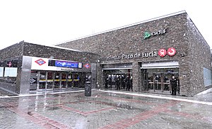
Paco de Lucía (Madrid Metro)
Madrid Metro station
Distance: Approx. 852 meters
Latitude and longitude: 40.4995522,-3.709039
Paco de Lucía [ˈpako ðe luˈθi.a] station completes extension of Line 9 of the Madrid Metro. It is located in fare Zone A and brings Metro to 50.000 new potential users. It opened on 25 March 2015, at the time making it station 301 of the Metro Madrid network.

La Paz (Madrid)
City neighborhood in Madrid, Community of Madrid, Spain
Distance: Approx. 1669 meters
Latitude and longitude: 40.48138889,-3.69694444
La Paz is an administrative neighborhood (barrio) of Madrid belonging to the district of Fuencarral-El Pardo. It is home to the largest hospital in Madrid, Hospital Universitario La Paz.

Valverde (Madrid)
City neighborhood in Madrid, Spain
Distance: Approx. 1608 meters
Latitude and longitude: 40.50583333,-3.68583333
Valverde is an administrative neighborhood (barrio) of Madrid belonging to the district of Fuencarral-El Pardo. It has an area of 8.977802 km2 (3.466349 sq mi). As of 1 March 2020, it has a population of 65,022.

Mirasierra
City neighborhood in Madrid, Community of Madrid, Spain
Distance: Approx. 849 meters
Latitude and longitude: 40.49166667,-3.70805556
Mirasierra ([ˌmi.ɾaˈsje.ra], "Mountain View") is an administrative neighborhood (barrio) of Madrid belonging to the district of Fuencarral-El Pardo. Mirasierra was founded in 1953.

Hospital Universitario Ramón y Cajal
Hospital in Community of Madrid, Spain
Distance: Approx. 1127 meters
Latitude and longitude: 40.487208,-3.693883
The Hospital Universitario Ramón y Cajal is a public general hospital located in the Valverde neighborhood, in Madrid, Spain, part of the hospital network of the Servicio Madrileño de Salud. It is one of the healthcare institutions associated to the University of Alcalá for the purpose of clinical internship.
Villanueva University
Spanish private university
Distance: Approx. 163 meters
Latitude and longitude: 40.496,-3.7019
Universidad Villanueva is a private university located in Madrid (Spain), affiliated to the Catholic organization Opus Dei. It is the smallest university in Madrid by number of bachelor's students. It started teaching in the year 2020, although its history as an institution can be traced back to 1977.
Weather in this IP's area
broken clouds
14 Celsius
13 Celsius
12 Celsius
14 Celsius
1020 hPa
76 %
1020 hPa
939 hPa
10000 meters
2.57 m/s
100 degree
75 %
08:00:23
17:58:24


