185.75.236.5 - IP Lookup: Free IP Address Lookup, Postal Code Lookup, IP Location Lookup, IP ASN, Public IP
Country:
Region:
City:
Location:
Time Zone:
Postal Code:
ISP:
ASN:
language:
User-Agent:
Proxy IP:
Blacklist:
IP information under different IP Channel
ip-api
Country
Region
City
ASN
Time Zone
ISP
Blacklist
Proxy
Latitude
Longitude
Postal
Route
db-ip
Country
Region
City
ASN
Time Zone
ISP
Blacklist
Proxy
Latitude
Longitude
Postal
Route
IPinfo
Country
Region
City
ASN
Time Zone
ISP
Blacklist
Proxy
Latitude
Longitude
Postal
Route
IP2Location
185.75.236.5Country
Region
salaspils novads
City
salaspils
Time Zone
Europe/Riga
ISP
Language
User-Agent
Latitude
Longitude
Postal
ipdata
Country
Region
City
ASN
Time Zone
ISP
Blacklist
Proxy
Latitude
Longitude
Postal
Route
Popular places and events near this IP address

Salaspils
Town in Latvia
Distance: Approx. 1189 meters
Latitude and longitude: 56.86666667,24.35
Salaspils (; German: Kircholm; Swedish: Kirkholm) (literally: "island castle") is a town in the Vidzeme region of Latvia. It is the administrative centre of Salaspils Municipality. The town is situated on the northern bank of the Daugava river, 18 kilometers to the south-east of the city of Riga.
Battle of Kircholm
1605 battle of the Polish–Swedish War of 1600–11
Distance: Approx. 1658 meters
Latitude and longitude: 56.84861111,24.34805556
The Battle of Kircholm (Lithuanian: Salaspilio mūšis; Polish: Bitwa pod Kircholmem; Swedish: Slaget vid Kirkholm; 27 September [O.S. 17 September] 1605) was one of the major battles in the Polish–Swedish War of 1600–1611. The battle was decided in 20 minutes by a devastating charge of Polish-Lithuanian cavalry, including the Winged Hussars. The battle ended in a decisive victory of the Polish-Lithuanian forces, and is remembered as one of the greatest triumphs of Commonwealth cavalry.

Riga Hydroelectric Power Plant Crossing Pylon
Transmission tower in Latvia
Distance: Approx. 2470 meters
Latitude and longitude: 56.83805556,24.37
The Riga Hydroelectric Power Plant Crossing Pylon is an overhead powerline crossing of the Daugava River, near Salaspils in the Latvia. The present crossing was built in 1974, and includes one 112-metre tall lattice tower. It is the tallest electricity pylon in the Latvia.

Salaspils Municipality
Municipality of Latvia
Distance: Approx. 1303 meters
Latitude and longitude: 56.85166667,24.35055556
Salaspils Municipality (Latvian: Salaspils novads) is a municipality in Vidzeme, Latvia. The municipality was formed in 2004 by reorganization of Salaspils town and its rural territory, the administrative centre being Salaspils. In 2010 the rural territory was renamed Salaspils parish.

Daugmale Parish
Parish of Latvia
Distance: Approx. 5755 meters
Latitude and longitude: 56.81666667,24.41666667
Daugmale Parish (Latvian: Daugmales pagasts) is an administrative territorial entity of Ķekava Municipality, Latvia. It was an administrative unit of Riga District. The administrative center is Daugmale village.

Salaspils camp
Nazi forced labour and concentration camp
Distance: Approx. 4209 meters
Latitude and longitude: 56.87438889,24.30136111
Salaspils camp was established at the end of 1941 at a point 18 km (11 mi) southeast of Riga (Latvia), in Salaspils. The Nazi bureaucracy drew distinctions between different types of camps. Officially, it was the Salaspils Police Prison and Re-Education Through Labor Camp (Polizeigefängnis und Arbeitserziehungslager).
Dārziņi
Neighbourhood of Riga, Latvia
Distance: Approx. 5508 meters
Latitude and longitude: 56.86472222,24.27527778
Dārziņi is a neighbourhood of Riga, the capital of Latvia, which is located in the Latgale Suburb. The neighbourhood mostly consists of summer homes and small plant gardens for personal use, and it is the southernmost neighbourhood of Riga. Dārziņi were added to the city of Riga in 1968.

Dārziņi Station
Railway station in Latvia
Distance: Approx. 5253 meters
Latitude and longitude: 56.87009444,24.28102222
Dārziņi Station is a railway station on the Riga – Daugavpils Railway.

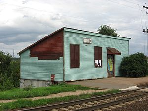
Dole Station
Railway station in Latvia
Distance: Approx. 2555 meters
Latitude and longitude: 56.86444444,24.32416667
Dole Station is a railway station on the Riga–Daugavpils Railway.

Salaspils Station
Railway station in Latvia
Distance: Approx. 750 meters
Latitude and longitude: 56.86065833,24.353125
Salaspils Station is a railway station on the Riga – Daugavpils Railway.

National Botanic Garden of Latvia
Botanic garden in Latvia
Distance: Approx. 594 meters
Latitude and longitude: 56.86377778,24.35833333
The National Botanic Garden of Latvia (Latvian: Nacionālais botāniskais dārzs) is a botanical garden in Salaspils, Latvia. It is one of the largest botanical gardens in the Baltic states.

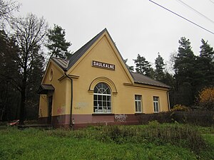
Saulkalne Station
Railway station in Salaspils Parish, Latvia
Distance: Approx. 4513 meters
Latitude and longitude: 56.84944444,24.43694444
Saulkalne Station is a railway station on the Riga – Daugavpils Railway.
Weather in this IP's area
overcast clouds
7 Celsius
4 Celsius
6 Celsius
7 Celsius
1003 hPa
88 %
1003 hPa
1000 hPa
10000 meters
3.54 m/s
9.78 m/s
173 degree
100 %

