Country:
Region:
City:
Latitude and Longitude:
Time Zone:
Postal Code:
IP information under different IP Channel
ip-api
Country
Region
City
ASN
Time Zone
ISP
Blacklist
Proxy
Latitude
Longitude
Postal
Route
Luminati
Country
Region
ct
City
santperepescador
ASN
Time Zone
Europe/Madrid
ISP
Cortex Sp Computer Sl
Latitude
Longitude
Postal
IPinfo
Country
Region
City
ASN
Time Zone
ISP
Blacklist
Proxy
Latitude
Longitude
Postal
Route
db-ip
Country
Region
City
ASN
Time Zone
ISP
Blacklist
Proxy
Latitude
Longitude
Postal
Route
ipdata
Country
Region
City
ASN
Time Zone
ISP
Blacklist
Proxy
Latitude
Longitude
Postal
Route
Popular places and events near this IP address
Empúries
Ancient city on the Mediterranean coast in the south-east of the Iberian Peninsula
Distance: Approx. 6419 meters
Latitude and longitude: 42.13472222,3.12055556
Empúries (Catalan: Empúries [əmˈpuɾiəs]) was an ancient Greek city on the Mediterranean coast of Catalonia, Spain. The city Ἐμπόριον (Greek: Ἐμπόριον, Emporion, meaning "trading place", cf. emporion) was founded in 575 BC by Greeks from Phocaea.

Fluvià
Distance: Approx. 2828 meters
Latitude and longitude: 42.20194444,3.11055556
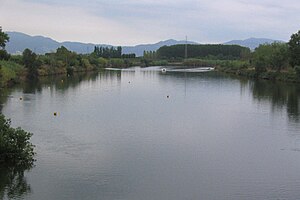
The Fluvià (Catalan pronunciation: [fluβiˈa]; Spanish: Fluviá) is a river in Catalonia. It rises in the Serralada Transversal, passes through Olot and Besalú, and flows into the Mediterranean Sea near Sant Pere Pescador. The ancient city of Empúries was founded near the mouth of the Fluvià, when it was 6 km south of its present location.

Sant Pere Pescador
Municipality in Catalonia, Spain
Distance: Approx. 362 meters
Latitude and longitude: 42.18888889,3.08333333
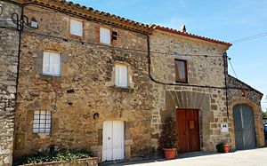
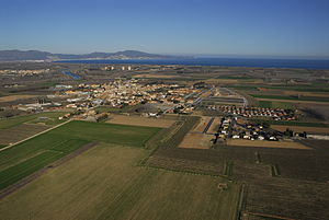
Sant Pere Pescador (Catalan pronunciation: [ˈsam ˈpeɾə pəskəˈðo]) is a municipality in the comarca of Alt Empordà, Girona, Catalonia, Spain, is a small town in the Bay of Roses on the river Fluvià, on the coastline of the Costa Brava. The town has the benefit of a sandy 7 km long beach. The first reference to the town dates from 974 when it was owned by the monastery of Sant Pere de Rodes part of the County of Empúries.
Aiguamolls de l'Empordà
Natural park near Girona, Spain
Distance: Approx. 4340 meters
Latitude and longitude: 42.21944444,3.11055556
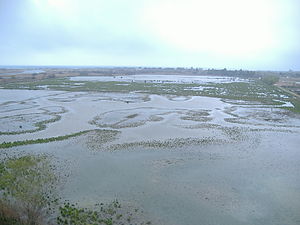
The Parc Natural dels Aiguamolls de l'Empordà is a natural park in Catalonia, Spain. It forms part of the Bay of Roses and, like the Ebro Delta, was a malarial swampland. The marshland lies between the Rivers Fluvià and Muga.

Viladamat
Municipality in Catalonia, Spain
Distance: Approx. 5684 meters
Latitude and longitude: 42.135,3.076
Viladamat (Catalan pronunciation: [ˌbiləðəˈmat]) is a village of Alt Empordà, 6 kilometers to the north from l'Escala, a municipality in Catalonia, Spain.

Vilacolum
Distance: Approx. 4062 meters
Latitude and longitude: 42.19431389,3.03634444
Vilacolum (Catalan pronunciation: [ˌbiləkuˈlum]) is a village in the municipality of Torroella de Fluvià, 10 km south-east of Figueres in Alt Empordà, Catalonia.
L'Armentera
Municipality in Catalonia, Spain
Distance: Approx. 1468 meters
Latitude and longitude: 42.174,3.076
L'Armentera (Catalan pronunciation: [ləɾmənˈteɾə]) is a municipality in the comarca of Alt Empordà, Girona, Catalonia, Spain, on the coastline of the Costa Brava.

Riumors
Municipality in Catalonia, Spain
Distance: Approx. 5766 meters
Latitude and longitude: 42.227,3.042
Riumors (Catalan pronunciation: [riwˈmɔɾs]) is a municipality in the comarca of Alt Empordà, Girona, Catalonia, Spain.

Torroella de Fluvià
Municipality in Catalonia, Spain
Distance: Approx. 3645 meters
Latitude and longitude: 42.176,3.042
Torroella de Fluvià (Catalan pronunciation: [turuˈeʎə ðə fluβiˈa]) is a municipality in the comarca of Alt Empordà, Girona, Catalonia, Spain. It includes the village of Vilacolum. The 11th Century Church of Sant Tomàs de Fluvià is a notable romanesque landmark.
Ventalló
Municipality in Catalonia, Spain
Distance: Approx. 5780 meters
Latitude and longitude: 42.15,3.03333333
Ventalló (Catalan pronunciation: [bəntəˈʎo]) is a municipality in the comarca of Alt Empordà, Girona, Catalonia, Spain.

Vilamacolum
Municipality in Catalonia, Spain
Distance: Approx. 2572 meters
Latitude and longitude: 42.197,3.057
Vilamacolum (Catalan pronunciation: [ˌbiləməkuˈlum]) is a municipality and village in the comarca of Alt Empordà, Girona, Catalonia. It is on the left side of the Fluvià river, in a flat land. The local economy is based on agriculture and tourism.

Empúries Marathon
Distance: Approx. 6554 meters
Latitude and longitude: 42.1336,3.1212
The Empúries Marathon (Catalan: Marató d'Empúries) is a long-distance run (42.195 km) which takes place in Empúries, the ancient Greek and Roman colony, next Sant Martí d'Empúries and L'Escala in Girona (Catalonia). The first edition of the marathon was held in 2003 to mark the collaboration of the City of L'Escala with the Universal Forum of Cultures in Barcelona 2004. Organized by the L'Escala Town Council and with the support of the Catalan Athletics Federation, the Empúries Marathon is held annually in the month of April or May, along with two additional athletics races: the half-marathon and 10,000-meter race.
Weather in this IP's area
scattered clouds
17 Celsius
16 Celsius
15 Celsius
18 Celsius
1017 hPa
67 %
1017 hPa
1017 hPa
10000 meters
0.83 m/s
1.59 m/s
75 degree
47 %
07:42:10
17:23:56


