185.74.62.251 - IP Lookup: Free IP Address Lookup, Postal Code Lookup, IP Location Lookup, IP ASN, Public IP
Country:
Region:
City:
Location:
Time Zone:
Postal Code:
IP information under different IP Channel
ip-api
Country
Region
City
ASN
Time Zone
ISP
Blacklist
Proxy
Latitude
Longitude
Postal
Route
Luminati
Country
ASN
Time Zone
Europe/Prague
ISP
United Networks SE
Latitude
Longitude
Postal
IPinfo
Country
Region
City
ASN
Time Zone
ISP
Blacklist
Proxy
Latitude
Longitude
Postal
Route
IP2Location
185.74.62.251Country
Region
plzensky kraj
City
susice
Time Zone
Europe/Prague
ISP
Language
User-Agent
Latitude
Longitude
Postal
db-ip
Country
Region
City
ASN
Time Zone
ISP
Blacklist
Proxy
Latitude
Longitude
Postal
Route
ipdata
Country
Region
City
ASN
Time Zone
ISP
Blacklist
Proxy
Latitude
Longitude
Postal
Route
Popular places and events near this IP address
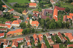
Sušice
Town in Plzeň, Czech Republic
Distance: Approx. 6 meters
Latitude and longitude: 49.23111111,13.52027778
Sušice (Czech pronunciation: [ˈsuʃɪtsɛ]; German: Schüttenhofen) is a town in Klatovy District in the Plzeň Region of the Czech Republic. It has about 11,000 inhabitants. The historic town centre is well preserved and is protected by law as an urban monument zone.

Budětice
Municipality in Plzeň, Czech Republic
Distance: Approx. 7469 meters
Latitude and longitude: 49.28333333,13.58472222
Budětice is a municipality and village in Klatovy District in the Plzeň Region of the Czech Republic. It has about 300 inhabitants. Budětice lies approximately 25 kilometres (16 mi) south-east of Klatovy, 54 km (34 mi) south of Plzeň, and 108 km (67 mi) south-west of Prague.

Čímice
Municipality in Plzeň, Czech Republic
Distance: Approx. 6709 meters
Latitude and longitude: 49.25361111,13.60583333
Čímice (German: Zimitz) is a municipality and village in Klatovy District in the Plzeň Region of the Czech Republic. It has about 200 inhabitants.

Dlouhá Ves (Klatovy District)
Municipality in Plzeň, Czech Republic
Distance: Approx. 4356 meters
Latitude and longitude: 49.19388889,13.50166667
Dlouhá Ves (German: Langendorf) is a municipality and village in Klatovy District in the Plzeň Region of the Czech Republic. It has about 900 inhabitants. Dlouhá Ves lies approximately 28 kilometres (17 mi) south-east of Klatovy, 63 km (39 mi) south of Plzeň, and 120 km (75 mi) south-west of Prague.

Dobršín
Municipality in Plzeň, Czech Republic
Distance: Approx. 4495 meters
Latitude and longitude: 49.26138889,13.56111111
Dobršín is a municipality and village in Klatovy District in the Plzeň Region of the Czech Republic. It has about 100 inhabitants. Dobršín lies approximately 25 kilometres (16 mi) south-east of Klatovy, 56 km (35 mi) south of Plzeň, and 111 km (69 mi) south-west of Prague.

Dražovice (Klatovy District)
Municipality in Plzeň, Czech Republic
Distance: Approx. 6346 meters
Latitude and longitude: 49.22472222,13.60694444
Dražovice is a municipality and village in Klatovy District in the Plzeň Region of the Czech Republic. It has about 200 inhabitants. Dražovice lies approximately 30 kilometres (19 mi) south-east of Klatovy, 61 km (38 mi) south of Plzeň, and 113 km (70 mi) south-west of Prague.

Hrádek (Klatovy District)
Municipality in Plzeň, Czech Republic
Distance: Approx. 4047 meters
Latitude and longitude: 49.26361111,13.49527778
Hrádek is a municipality and village in Klatovy District in the Plzeň Region of the Czech Republic. It has about 1,400 inhabitants. Hrádek lies approximately 22 kilometres (14 mi) south-east of Klatovy, 55 km (34 mi) south of Plzeň, and 114 km (71 mi) south-west of Prague.

Mokrosuky
Municipality in Plzeň, Czech Republic
Distance: Approx. 6865 meters
Latitude and longitude: 49.27555556,13.45472222
Mokrosuky is a municipality and village in Klatovy District in the Plzeň Region of the Czech Republic. It has about 100 inhabitants.
Petrovice u Sušice
Municipality in Plzeň, Czech Republic
Distance: Approx. 5928 meters
Latitude and longitude: 49.21888889,13.44083333
Petrovice u Sušice is a municipality and village in Klatovy District in the Plzeň Region of the Czech Republic. It has about 600 inhabitants. Petrovice u Sušice lies approximately 23 kilometres (14 mi) south-east of Klatovy, 59 km (37 mi) south of Plzeň, and 120 km (75 mi) south-west of Prague.

Podmokly (Klatovy District)
Municipality in Plzeň, Czech Republic
Distance: Approx. 4207 meters
Latitude and longitude: 49.23027778,13.57805556
Podmokly is a municipality and village in Klatovy District in the Plzeň Region of the Czech Republic. It has about 200 inhabitants. Podmokly lies approximately 29 kilometres (18 mi) south-east of Klatovy, 60 km (37 mi) south of Plzeň, and 114 km (71 mi) south-west of Prague.

Žihobce
Municipality in Plzeň, Czech Republic
Distance: Approx. 8287 meters
Latitude and longitude: 49.21555556,13.63166667
Žihobce is a municipality and village in Klatovy District in the Plzeň Region of the Czech Republic. It has about 600 inhabitants.

Kašperk Castle
Distance: Approx. 7902 meters
Latitude and longitude: 49.16611111,13.56388889
Kašperk Castle (Czech: hrad Kašperk, German: Karlsberg) is a medieval castle placed in southwestern Bohemia (modern Czech Republic, former Kingdom of Bohemia). It is said to be the most highly located royal castle in Bohemia. Its elevation is 886 metres (2,907 ft) above sea level).
Weather in this IP's area
clear sky
-2 Celsius
-4 Celsius
-2 Celsius
0 Celsius
1038 hPa
88 %
1038 hPa
979 hPa
10000 meters
1.65 m/s
1.59 m/s
142 degree
4 %

